Welcome. We're your premier source for fun places to explore by bicycle or on foot. Offering guides, maps and articles on road and trail riding for the novice to seasoned cyclist - helping you find your #NextBikeAdventure
Now that summer is here and many traditional outdoor activities are coming to the top of my list, I have a big decision to make. With my new e-bike, where should I go for my first out-of-town weekend bike getaway?
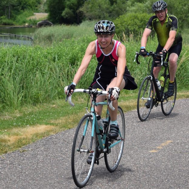
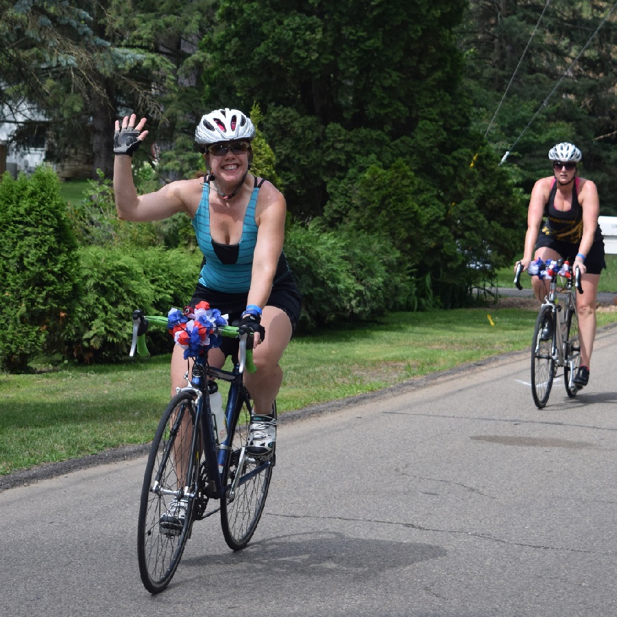
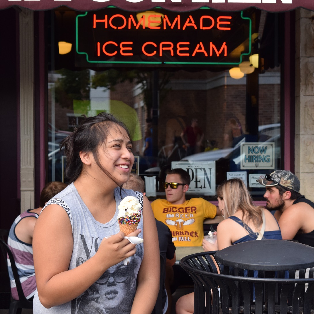
One of my favorites is Albert Lea, Minnesota, A one-tank getaway that offers a beautiful bike route around Fountain Lake that makes it easy to connect to the Blazing Star State Trail. Another option is to follow one of the routes from the annual bike ride called Rock n’ Roll the Lakes. This year the ride takes place on August 12th. Offering cyclists of all abilities several fun, scenic route options for that #NextBikeAdventure!
Bike-friendly Albert Lea
Less than two hours, drive down Interstate 35 from Minneapolis. After passing the I-90 crossroad, pull into Albert Lea and prepare for a weekend of outdoor fun. Known as the Land Between the Lakes, the city sits between Fountain Lake and Albert Lea Lake, prime destinations for soaking in the rays while biking, hiking, or paddling. Getting around on your bike from several lodging options is easy with the city’s low-traffic bike lanes and trails. After checking in at one of the hotels, it’s exciting to ride around this southern Minnesota community.
Touring around Albert Lea Lake
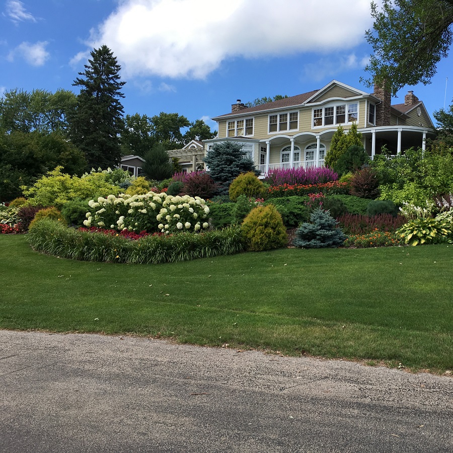
The homes along the Fountain Lake route are very picturesque.
In town, touring around Fountain Lake, traveling clockwise, is recommended. The experience of this route is reminiscent of riding around Lake of the Isles in Minneapolis. With beautifully landscaped lawns along the fingering shoreline, a ride around the lake is very picturesque. This popular route is about eight and a half miles around, using trails and quiet residential streets.
After returning to the downtown area of Albert Lea, you will find many options for lunch. Then it’s time to ride on the paved Blazing Star State Trail out to Myre-Big Island State Park.
Myre-Big Island State Park and the Blazing Star State Trail
The Blazing Star State Trail offers over six miles of riding from Albert Lea out through the State Park.
Here in the park, you will find both, a mountain bike and a paved trail system for cyclists of all skill levels to enjoy. The park offers about seven miles of wide grass trails in a sequence of three separate loops, strung together alongside the State trail for mountain bikers. The Blazing Star State Trail is paved and runs from Albert Lea Lake in town out through Myre-Big Island State Park, approximately six miles.
Both trail systems meander through the open prairie meadows with some young woodland near Lake Albert Lea throughout the park. Nice rolling hills make for a surprisingly good workout, and the park is also an excellent birding spot.
Road Biking Opportunities
Exploring the area on a bike is easy, too. You can use the roads to navigate both around town and rural routes throughout southern Minnesota. There’s even a dedicated bike lane to get you in and out of town safely. From past Rock n’ Roll the Lakes events, here are the printable maps for the 10-mile loop option and the 30/50-mile loop option for your enjoyment.
More about Albert Lea
The bike route around Albert Lea Lake is reminiscent of the Lake of the Isles.
When you need a break from the outdoors, there’s plenty to keep your exciting adventure going. There are locally-owned shops and one-of-a-kind restaurants, and the area’s history will top off your bike adventure. Check out more here.
The best part about spending time here in Albert Lea, it’s easy to get around by bike while keeping your social distance from others for a memorable adventure.
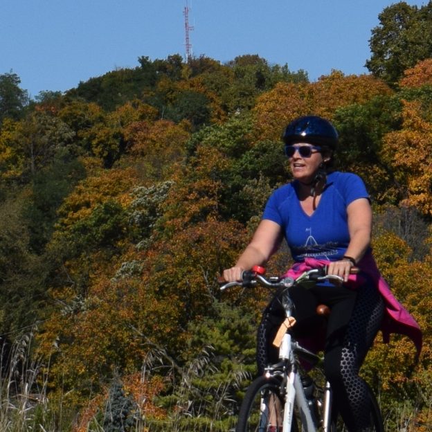
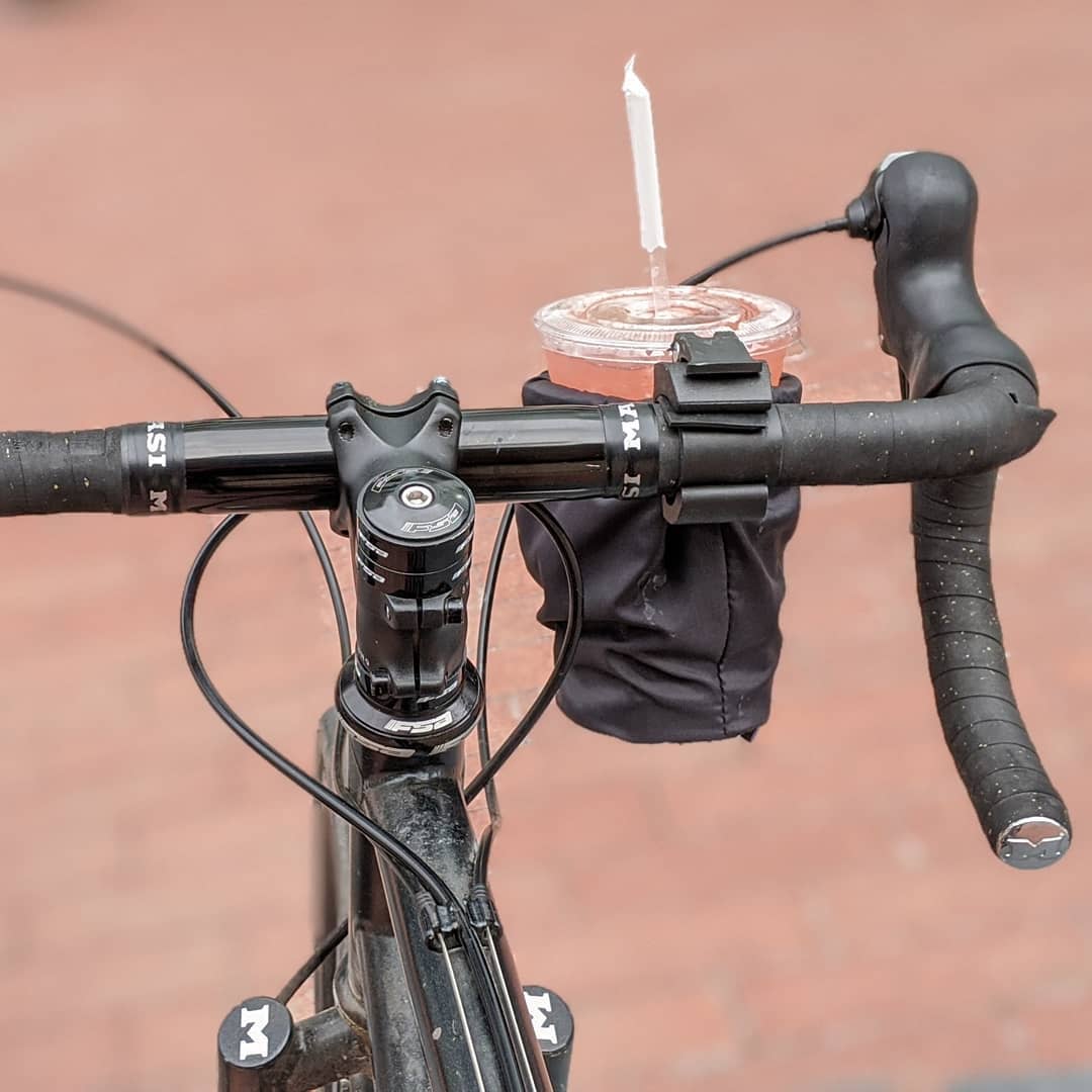
With summer riding opportunities here, it may be time to look for a new bicycle bell for added safety. Personally, I prefer using a bell when approaching slower cyclists and people walking on the trail, just ahead of me. Rather than using my voice alone, with a tone that may vary. I find a bell noise from SpurCycle, with a quick statement of “On your left,” when passing, is more effective and appreciated. The Compact Bell is perfect and offers the same high-frequency ping as SpurCycle’s original bell, just smaller with fewer moving parts.
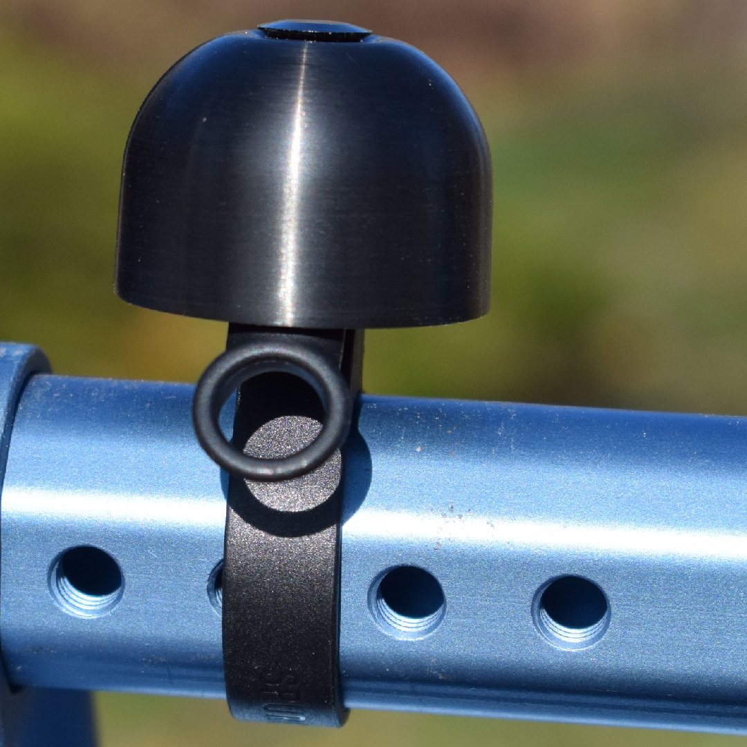
The SpurCycle Compact Bicycle Bell
In a recent test of the SpurCycle Compact Bell, I found the ring lasts longer than most bells. I found the high-frequency ping with a rich aftermath tone helps those, as you approach, of your on-coming presents.
The perfect brass bell housing holds a ring longer, starting with a very hard “ping.”
This compact bell is plenty loud for off-road riding and suburban commuting but won’t win against car horns and heavy street traffic in a metropolitan area. This bell’s true advantage is how long the ring lasts (or “sustains”), ending at the same frequency.
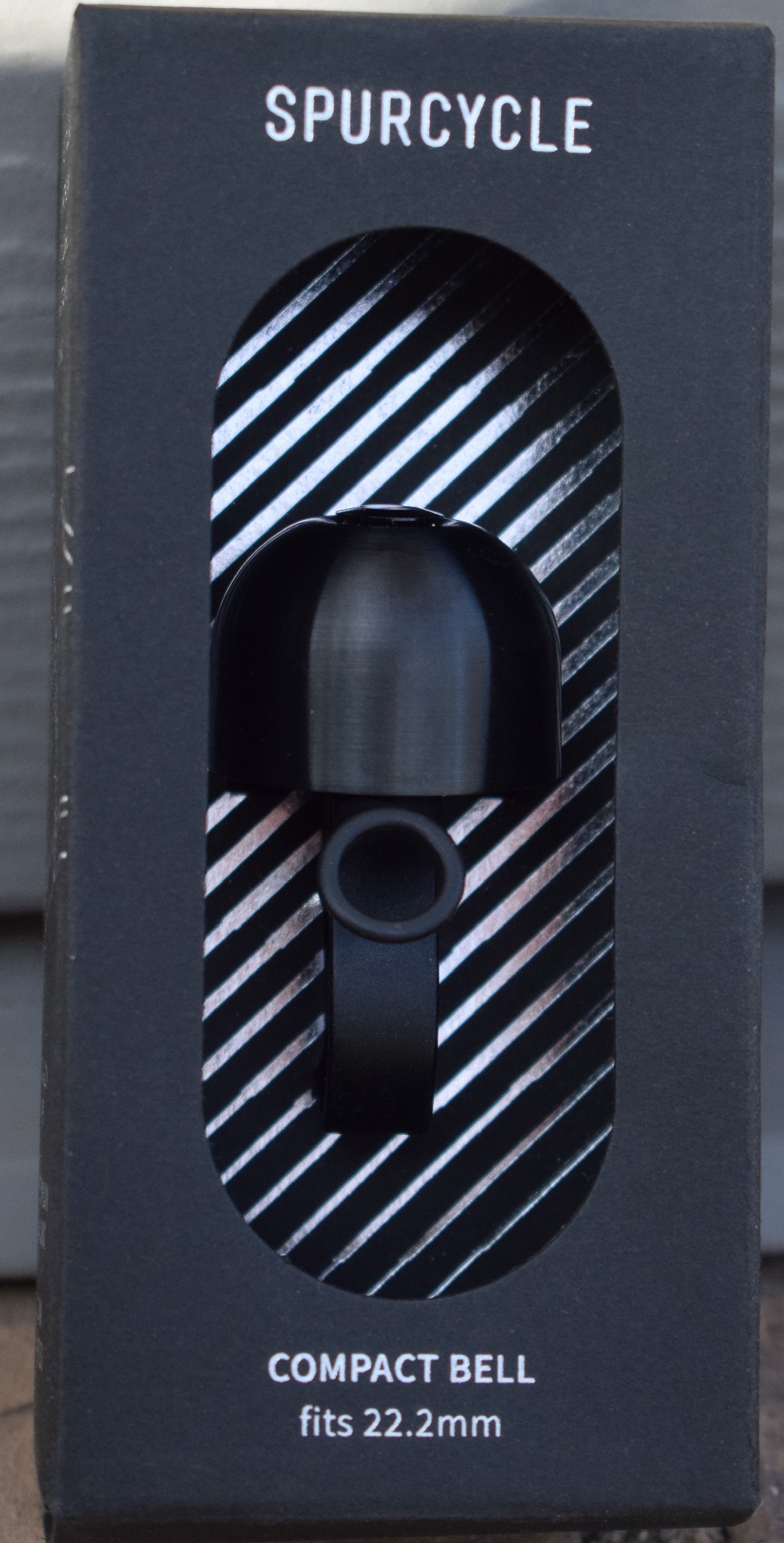
From its package, test out the high-quality ping this bicycle bell makes.
It’s great for commuters or mountain bikers because you can start the ring 10-15 seconds before passing a biker or pedestrian. Letting them know where you are and when you will be approaching. With the SpurCycle Bell, there’s no need to ring your bell 20-times like the inexpensive department store models. The initial ring offers enough of a shrill to get the attention of even the most hardcore earbud rockers, if you do choose to hit it repeatedly.
If your bike has a larger diameter handlebar (22.2 to 31.8 mm), consider the SpurCycle Original.
Mastering the use of your voice or the use of a bicycle bell
In a recent article published by CyclingSavvy, should you use a bicycle bell or your voice? For many, it’s a cultural issue. In this in-depth article, John Brooking discusses how you can use a bell or your voice to alert people and what to check for after sending an audible signal. He also touches on the other sounds bicycles make and how these extend your pre-ride safety check. Making it natural so your bell and voice, when riding, is a call-and-response. Musicians use this so the audience can sing along; you can use it, so your passage is predictable and safe.
Personally, as you can probably tell in this read, I prefer the bell to voice commands. Especially if you are in an urban area with heavy pedestrian foot traffic. Having spent time in Amsterdam on a bicycle made me a true believer that the bell’s sound was mightier than the voice.
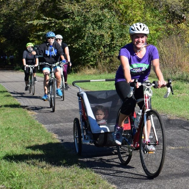
Are you looking for a family-friendly outing that explores the northwest suburbs, the Brooklyns of the Twin Cities? Enjoy the inaugural Pedal Jam Bike Ride on trails in Brooklyn Center and Brooklyn Park. In conjunction with the Brooklyn Center Health Fair and Brooklyn Park IgboFest cultural festival, the ride will take place on August 12, 2023.
Pedal Jam/Bike the Brooklyns
About the Pedal Jam/Bike the Brooklyns Ride
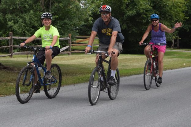
The ride sets the stage for the family to enjoy a bike adventure together, traveling 6.5 miles and showcasing businesses, parks, and residential areas of the two cities. The ride starts at Centennial Park, 6301 Shingle Creek Pkwy, in Brooklyn Center, and ends at the Brooklyn Park Community Center, 8500 W Broadway Ave, in Brooklyn Park.
The Pedal Jam begins at 2 p.m. But come early to check in, collect your number, visit the food trucks, and enjoy the Brooklyn Center Health Fair before the ride starts. From 12 Noon up to the start of the Pedal Jam, you can even get your bike tuned up for free. On the route, riders are encouraged to make stops along the way for fun activities and treats. Then, a the end, at Brooklyn Park Plaza, celebrate with chalk art, popsicles, music, giveaways, and the grand prize drawing for a new e-bike!
After the ride, also visit Igbofest down the street at North Hennepin Community College, enjoying ethnic food, music, and performances until 6 p.m. Prize announcements at the Pedal Jam will be at 4 p.m., and you must be present to win.
Pre-register here
Ride registration is $10 for Adults, 18 and under, is $5 (Youth under 12 must ride with an adult). Click here the Register.
The ride starts at 2 p.m., and cyclists are invited to register on-site, starting at 12 Noon if they haven’t pre-registered and have time to collect their rider number.
Minneapolis Northwest Tourism, the tourism marketing affiliate of Brooklyn Park and Brooklyn Center, is the host sponsor. They would like to thank the Brooklyn Park Library, the city staff of both Brooklyn Park and Brooklyn Center, and the police and fire departments.
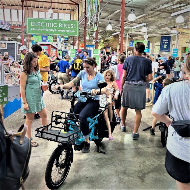
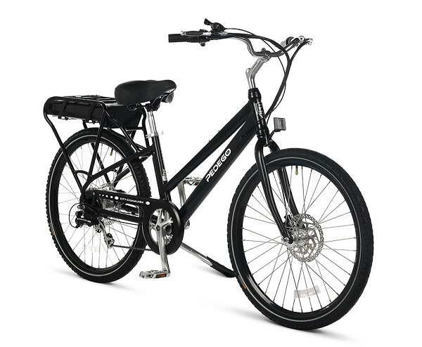
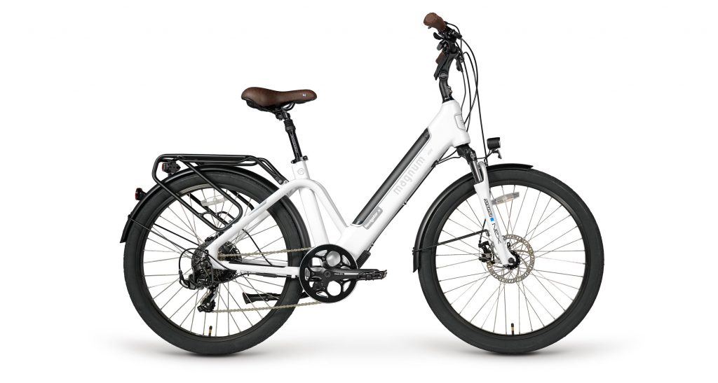
Thanks for exploring all the electric assist bikes (e-bikes) in the Eco Experience Building at the Minnesota State Fair. From past events, check out the top 10 questions asked when considering an e-bike. With the latest options in e-transportation available today, thanks to Affinity Plus and HaveFunBiking. Below, find links to two E-bike you can win. Plus, a list of bike shops with their favorite electric assist bicycle they are exhibiting. Also, find their contact information you may want to bookmark and have available when you need an E-bike.
The Joyful Riders Club is coming to Richfield on the evening of August 9th! Come out for this dance-paced community bike ride around beautiful Richfield, MN. While meeting new friends, the ride will feature live music with DJ Dev. as you explore this bike-friendly city. With a fun-filled evening of bike-focused highlights, upon your return, enjoy refreshments and more music at the award-winning inclusive playground!
Join the Joyful Riders Club dance-paced community bike ride in Richfield
Join the Joyful Riders
Join other cyclists at the Richfield Pool/Richfield Ice Arena parking lot (636 East 66th Street) on August 9. The ride will roll out after a few announcements at 6:30 p.m. and return by 8:15 p.m. The route is an estimated 5 miles and will take place primarily on protected trails and bike lanes.
Biking, Music, and Dancing
Prepare to pedal, groove, and learn about everything the community is doing to prioritize cycling and bike/ped safety. Don’t forget to bring your lights and smiles to brighten the night!
Families and Friends
The ride will maintain a lively party pace, ensuring everyone can enjoy the fun together. It’s a no-drop ride, so feel free to ride at your own pace, bring the kids and enjoy a beautiful summer night.
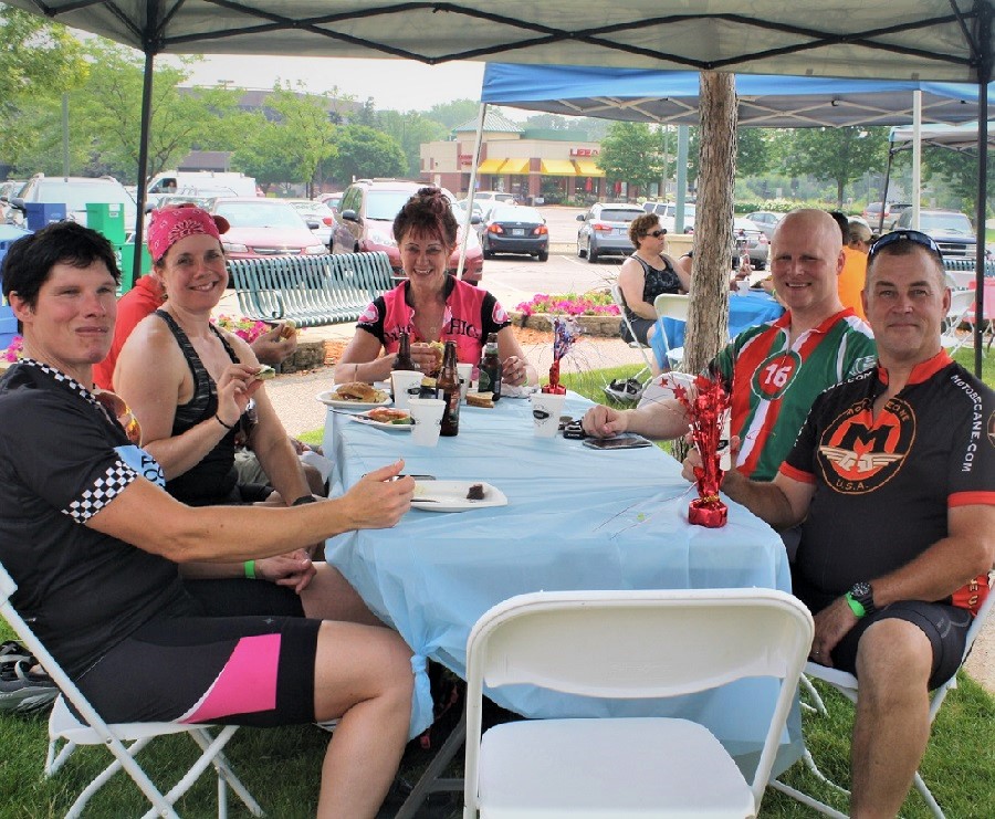
With all the new maps in the 2023 Minnesota Bike/Hike Guide, we are constantly scouting for good eating haunts, and think you will agree. A tasty meal can add to an adventure. But locating an outstanding cafe, restaurant, or sweet shop in an unfamiliar place can be tricky, especially when hunger has already set in. So please look at the helpful Good Eating tip sheet we created for finding a memorable food experience on your next adventure. Then scroll through our list of communities with unique places to eat below from the current maps we have posted.
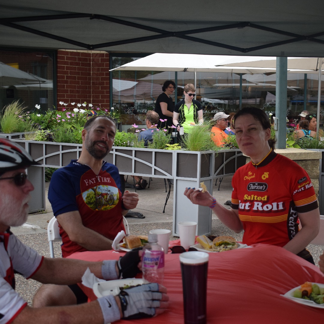
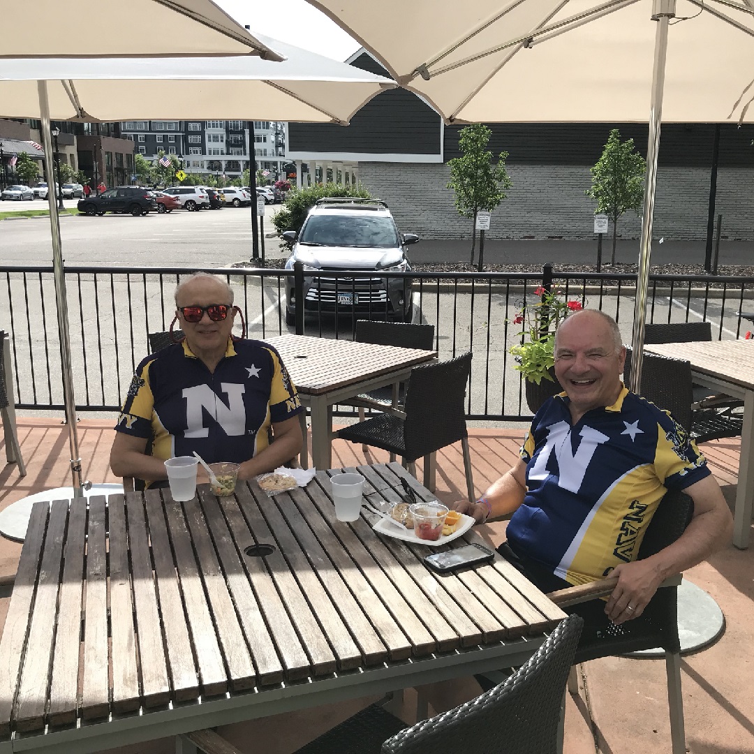
Patio dining is the perfect option in Minnesota’s summer months.
If you have a recommendation for a place we should check out, or you would like us to post your review at HaveFunBiking, please send them our way at HaveFunBiking.
Here are our ever-evolving good eating haunts to enjoy
Albert Lea
With scenic bike routes around the fingers of Fountain Lakes and the Blazing Star State Trail, out to Myre Big-Island State Park. An evening downtown at Crescendo is a great dining experience, especially with their piano music setting the ambiance.
With many bike-friendly roads, the 8-mile Scenic Circuit Loop, and the Central Lakes Trail running through the community, plus the off-road fun in the County Parks of Lake Brophy and Kensington Runestone, upon your return, you will be ready for a wide variety of dining options.
With many bike-friendly roads and trails throughout the community and off-road fun in Minnesota Valley River bottoms, experience some culinary delights in the south metro here.
With many bike-friendly roads, the 12-mile Scenic Circuit Loop, and the paved Paul Bunyan Trail running through the community, plus the off-road fun French Rapids Park, upon your return, you will be ready for a wide variety of dining options.
With many trails throughout the community, scenic bike loops, and off-road fun in Ravine Regional Park to pedal, check out the many eating establishments that will make your taste buds dance.
With many bike-friendly road routes and the pave Cuyuna Trail now connecting Ironton, Crosby, Deerwood, and several Cuyuna Moutain Bike trailheads, you will find plenty after your ride of places to challenge your taste buds when visiting.
Enjoy miles of scenic riding with the 14-mile Scenic Circuit Loop that connects to the Nine-mile Creek and Minneapolis trail system for more riding options. Then stop at one of the many eating establishments to satisfy your appetite.
Regardless, if you are riding the trails that connect to the 12-mile Scenic Circuit Loop or off-road trails out at River Bend Nature Center, you will find eating establishments to satisfy your tastes.
With the Mississippi River Trail passing through the city, connecting to the Mesabi Trail and several off-road parks is easy. After your ride, enjoy several fun places to eat and drink while visiting.
Enjoy miles of scenic riding with the 10-mile Scenic Circuit Loop here that connects to the Mississippi River Trail (MRT) for more riding options. Then stop at one of the many eating establishments to refuel.
With many trails throughout the community, scenic bike loops, and off-road fun in Stohls Lake Park, find several tasty options to enjoy after your ride.
Set in the rolling Mississippi River Valley, the area here offers miles of paved trails connecting to the Twin City Metro trail-grid and off-road riding to work up an appetite while visiting,
With many paved trails around the lakes and parallel to many Dakota County roads throughout the community and off-road fun at West Lake Marion Mountain Bike Park, you will work up an appetite to add to your experience visiting here.
After riding the Minneopa, Red Jacket, or Sakatah paved trail systems here or the off-road mountain bike parks, check out the current Free Press of Fine Dining.
With many trails throughout the community, scenic bike loops, and off-road fun in Elm Creek Park Reserve, you will find plenty of riding opportunities and places to expand your taste buds when visiting.
With many towns along the Mesabi Trail. When not riding the paved trail or one of the popular bike parks at Giants Ridge or Red Head mountain, be prepared for various tastes. Expect to be surprised…and pleased!
Here are some eating experiences when visiting communities on the Mesabi Iron Range.
Bon Appetit!
Minneapolis Northwest
With the rich diversity of Brooklyn Center and Brooklyn Park, the many trails here will take your taste buds on a flavor tour of the world without leaving the community,
With many trails throughout the community, scenic bike loops up to Clintonton Falls, and off-road fun in Kaplan’s Woods, enjoy Foremost Brewpub and flatbreads after a day of riding.
Enjoy miles of scenic riding with the 9-mile Scenic Circuit Loop that connects to the Nine-mile Creek and Minneapolis trail system for more riding options. Then stop at one of the many eating establishments here to refuel. New this year and worth checking out is Kataki Sushi & Ramen.
With many trails throughout the community that connect to the 10-mile Scenic Circuit Loop and the Xcel Energy Mountain Bike Park at Quarry Lake Park. You are sure to work up an appetite while visiting.
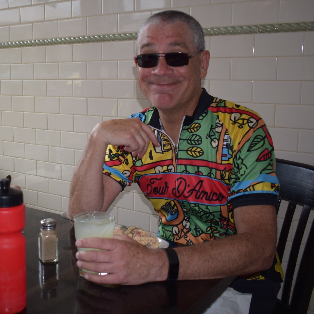
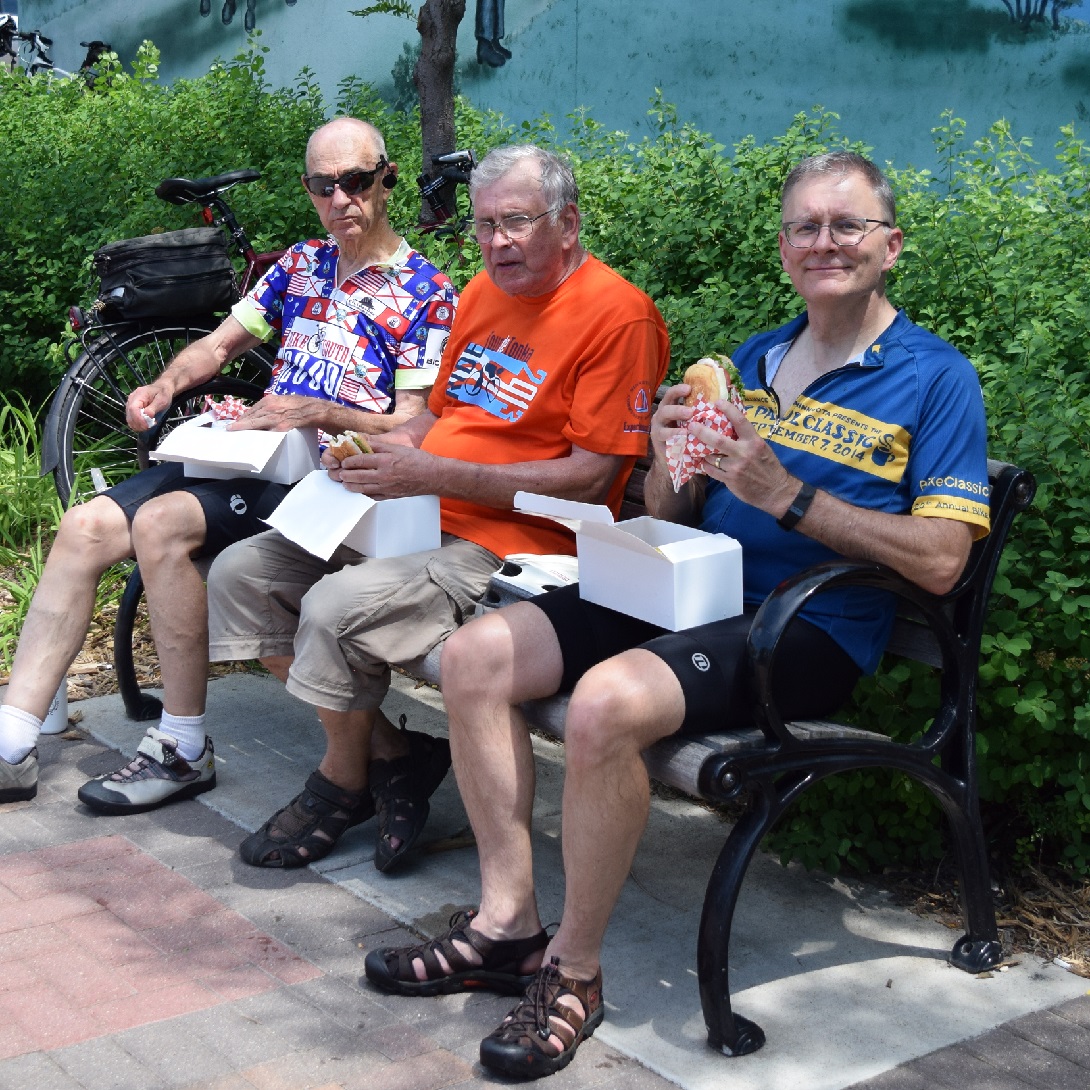
Good eating along the trail might be a box lunch from the local deli.
Waconia
With a bike-friendly route around Lake Waconia, many paved trails running parallel along county roads, and the off-road fun at Carver Park Reserve, you will work up an appetite to add to your experience visiting here.
Enjoy miles of scenic riding with the 8-mile Scenic Circuit Loop that connects to the Glacial Lakes State Trail for more riding options. Then stop at one of the many eating establishments to satisfy your appetite.
As the e-transportation industry continues to develop, we occasionally list bicycle inventory closeouts that you will find here next to our product review items. So please bookmark this page and check back often as we refresh this page with new items and deals to enjoy that next adventure.
New product reviews on items for that next outdoor adventure
As tree buds appear along the forested trails, finally shedding their winter coat, here is a list of new products we thought you might find interesting for that next outdoor adventure. New products for lovers of bikes.
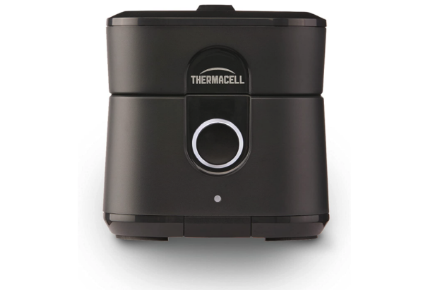
The Thermacell E55 offers a 20 ft. radius of protection from mosquitos.
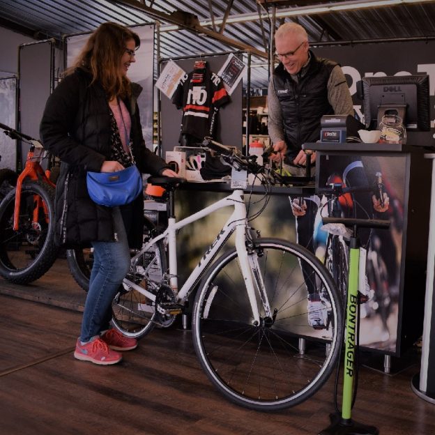
Over my 25 years in the cycling industry, I have found that the excitement of a new bike only increases as you get older. Here are a few cycles and gear to check out at your favorite bike shop. Click here to see our full review of fun products for that next bike adventure, and check back often.
Save with these bike gear auction items.
Sorry, this auction has ended!
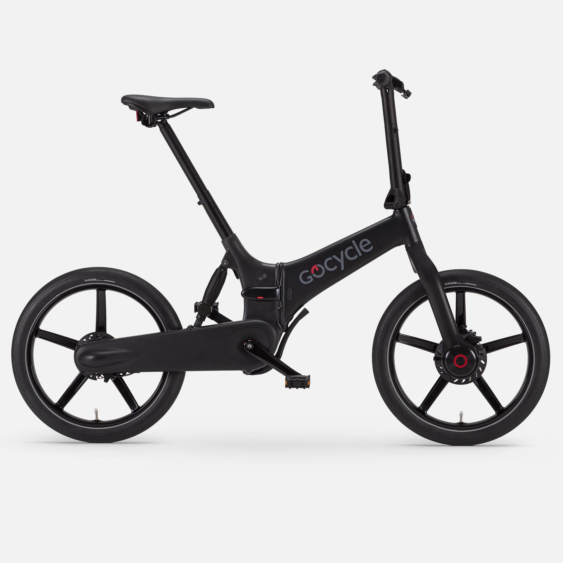
With the closing of PowerBikes.com here in the Twin Cities, here is your chance to get a new e-bike at a near-wholesale price. The inventory listed below is being auctioned off with a huge selection of bike accessories, e-bike certified helmets, locks, bags, cell phone mounts, bags, and every imaginable bike part & tool.
This 2022 Gocycle G4 is one of many e-bikes on the action.
You can get the best deal on a new electric assist bike before the spring riding season begins. Select from new in-the-box, new pre-prepped, demo, and used e-bikes. Check the full list of e-bikes here.
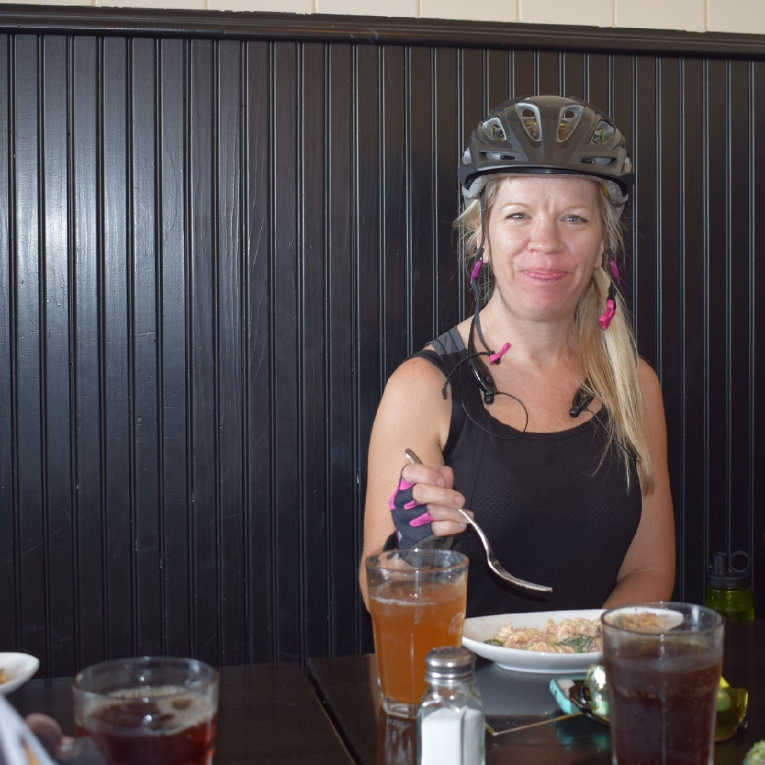
Here are some good eating tips when riding along Minnesota’s trails. Maybe it’s to a new area you haven’t had the chance to explore yet. When visiting a new town, or one that you may not have been to in a while, where is the best place to eat, find that afternoon snack or a refreshing beverage?
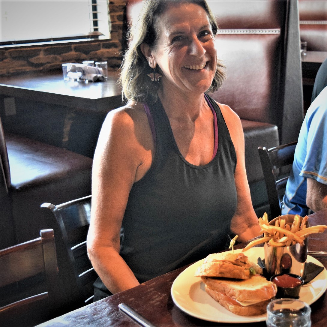
A meal can add to the experience of the trail.
A tasty meal can add to an outing, but locating a good restaurant in an unfamiliar place can be tricky — especially when hunger has already set in. To find the best tastes in a new town, follow these tips to know whom to ask and where to look. Bon appetit!
1. Plan, tap your network, then look at local news/blog posts
Traveling to a new place can be nerve-racking, but don’t be afraid to ask for recommendations from the barista at that coffee shop near your hotel or the locals there. My first move is to check my contacts for locals to hit up for advice or contacts who might be able to introduce me to someone in the area. Often, locals won’t send you to the restaurants on every best-of list but to their beloved haunts.
Add some fun research to your trip planning by reading up on local history that may influence a signature dish or sandwich served along the trail. A treasure trove of posts from local food bloggers or reporters is a quick Google search away to find the hot spots to add to the memorable trip. It’s easy to save all the addresses to a Google Map or print one out and highlight the places worth visiting along the trail. Also, before you go, you can post on Facebook and Twitter to see if anyone in your circle also has must-visit spots to share.
Another option is putting the word out to your social media network that you plan to visit an area and are looking for recommendations to favorite haunts. Put the word out on your Facebook, Instagram, or LinkedIn page.
Another option is to look at local newspapers and websites, though, increasingly, vigorous local food scene coverage can be hard to find. “Local news is much more helpful in larger cities.
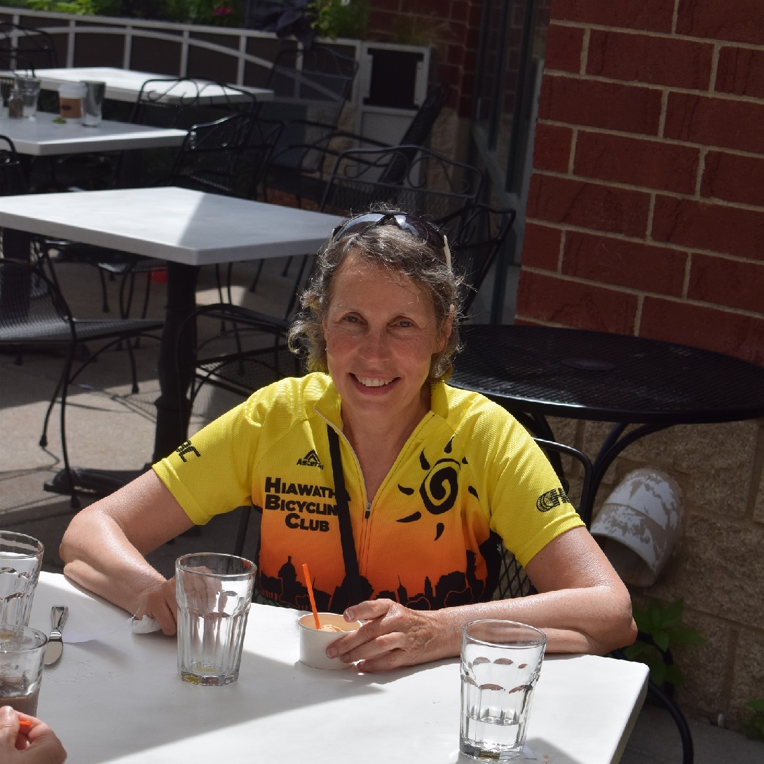
A deli might be the perfect option when a picnic along the trail is in the plan.
2. Ask the locals where to eat
Getting recommendations from the hotel staff or local chamber can be a reputable source. But, some of the best restaurant picks we’ve gotten are people we’ve met along the trail enjoying the many highlights the area offers. The local police can be a wealth of knowledge of good eats, and employees at the local bike shop could have a scoop on what’s good nearby for lunch. And asking people you meet can be a good icebreaker for even more tips and suggestions to discover that gastronomic delight.
3. Avoid eating on the main tourist drag
Restaurants near prominent tourist attractions usually don’t have to be excellent or exciting to get a decent crowd. Most travel experts say, “Usually, neighborhood places are a better bet than the main tourist drags.” Don’t be afraid to walk down a famous restaurant stretch and pop into a place where the menu draws you in. If you are like me, “I am moved by menus that make me hungry.” Follow your hunger, and you (probably) can’t go wrong. Do some research beforehand through Yelp, message boards, and friends who have been there.
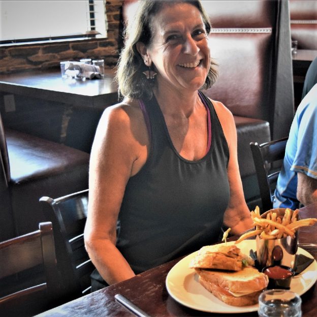
When the food is spectacular, you may have to make reservations.
4. Look for lines, and then book reservations
That says a lot if people are willing to wait to dine at a particular eatery. We’re not advocating wasting precious vacation time waiting long times to be seated for every meal, but once you find a spot that looks hot, research to find a better time to come back, or even better, see if they take a reservation.
Enjoy our list of fun places to eat when riding Minnesot’s trails.
5. Our list of good eating places along Minnesota’s trails
At HaveFunBiking.com, with all the new maps in the 2023 Minnesota Bike/Hike Guide, we are constantly scouting for good places to eat. See our evolving list of places for a delightful gastronomic meal as you explore Minnesota’s trails and touring roads.
Visiting Waconia with your bike, you will find a charming lakeside community with uptown pizzazz. The area around Waconia offers many fun bike-friendly adventures on the trails and roads there. Nestled along the southern shores of Lake Waconia in Carver County, the area boasts many year-round activities, including; sailing, boating, fishing, water skiing, and swimming, to name a few other recreational opportunities when not touring around on your bicycle while visiting.
The town’s tourism draw was sparked in 1884 when Coney Island, in the middle of Lake Waconia, was turned into a resort. A future planned park area there in a few years, today the mainland has become very popular as a resort community to take its place. Its friendly parks, streets, and nearby trail make it easy to explore all of Carver County.
More About Bike-Friendly Waconia
The warm, welcoming community of Waconia is located less than 45 minutes west of the Twin Cities. Its lakes and surrounding wildlife help make the town a relaxing locale for tourists from all over.
To describe the town as “bike-friendly” may be an understatement. Most of its streets cater to those who prefer pedaling their way around, exploring the area much easier. You can visit one of its several lakes, or immerse yourself in the town’s history. There are also many locally-owned shops to browse and restaurants to satisfy your appetite.
Riding Options When Visiting Waconia
The area has plenty to offer those who prefer to get around by bike. There’s access to trails that take you beyond the town’s border and bike-friendly county roads that allow you to explore everything the town has to offer. There’s something for everyone to enjoy.
Dakota Regional Trail
The northern part of the town has access to the Dakota Regional Trail. Part of the Three Rivers District, you can actually ride it all the way to Wayzata. The paved trail’s Waconia section will take you through its neighborhoods and wildlife. You’ll also get a nice sneak peek at Lake Waconia.
Carver Park Reserve
The park, managed by the Three Rivers District, provides access to the Lake Minnetonka LRT Trail. It’s another trail that can take you beyond Waconia if you wish for a longer ride.
Road Bike Touring
If you don’t want to stick to the trails, then you’re in luck; the town is full of bike-friendly roads that allow for almost limitless exploration. It also has plenty of shops, restaurants, history, and more to fill an entire weekend.
An At-A-Glance Look at Waconia
Be sure to check out our At-A-Glance Waconia Article for more details on where to stay, play, and explore for your hand-held devices. As this story and the At-A-Glance Article are mobile-friendly for your convenience, have fun!
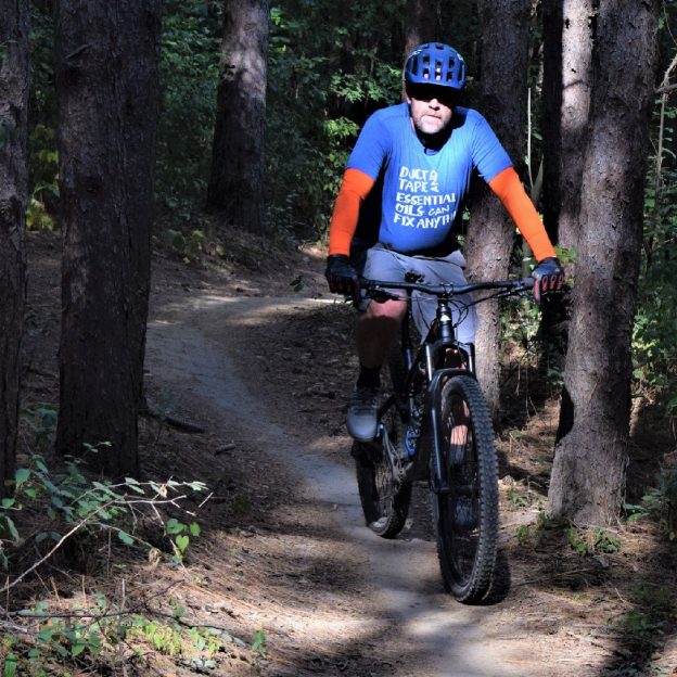
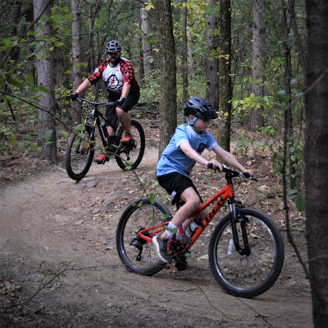
In Northern Minnesota’s vast forests, find an extensive network of rugged singletrack and easy-to-moderate mountain bike trails to enjoy. Explore the following list, with many state, regional, and city parks that maintain off-road trails to provide riders at every skill level with a fun experience. Whether seeking a serene roll or a challenging thrill, Northern Minnesota has a mountain bike park waiting. For that next Adventure you are planning, here are more than 50 trail systems to choose from.
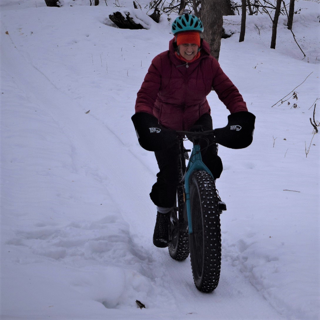
You will find the fat bike trails fun in spring, summer, fall, or winter!
Fun Northwestern Minnesota Mountain Bike Trails
Bemidji
Lake Bemidji State Park: 5 miles
Beginner to advanced: Park has much to offer with dirt and packed grass trails. The system is well maintained, and the forested terrain has some challenging sections. Map
Movil Maze: 8 miles
This system lives up to its name, so bring a compass and use the map of the area. There are several spurs that branch off this trail. The trail is a combination of grassy sections and dirt singletrack with ramps. Parts of the system are groomed for fat bikes in the winter. Map
Callaway
Maplelag: 23 miles
Here you will find a mixture of challenging singletrack and grassy double track, easy to expert on well-kept trails through hardwood forest. Maplelag Resort offers dining and lodging options. About 25km are groomed for fat biking in the winter. Map
Detroit Lakes
Detroit Mountain: 10 miles
This mountain bike park has trails perfect for beginners and experts. Ride contour flow trails, take the lift up to the top, then zip down the downhill flow trails, or ride the skills park. Lodge with bathrooms, bar, and concessions are onsite. Connecting trail takes you to Mountain View Rec Area trail. Groomed fat bike trails are available in the winter on select routes. Map
Dunton Locks County Park: 3 miles
While in the area, find trail loops along the shores between Lake Sallie and Muskrat Lake. Some wind through hardwood forested hills. Trails are shared with hikers and are groomed for skiing in the winter. Map
Mountain View Recreation Area: 6 miles
Single track loops through mature, mixed hardwood forest. Trails are laid out to be challenging. Connecting trail takes you to Detroit Mountain Rec Area. Map
Lake Bronson
Lake Bronson State Park: 5 miles
Good variety of accessible trails and loops to allow for different choices. The trails go through forest and prairie and are a mixture of grass and gravel. Map
Moorhead
Gooseberry Mound Park: 3.5 miles
Flat and wide singletrack loops on the banks of the Red River of the North. Connects to a short skills-building trail with bridges and rock gardens in Horn Park. This park is beginner-friendly because obstacles have ride-around options. Groomed for fat bikes in the winter. Map
M.B. Johnson Park: 4 miles
Singletrack loops along the banks of the Red River of the North. Trailhead has bathrooms, water, and a shelter. Groomed for fat bikes in the winter. Map
Iwen Park: 7 miles
Beginner-friendly trail consisting of a north and south section. Not groomed for fat bikes, but usually well-traveled by snowshoers. Map
Roseau
Hayes Lake State Park: 5 miles
Beginner trail on grassy, level terrain in a wooded area. Trails start at Hayes Dam. Map
Mount Roseau: 6 miles
Twisting trails on rolling hills in an open, grassy area, rated beginner to intermediate. Lots of switchbacks on this 60-foot artificial hill keep you on your toes. Map
Ulen to Crookston
Agassiz Recreational Trail: 53 miles
This abandoned railroad grade is a designated multiple-use trail shared by pedestrians, cyclists, equestrians, and ATV riders. It passes through Ulen, Twin Valley, Gary, Fertile, and Crookston and offers scenic views of the Sand Hill and Wild Rice Rivers while passing many farm fields. Map
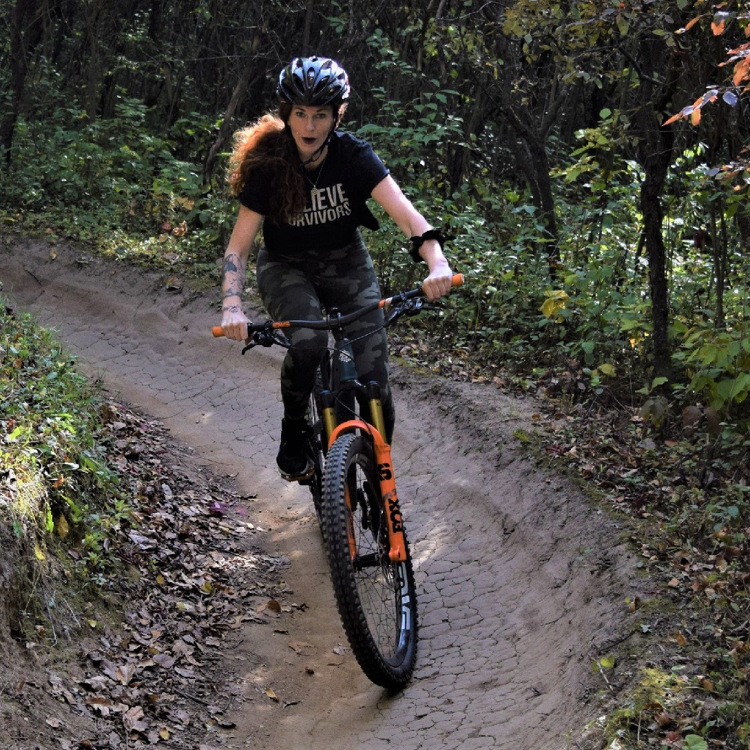
Family fun is a sure bet on many of the trails in Minnesota’s Northeast
Northeastern Minnesota Mountain Bike Trails
Northeastern Minnesota has the Sawtooth Mountains along the North Shore of Lake Superior, ski hills at Spirit Mountain and Giant’s Ridge, the deep forests of the Superior and Chippewa National Forests, the 135-mile Arrowhead State Trail, and the pristine beauty of some of the state’s most beautiful state parks.
Carlton
Jay Cooke State Park: 13 miles
This trail system combines grass, dirt, and pavement with spectacular views. Silver Creek Trail and Summer Trail are groomed for fat bikes in the winter. Map
Trails in the Chippewa National Forest
State and national forests offer a variety of areas to explore by bike. Some trails are exclusively non-motorized, while others are shared with various users, including OHVs and equestrians.
Simpson Creek Trail: 13 miles
Deer River, MN
Enjoy rolling topography through pines and along glacial eskers, with overlooks onto Cut Foot Sioux Lake and journeys into the cedar swamp. Cyclists travel on both old tote roads and dirt trails. Access at the Cut Foot Sioux Visitor Center or Eagle Nest Road (FR2198). Map
Cut Foot Sioux Trail: 18 miles
Deer River, MN
An extension of the Simpson Creek Trail, this is an 18-mile loop along old Forest Roads with gravel and sand. Access from the Cut Foot Sioux Visitor Center or the Hwy 46 Wayside Rest 5 miles north of the Center. Map
Suomi Hills Trail: 19 miles
Marcell, MN
The remote and stunning Suomi Hills has 19 miles of hiking, biking, and ski trails and is part of a semi-primitive non-motorized area. The rolling topography offers mountain bike trails for intermediate and advanced cyclists. Access the Suomi Hills area from the Highway 38 National Scenic Byway. Map
Trout Lake Trail: 11 miles
Marcell, MN
This is a nice short scenic trail into the woods and out onto the Trout Lake Estate, a national historic site featuring a 1920 lumber baron estate. Access from the north end of Trout Lake off Co 326 or the south end near FR 2065 and FR 2065. Map
Cloquet
Pine Valley Trails: 5 miles
Stacked loops rated beginner to intermediate with switchbacks and flow sections through stands of pine trees and open areas. These gravel trails are machine built and feature two expert and one intermediate jump trail. Because of the nature of the soil, trails remain open even when wet. Skinnies and gap jump with b-lines keep things interesting. Groomed for fat biking in a park that also has ski trails. A dirt parking lot with a porta potty is available adjacent to the Cloquet hockey arena. Map
Cohasset
Tioga Trails: 25 miles
This new mountain bike trail system in the location of a former mine pit offers trails for all skill levels as well as jump lines, flow trails, and a beginner skills section. Groomed for fat bikes in the winter. Map/Info
Duluth Area Mountain Bike Trails
Duluth has been named Gold Level Ride Center by the International Mountain Biking Association (IMBA), one of six destinations worldwide. The Cyclists of Gitchee Gumee Shores (COGGS) maintain and develop Duluth’s extensive trail system.
Craft Connector: 1.1 miles
The two-way trail connects the Enger Tower Scenic Overlook and the Lincoln Park Craft District. The downhill ride from Enger has some jump opportunities.
Downer Park: 0.5 miles
A work in progress for the advanced rider. More trails coming.
Duluth Traverse: 40 miles
As beginner-level singletrack, the Duluth Traverse (DT) connects the city’s trail networks at Lester Park, Hartley Park, Piedmont-Brewer Park, Spirit Mountain, and Mission Creek. Currently, 75% of the DT is on singletrack trails, the balance is on gravel roads and some paved road sections. It’s a work in progress and will eventually be all standalone singletrack.
Hartley Park: 9 miles
Beginner to intermediate trails through the hardwood forests and open marsh areas of Hartley Nature Center.
Lester Park: 12.5 miles
Beginner to intermediate. Beautiful views of the river valley and smooth, flowing single track. There are some rocky or rooty sections, but overall the trail is non-technical and the best option in the Duluth area if you are newer to mountain biking. Groomed for fat tire biking in the winter.
Mission Creek: 23 miles
Beginner to intermediate. Fast and flowing singletrack with many bridges, berms, and rollers. This trail network traverses a dramatic, heavily forested landscape with spectacular views of the St. Louis River Valley and Jay Cooke State Park. Groomed for fat biking in the winter.
Piedmont & Brewer Trails: 9 miles
Intermediate to advanced, challenging trails with bridges and features. Significant elevation changes with large rocky bluffs. Groomed for fat biking in the winter.
Spirit Mountain Bike Park
Beginner to advanced. Outstanding views of Lake Superior are the norm at Spirit Mountain. The terrain is demanding but is sure to reward with amazing vistas. Lift-assisted downhill mountain biking and fat biking.
Stone Age: 1.2 miles
Short but quite a workout, even for advanced riders. A long, technical uphill is rewarded with awesome views and the way down has challenges around every corner. Just north of the Mission Creek trails.
This remote and rugged backcountry trail travels through wilderness areas on Minnesota’s North Shore. It’s primarily used for snowmobiling but is open to hiking and biking and, in parts, ATV riding. Map
Ely Area Mountain Bike Trails
Hidden Valley Recreation Area: 23 miles
Hidden Valley’s ski trails become a mountain bike paradise during the warmer months. In addition to 13 miles of wide, grassy paths, there are another 10 miles of singletrack trail. The system currently consists of five loops rated beginner to expert:
– Magic Carpet: Any level of rider. Balance of climbs and flowy downhills
– The Big Pines Loop: Scenic views as you drop into and climb out of a narrow slot canyon.
– Erratic Behavior: Good climbs, big boulders, and rock gardens with challenging terrain.
– The Outback: The most difficult and longest trail into the far corners of Hidden Valley. Great vistas, good drops, the opportunity to get some air, and rocks to climb.
– Ely Airlines: This short, one-mile trail features jumps, drops, banked turns, and other challenges.
The singletrack trail is groomed for fat biking in the winter. Hidden Valley also has a one-mile mountain biking skills course near the club chalet. Info
Fernberg Tower Area
This area is located along Fernberg Road, east of Ely. Several county and forest roads intersect, giving an opportunity to explore the Superior National Forest, visit the hill that once held the Fernberg Lookout Tower, and visit several lakes. The route includes both gravel and natural surface trails. More Info
Nickel Lake Area: 12 miles
This area provides rolling wooded hills, grassy bogs, and beaver dams. There is access to several isolated lakes and an abandoned granite quarry that last operated in the 30s. More Info
Fenske Lake Area
This area has many opportunities to explore forests and logging roads. Trails cross over rolling hills and pass through spruce forests. More Info
Grand Marais
Pincushion Mountain: 10 miles
Challenging trails with awesome Lake Superior views. Switchbacks, bridges, rock gardens, and lots of elevation changes. Groomed for fat tire biking in the winter. Map
Grand Rapids
Forest History Center: 5 miles
Explore the Forest History Center by bike. Beginner trail through 1900s logging camp and virgin timber forest. More Info
Legion Trails: 7 miles
Hand-built singletrack trail ranging from fast and flowing to tight, twisty, and technical. Near Grand Rapids High School. Map
Grand Rapids to Ely
Taconite State Trail: 165 miles
The popular multipurpose trail moves through out-of-the-way forests and lakes and stretches 165 miles from Grand Rapids to Ely. It intersects with the Arrowhead State Trail just west of Lake Vermillion. Passes through Bear Head Lake State Park. Some areas may be impassable in the summer. Map
Hinckley
Saint Croix State Park: 21 miles
Wide, grassy trail in the woods with some dirt sections on the Matthew Lourey State Trail. Map
On the Mesabi Iron Range
Biwabik
Giants Ridge: 9 miles
Giants Ridge offers lift-served mountain biking on eight downhill gravity trails ranging from easy to expert. The Mountain Bike Park has over nine miles of purpose-built trails on rolling hills through the Superior National Forest. In the winter, 60km of the groomed ski trails are available for fat biking and the resort also offers lift-served downhill fat biking on select downhill runs. Map/Info
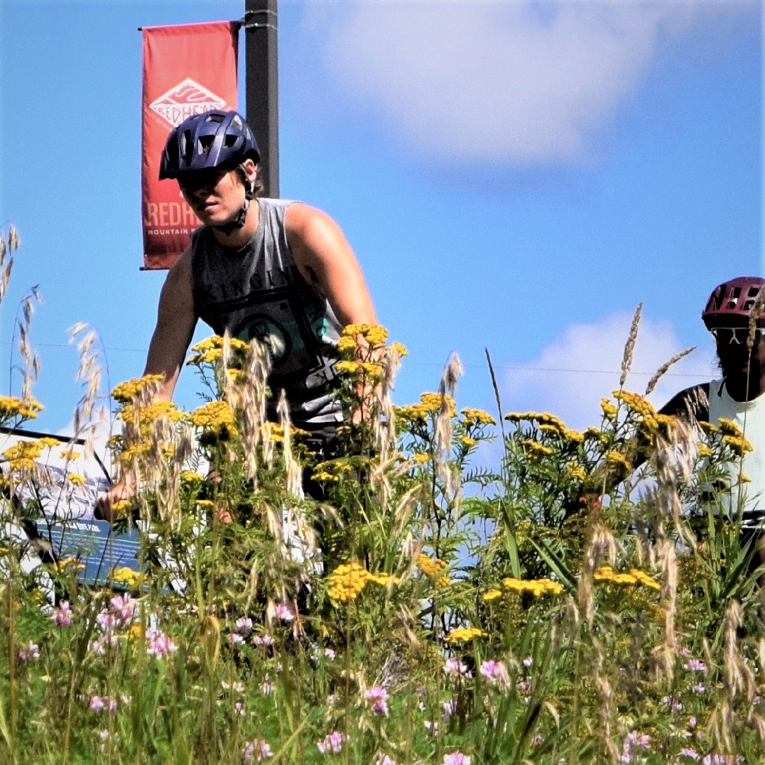
Heading out on Red Head
Chisholm
Redhead Mountain Bike Park: 25 miles
A new, developing trail system on the grounds of the Minnesota Discovery Center as of June 2020. Built around a series of former mine pits, this challenging trail system has some beginner trails but is mostly for intermediate to advanced riders. Punchy climbs and descents, plenty of rock gardens, and jumps make for a great ride, while the scenery is nothing short of spectacular with its ravines, red cliffs, and views of deep, blue lakes. There’s even a waterfall crossing on Fractured Falls Trail. Groomed for fat bikes in the winter.
The goal is to eventually offer trolley rides to some of the far-out trail loops near the Glen location, a restored, historic mining village. The Discovery Center has restrooms and a restaurant. Map/Info
Hibbing
Maple Hill Park: 4 miles
Intermediate, two-way singletrack with a dirt surface in a 133-acre city park. Map
Virginia
Big Aspen Trail: 21 miles
The Big Aspen Trail is 21 miles in the Superior National Forest with many loop opportunities and beautiful scenic vistas. The trail is part of old logging roads and abandoned railroad grades from the Virginia and Rainy Lake Lumber Company. It is a multi-use trail, allowing mountain bikes, ATVs, horses, and in the winter, cross-country skiers. Map
Lookout Mountain: 11 miles
The trail system has dedicated mountain bike singletrack with berms, bridges, and rock gardens in the Superior National Forest. Once you reach the top of a large hill it’s mostly rolling hills through forestland. There are a few large rock features and some challenging intermediate skill-level sections. The trails are two-way; look out for oncoming bikes and hikers. Map
Side Lake
McCarthy Beach State Park: 17 miles
A choice of nice rides is available on the park trails and the low-maintenance St. Louis County roads inside the park boundary. Bikers can venture out of the park on the Taconite State Trail. Map
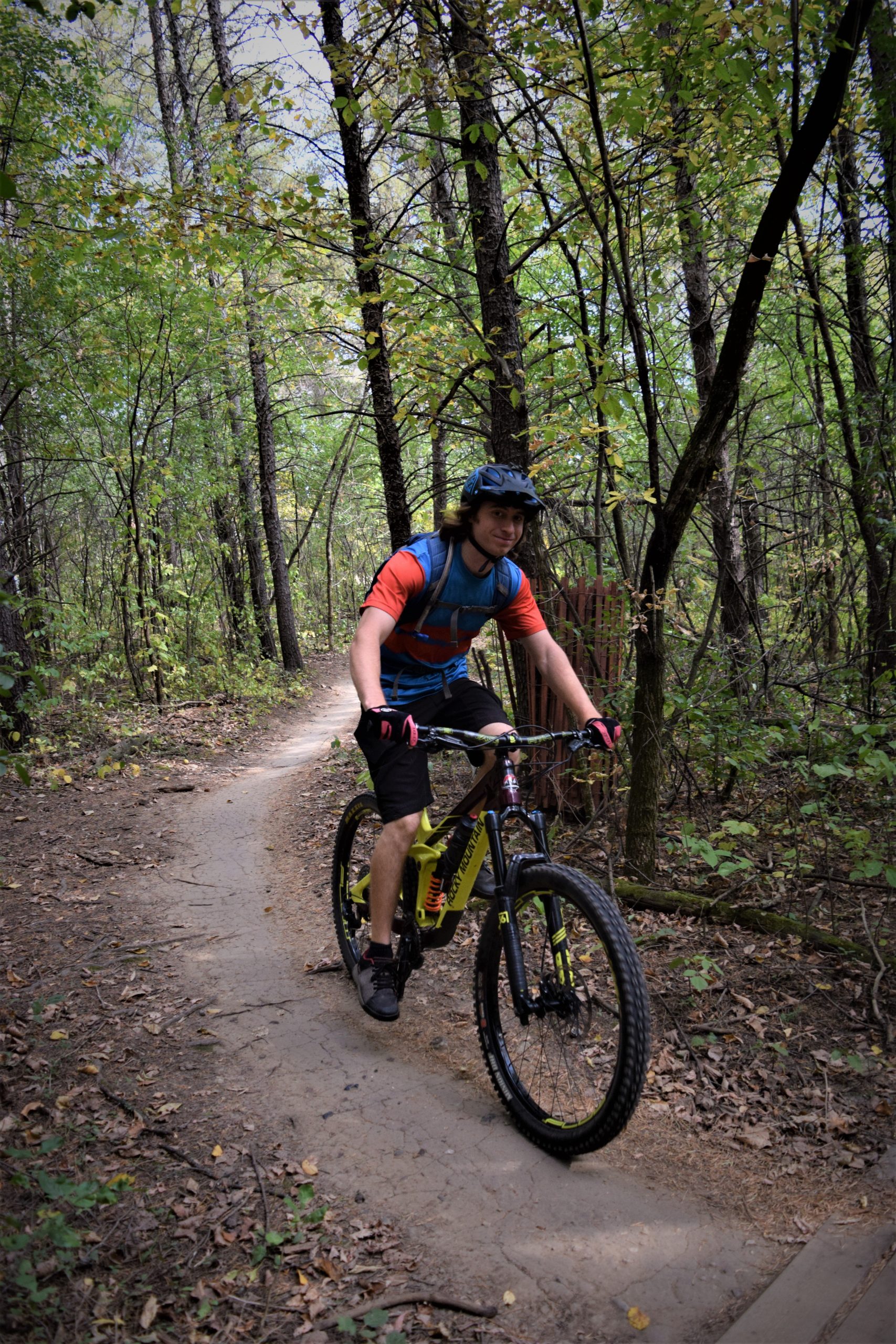
Fun on the trail
Tofte/Lutsen
Britton Peak: 5.5 miles
Trails are intermediate to advanced with a short beginner loop. Enjoy views of the Temperance River Valley and advanced features like a rock garden and boardwalk. Connects with High Climber and Jackpot Trails. Map
Jackpot and High Climber Trails: 16 miles
This unique ride follows the rolling ridges overlooking Lake Superior and features a machine-built flow trail with big berms, rock gardens, drops, jumps, and rock-armored creek crossings in a Wilderness setting. It’s laid out to be beginner-rated, but technical B-line options are up to the expert level. Parking is available on either end at Britton Peak Trailhead (Tofte) and Ski Hill Road Trailhead (Lutsen Mountains) and on Onion River Road.
While the trail is point-to-point, there are options for a loop ride. From Lutsen Mountains: Ride north on Ski Hill Road to Barker Lake Road, take Barker Lake Road to Honeymoon Trail (USFS 164), and head west on Honeymoon Trail to Sawbill Trail. From there, ride the pavement south to Britton Peak. Follow Jackpot and High Climber back to Lutsen. This option adds approximately 22 miles. Another option is to take the Gitchi Gami Trail. Onion River Road bisects the trail system and serves as the dividing line between High Climber to the east and Jackpot to the west. Map
Tower to International Falls
Arrowhead State Trail: 135 miles
Approximately 69 miles of the trail are suitable for mountain biking in the summer, but there may be wet areas. Intersects with the Taconite State Trail. Mountain bikers should call the nearest Parks and Trails Area office before leaving for their destination to inquire about local trail conditions and amenities. This is a multi-use trail, including horseback riding. Map
Two Harbors
Donald D. Ferguson Demonstration Forest: 10 miles
Easy beginner trails through boreal woods in the Superior National Forest, shared with hikers. The trail system is set to expand, with the ultimate goal of 15-20 miles. Groomed for fat bikes in the winter, skis, and snowshoes are also allowed. Map
Split Rock Lighthouse State Park: 3 miles
Easy trail with a mix of dirt and grass shared with hikers. No singletrack. Stunning views of the Split Rock Lighthouse along Lake Superior. Can be combined with a return on the paved Gitchi Gami Trail for a 6-mile loop. The park grooms this loop and another 3 miles for fat biking in the winter. Map
Split Rock Wilds Trail: 22 miles
The newest mountain bike trail system in northeastern Minnesota offers a challenging, point-to-point backcountry riding experience connecting the new Shipwreck Creek campground at Split Rock Lighthouse State Park with the Cove Point Lodge property. Trail conditions vary from rugged and rocky to fast and flowy and include multiple advanced and expert-level features like jumps, rock rolls, and drops. There is, however, a beginner-friendly loop near the campground. Map


