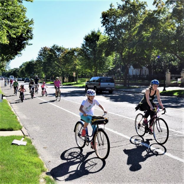
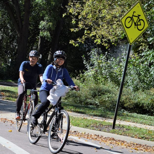
Tag Archives: True North

This Bike Pic Saturday, we captured these two biker gals out front of the group of cyclists, riding down Summit Avenue, in St Paul, MN for another True North experience.

Bike Pic May 09, a perfect weather day for a bike ride with friends!

This Bike Pic Tuesday, we captured these two biker gals out front of the group of cyclists, riding down Summit Avenue, in St Paul, MN for another True North experience.

So, get into the zone when continuing your time outdoors and your #NextBikeAdventure. View all the great ideas and bike destinations in the latest Iowa or Minnesota Bike/Hike Guide. Then plan your next outing with family and friends, and check out more stories at Let’s Do MN.

Thanks for viewing our latest bike pic

Now rolling through our 19th year as a bike tourism media, enjoy! As we pedal forward, we aim to encourage more people to bike and have fun while highlighting all the unforgettable places you can ride. As we continue to showcase more places to have fun, we hope the photos we shoot are worth a grin. Enjoy the information and stories we have posted as you scroll through.

Do you have a fun bicycle-related photo of yourself or someone you may know we should post? If so, please send your picture(s) to [email protected]. Please Include a brief caption for the image, who shot it, and where. Photo(s) sent to us should be a minimum of 1,000 pixels wide to be considered. You will receive photo credit and acknowledgment on Facebook and Instagram if we use your photo.

As we continue encouraging more people to bike, please view our Destination section at HaveFunBiking.com for your #NextBikeAdventure. Also, check out the MN Bike Guide, now mobile-friendly, as we enter our 14th year of producing this handy information booklet full of maps.

Bookmark HaveFunBiking.com on your cell phone and find your next adventure at your fingertips! Please share our pics with your friends, and don’t forget to smile. With one of our cameras ready to document your next cameo appearance while you are riding and having fun, we may be around the corner. You could be in one of our next Pic of the Day.

Have a great day with a safe and memorable year ahead!

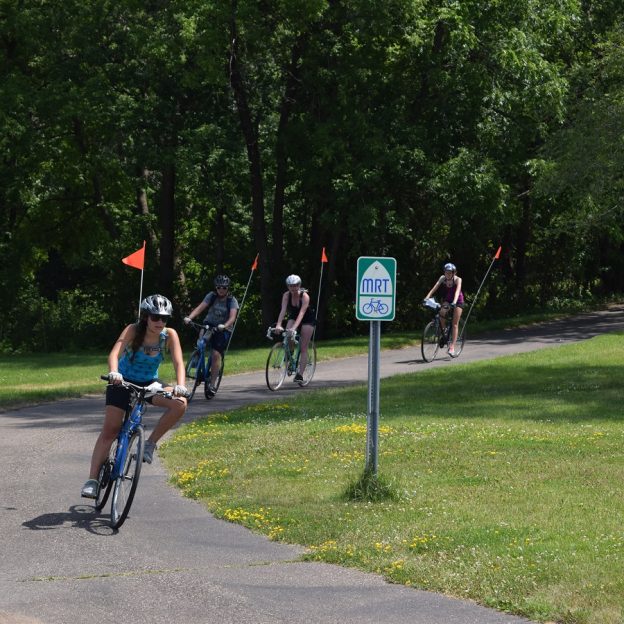
The Coon Rapids 10-mile bike loop makes it easy to connect and discover

by Russ Lowthian, HaveFunBiking.com

Named for the turbulent Mississippi River waters at the confluence of Coon Creek, the city of Coon Rapids is a fun place to explore on a bicycle. One of the nine communities in the Twin Cities Gateway, it’s a perfect destination for a bike vacation using the Coon Rapids 10-mile bike loop. Here you will find many connections to hundreds of miles of trails. The Coon Creek Trail and the Mississippi River Trail are two greenway systems here that allow you to pedal safely throughout the area. So, if you enjoy biking along rivers and creeks, we have some ideas for you, starting with the Coon Rapids 10-mile loop.

The 10-mile bike loop is fun for all levels of riders.

The Coon Rapids 10-mile bike loop

Leaving from the outer parking lot of the Muddy Cow Restaurant or a nearby hotel, the route travels in a clockwise direction. Pulling out onto Springbrook Drive, this tour safely crosses Coon Rapids Boulevard. Once across, we suggest using the paved trail that runs parallel to the street due to heavy traffic. After crossing 85th Avenue, about two miles into the loop, consider stopping at the Springbrook Nature Center.

Many roads here offer trails that parallel for added comfort and fun.

Now pedaling along the south side of 85th Avenue, at East River Road, cross the street at the stoplight and use the sidewalk on the west side, up to 85th Lane. Here enjoy the quiet neighborhood streets that connect you to the Mississippi River Trail (MRT).  At 86th Avenue, continue straight ahead on the MRT between two residences, and the real fun begins. Then, as the trail drops into the forested vegetation along the bank of the Mississippi River, it’s a whole new experience.

The visitors center here makes a great rest stop.

Following the trail along the river to the Coon Rapids Dam, you will pass several trail T’s in the park, offering more loop options. One loop in the park circles Cenaiko Lake where you will find many people fishing for trout.

The Coon Rapids Dam and Visitors Center

At the visitor’s center at the Coon Rapids Dam, you will find more information on the area and its history. The dam is another popular fishing location and a crossing point for cyclists riding the Three Rivers Trails throughout the Twin Cities Metro.

Riding across the Coon Rapids dam always offers a refreshing mist of cool air.

Turning north to Coon Creek

Riding up Egret Boulevard, you can ride in the bike lane or use the parallel pedestrian path.

Now at the Dam, the 10-mile Loop leaves the MRT and heads north out of the park on Egret Boulevard. You can ride the designated bike lane or use the pedestrian path paralleling the street on a bike-friendly road. Continuing north after crossing Coon Rapids Boulevard, at Robinson Drive, you will find the Coon Creek Trailhead. On the trail and after crossing the creek, the 10-mile loop takes a right at the trail T. If you want to add a few miles to your ride, here is another option. To your left, the trail will take you up through the Erlandson Nature Center and, further along, connects to Bunker Hills Regional Park.

The smells, sounds, and views of nature as you pedal

Now pedaling south alongside Coon Creek, enjoy the smells, sounds, and views of nature. This stretch of the trail is a tranquil wilderness setting as you pedal along the stream through the forested canopy.  After crossing over a creek bridge one more time, pass under the railroad tracks for another option. Stop for a round of bumper boats, go-karts, or miniature golf at Lilli Putt before heading east and completing the 10-mile Loop.

Enjoy the smells, sounds, and views of nature along the trail.

The trail runs parallel along Coon Rapids Extension and Boulevard for the last few miles of the route. Back at the parking lot, or your hotel, check out nearby eating establishments and plan another bike adventure in the Twin Cities Gateway Area.

Printable map and Q (cue)-sheet)

For a printable bike map of Anoka, click here

For a turn-by-turn Q-sheet of Anoka, click here

The Blaine 10-mile bike loop can add more memories to a sporting event

by Russ Lowthian, HaveFunBiking.com

With miles of connecting bike trails around the city of Blaine, sports fans and visitors alike will find many phenomenal sights while bicycling here. One of the nine communities of the Twin Cities Gateway this city is a perfect destination for a bike vacation tied to a sporting event. The city offers many trail opportunities surrounding the sports facilities here. So, whether you are an athlete looking for a fun way to get a pre-game workout. Or, a visiting sports fan looking for some added memories we have some ideas starting with the Blaine 10-mile bike loop.

The Blaine 10-mile bike loop can add more fun to your game visit.

The Blaine 10-mile bike loop

A perfect bicycle tour before or after a game this bike loop begins in the parking lot of the National Sports Center(NSC). The route heads south using the service road between NSC and Schwan Super Rink and passes through several parking lots south to 101st  Avenue. Traveling in a clockwise direction drive your bike south on Davenport to the stoplight at 99th Avenue and cross Highway 65. If you are staying at the Asteria Inn & Suites, on 93rd Ave, this is a great place to meet up with the 10-mile loop. it is a short 1/4-mile ride, north on Baltimore Street, from the hotel to 99th Avenue.

The Blaine 10-mile bike loo is fun for all ages.

Crossing the highway and enjoying the trails in Blaine

If you prefer staying off the streets after crossing the highway the trail that runs parallel on 99th Avenue, on the south side, for your added comfort.  On Clover Leaf Parkway, take a right and you are soon on a sequence of city trails up through several neighborhoods. For the next couple miles the route meanderers to the north. As you pedal along the trail you will pass several small neighborhood ponds where it is common to view wildlife.

Many roads here offer trails that parallel for added comfort.

At 113th Ave. the route relies on a combination of roads (with parallel trails). These quiet, low traffic city streets connect you to more neighborhood trails on the route up to Paul Parkway. The last stretch on this section takes riders through the Blaine Baseball Complex with several trail options circling the ball fields. One option, if you don’t mind adding more mileage to your ride is taking a left at the trail T to Bunker Hills Regional Park. On the 10-mile loop turn to the east on Paul Parkway where you will find a trail running parallel with the street.

A sweet tooth option at the 6-mile mark

It’s always fun when riding in the Twin Cities Gateway to stop for ice cream.

If you don’t mind adding a couple of extra miles, take a left on Ulysses Street for ice cream. It is approximately a mile, each way, that you will have to add to your total mileage, But the Big Dipper Creamery is worth the extra miles with 52 flavors to choose. For any bike service needs, while touring here, Pioneer Cycle is across Highway 65, north of Main Street.

Enjoying nature along the trail.

Continuing east on Paul Parkway the route crosses over Highway 65 and turns south on Aberdeen St, again with a trail running parallel on the west side. If you have worked up an appetite for breakfast, lunch or some pie,  Carol’s Restaurant is an option. Her homemade cooking is always a treat when I stop there!. Further south, the 10-mile loop jogs to the east and meanders past some more picturesque trail setting that takes you over a wooden bridge.

Returning back to the NSC or your hotel

After the round-a-bout at 113th, the route continues south on Club W. Parkway. For those staying at the Best Western Plus or  Fairfield Inn & Suites in Blaine, take a right on 108th Ave. The Hotel is south of Target, on the east side to Baltimore Street. If you missed the Big Dipper Creamery option, above you will find ice cream next door to the hotel. For bike touring visitors staying at Asteria Inn & Suites, on 93rd Avenue, continue south using the cue sheet link below.

The 10-mile Blaine loop continues south on Davenport, below 105th Avenue and into the National Sports Center parking lot. Back at the NSC or your hotel checkout a nearby eating establishment and plan another bike adventure in the Twin Cities Gateway Area.

Printable map and Q (cue)-sheet)

For a printable bike map of Blaine click here

For a turn-by-turn, Q-sheet of Blaine click here

This bike pic Saturday, enjoy your time out riding the trails with family and friends as the fall colors are at there peak.

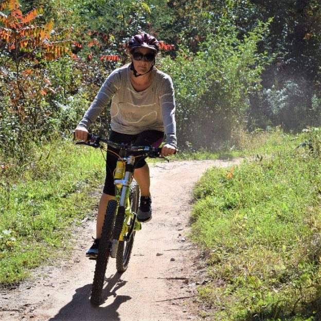
A healthy energy boost makes any off-road cycling adventure better

by Russ Lowthian, HaveFunBiking.com

If you are like me, I like to carry a few energy boost jell packs while enjoying nature in the wild. On my latest adventure, before the snow covered the Northwoods landscape, I found Trail Butter. Trying them I found they were delicious and provided a level of energy that lasted longer. Plus, having several flavors added to the experience and fun of mountain biking in the true north.

Trail Butter flavors in the 1.15 oz. packets for an energy boost.

A natural energy boost source while off-road biking in the true north

Wanting to get one more bike adventure in before snowfall in the upper Midwest, I spent four days exploring the Beltrami Island State Forest, near Roseau, MN. A mammoth forest covering more than 700,000 acres it’s about 30 miles south of the Canadian border. With Roseau several miles away I wanted to maximize my time and the weight of what I carried along. Using a couple of primitive campsites along the 140-miles of logging roads and trail loops the Trail Butter packets fit my needs well. Each day,

The 4.5oz size was my choice on my recent Northwoods trip.

I averaged about 30-miles of mountain biking from the established base camp for that section of the State Forest. Every five or six miles I stopped and enjoyed a single-size serving size of the Trail Butter. Stopping periodically for an energy boost of this nut butter made it easy to complete the planned route in plenty of time before dark.

With Trail Butter no gooey aftertaste

As I have found with some of the other energy products on the market, with Nut Butter there was no pasty after taste. I also found the company’s claim on its website description, as “slow-burning” and this was also true. The almond component of the nut butter mix offers a ready source of fat that burns slowly, perfect for any outdoor activity. Not like some of the other energy products I have tried, full of high fructose corn syrup or other sugar that doesn’t sustain you for very long.

Offered in four flavors and three different sizes

A 16oz jar of Trail Butter works well back to base camp or at home.

The Trail Butter packaging comes in three different styles and to date come in four flavors, with their Spiced Chai Seasonal Nut Butter Blend. Their regular flavors include the Original Nut Butter Blend; Maple & Sea Salt Blend; and the Dark Chocolate & Coffee Nut Butter Blend. Like the Original flavor, which is an almond nut base with chocolate and cranberries, you will find 680 calories to turn into energy in every single serving. Sizes include:

  • The single-serving 1.15oz packets that are easy to open and resemble the packaging of a typical gel. This size works well when disposing of the packaging isn’t an issue.
  • The 4.5oz size was my choice on my recent trip. It gave me several servings in one reseal-able, easy to eat out of the pouch. I just had to decide which flavor I wanted to carry each day.
  • Also available in 16oz jars. This size works well for those who are able to make it back to base camp or at home to prepare a sandwich.

Made in the U.S., Trail Butter is manufactured by a small company out of Portland, OR.  and sells for a reasonable price. So check out their website and give Trail Butter a try for your next adventure!

The Ham Lake 10-mile bike loop makes it easy to connect and discover

by Russ Lowthian, HaveFunBiking.com

A favorite place for bicyclists to visit, getting around on the Ham Lake 10-mile bike loop makes it easy to connect and discover the area. For summer fun and winter fat biking, Ham Lake is one of the nine communities of the Twin Cities Gateway you should consider exploring. With easy trail connections, it’s a comfortable place to ride. It’s almost like there is a bike-friendly road or trail wherever you go. Along with the 10-mile bike loop, with so many options you will find several days of attractions and parks ready to discover.

Riding through the neighborhood makes it easy to connect to the trail.

The Ham Lake 10-mile bike loop

For this 10-mile bike loop, the route travels counter-clockwise and begins in the parking lot of the AmericInn on the west side of Highway 65. Riding a short distance from the hotel on the Service Road the route quickly jogs through a neighborhood, up to Bunker Lake Boulevard. The first two miles are on the paved shoulder, so for safety, drive your bike like you would a car. Then, once you see the ball field it is easy to merge onto the bike trail that parallels the boulevard. At Prairie Road, the trail crosses for an adventure in the county park.

Riding the Ham Lake bike loop.

Explore the miles of trails in Bunker Hills Park

Now in Bunker Hills Regional Park, you will find a series of trails and parkways that crisscross at several locations. The natural setting of the park offers visitors several distinctive flora covings as you ride the trail loops here. At one point you are pedaling through native prairie grassland with patches Bur Oak. Next, you are pedaling through stands of pines that will lead you to shoreline views near Bunker Lake.

The natural setting here offers visitors several distinctive flora covings in the park.

For the 10-mile Ham Lake Loop, we will follow the trail close to County Parkway C, past a series of parking lots, a playground, restroom, and the Veteran’s Memorial site. Soon our selected trail route passes Bunker Beach Water Park and then follows County Parkway A to the south gate. Here at the trail T, our selected route takes a left and heads east.

Leaving the park it may be time for ice cream?

Leaving Bunker Hills Regional Park the trail comes out at the local high school. Here the route continues in an easterly direction on Bengal Drive, out of the school parking lot. At Jefferson Street, the route jogs to the right. Here watch for the trail on your left.  In a short distance, the neighborhood trail here comes out on 127th Ave and zig-zag down to Buchanan Street. If you have a sweet tooth or looking for a cool treat, stop at Big Dipper Creamery, with 52 flavors.  If bike service is need on your ride Pioneer Cycle is across Highway 65, north of Main Street.

It’s always fun when riding in the Twin Cities Gateway to stop for ice cream.

Now heading north, the 10-mile bike loop takes you back up the Service Road along Highway 65 back to the AmericInn. Back at the hotel parking lot checkout the nearby eating establishments and plan another bike adventure in the Twin Cities Gateway Area.

Printable map and Q (cue)-sheet)

For a printable bike map of Ham Lake click here

For a turn-by-turn, Q-sheet of Ham Lake click here

For winter fun check out the Ham Lake Snow Bowl

If you’re around in February, with your fat bike, consider the annual Ham Lake Snow Bowl. The event includes a fat bike race, scavenger hunt, ice fishing, local crafts and food, and more.

The Mounds View 10-mile bike loop connect to parks and nature

by Russ Lowthian, HaveFunBiking.com

With a great mix of busy and calm the Mounds View 10-mile bike loop lets you ride your bike along creekside trails from park to park. One of nine Twin Cities Gateway communities, it’s a perfect destination for a bike vacation with all the trail opportunities and connections here. Plus, their annual Festival in the Park event is something to plan for if you want to watch bike racers testing their cycling skills with blood, sweat, and gears. Maybe you want to give it a try yourself at the events beginner race?

Enjoy watching the Festival in the Park bike races or try it yourself.

Regardless when you visit here it’s fun to pedal through many quiet neighborhoods that connect you to trails that comfortably take you from park to parks. Along the way, especially on this 10-mile route, you may catch a true Minnesota wildlife experience along the Rice Creek Trail.

The Mounds View 10-mile bike loop

This bike loop travels clockwise and begins in the parking lot of the Mermaid Entertainment Center or your nearby hotel. Leaving to the west on the paved trail, on County Road H, once you see the soccer field, turn south into Long Lake Park. Now, on  Rice Creek North Regional Trail, enjoy the scenery as you pedal along the east bank of the creek. Now heading west, over the next few miles, you will pedal along the railroad tracks. At Stinson Boulevard the trail turns to the south.

Riding the Rice Creek Trail system is an adventure in itself.

A TrueNorth touch of nature along the Rice Creek

Leaving the RR tracks you will soon be in sight of Rice Creek, as it flows towards the Mississippi River. Here you will take the trail Y to the right and resume riding along the creek to the west. This section of the trail will put you in touch with nature, the forest air, sounds, and wilderness sightings. It will open your TrueNorth senses!

Connecting to trails from bike-friendly streets is easy in Mounds View.

A sweet option, before the next section of the trail

As the trail nears Central Avenue, you have an option. If you have a sweet tooth or the weather is hot, ride 1/2-mile south on the trail parallelling Central Avenue, to Grandpa’s Ice Cream. Otherwise, the Mounds View 10-mile bike loop continues west under the Highway 65 trail tunnel.

It’s always fun when riding in the Twin Cities Gateway to stop for ice cream.

After crossing under the highway take the upper trail where you will enter into Locke County Park, with restroom facilities. A little further, just past the dog park, the route turns north over the RR tracks and comes out at 73rd Avenue. Here on the south side of the street, you will find a trail that runs parallel as the route now turns back to the east.

Another park and wildlife hatchery

With a slight jog to the northeast first, up through another peaceful neighborhood, the route turns east again to Silver View Park. On the north side of the park, you will find several rest stop options and Cars Bike Shop. The 10-mile loop utilizes the trail around the north side of the little lake here in the park. In the spring of the year, through mid-summer, it is common to waterfowl with their broods of ducklings and goslings sunning themselves along the trail.

Ducks are easily spotted throughout the summer along the trail.

Now on the trail alongside Long Lake Road, the route jogs through a few more neighborhoods on the way back to County Road H and the trail on the south side. Back at the parking lot at the Mermaid checkout a nearby eating establishment and plan another bike adventure in the Twin Cities Gateway Area. Consider the Rice Creek North Regional Trail up to a chain of lakes?

Printable map and Q (cue)-sheet)

For a printable bike map of Mounds View click here

For a turn-by-turn, Q-sheet of Mounds View click here

The New Brighton 10-mile bike loop ties history with nature

by Russ Lowthian, HaveFunBiking.com

From its early years discover the historical connection to railroads and livestock this bike-friendly community. Today the New Brighton 10-mile bike loop offers cyclists a mixture of history, nature and many attractions as you ride here. Plus it is easy to add additional adventure with trail connections that will take you throughout the Twin Cities Gateway. With all the opportunities here you will find a picture-perfect destination for your next bike vacation here.

The New Brighton bike loop is fun for the whole family.

The New Brighton 10-mile bike loop

This bike loop travels clockwise and begins at the Homewood Suites by Hilton. Taking a left out of the parking lot onto Old Highway 8, you will find a trail on the west side as you pedal south. Soon after passing Lions Park the route enters a new development on Ring Road and catches the trail. Soon you are making a big sweep through the prairie grass as the trail crosses under the RR bridge near the freeway and takes you out on Beach Road. Lake. After crossing the south shore of Long Lake experience a mix of busy and calm. Now pedaling Manning Trail, along the freeway border wall, to your right enjoy nature along the south shore of Pike Lake. If you want to explore nature along the shoreline there is an optional short loop off the path.

A fun bike loop to explore with friends.

A stop for ice cream while biking to the Rice Creek Trail

Now pedaling to the northwest through the residential neighborhoods on the west side of Pike Lake the route ventures up to the Rice Creek North Regional Trail. On your way over to Central Avenue, if it is a hot day, consider stopping by Grandpa’s Ice Cream, at Moore Lake Road. Now riding north on a trail running parallel to Central, just before at 69th Avenue you are at the Rice Creek Trailhead. Here the 10-mile loop travels back east towards the headwaters of Rice Creeks. An option for future consideration is the Rice Creek Trail West. From Central Avenue, the trail follows the winding flowage to the Mississippi River and its well-known trail, the MRT.

The flavors here are worth stopping for.

The smells, sounds, and wilderness sightings along the trail

Back on the 10-mile route, pedaling east, this section is one of my favorite parts of the Rice Creek Trail. As the route winds back and forth along the waterway under a forested canopy I am amazed. Riding this section of the trail the forest air, noises, and wildlife sightings will encompass you. At the next trail Y, the bike loop pulls away from the creek and continues along a rail line that helped establish New Brighton. After crossing Rice Creek one more time on this bike loop you will be entering Long Lake Regional Park.

Biking along the rail line brings hits from the community’s past.

Stop by the New Brighton History Center, in the park

Here in the park, you will find numerous trails circling around between the east shore of Long Lake and the south shore of Rush Lake. Follow the turn-by-turn cue sheet of the route if you don’t want to miss a turn. There are a lot of intersections in the park. After crossing a final set of RR tracks you will pass the New Brighton History Center. Here you can stop and learn more about the areas past before returning back to the start.

A great place to stay on a bike vacation.

Returning back along Highway 8, it’s just a short distance back at the parking lot at Homewood Suites. After parking your bike check out a nearby eating establishment. Then plan another bike adventure in the Twin Cities Gateway Area.

Printable map and  Q (cue)-sheet)

For a printable bike map of New Brighton, click here

For a turn-by-turn, Q-sheet of New Brighton, click here

New Brighton’s annual Stockyards Days

If your vacation plans are centered around the second week in August, consider joining the fun at the community’s annual Stockyards Day’s.

The Shoreview 10-mile bike loop easily connects to a wildlife oasis

by Russ Lowthian, HaveFunBiking.com

A community with an abundance of lakes, hence the name Shoreview, you will find an oasis for wildlife viewing opportunities along its trails. While visiting and riding the Shoreview 10-mile bike loop you will find many trail connections here for several adventures. Regardless of when you arrive, you will find bike trails around the eleven lakes here with many natural settings. One of nine communities of the Twin Cities Gateway, Shoreview is a perfect destination for a bike vacation.

Riding alone, or with friends, many wildlife viewing opportunities are waiting.

The Shoreview 10-mile bike loop

For this bike tour travel clockwise and beginning in the parking lots of the Best Western Plus and Hilton Garden Inn. Taking a right onto the bike lane along Gamsie Road, then Chatsworth as the route first travels north. At Snail Lake Road, you will find a trail running parallel on the south side as you pedal to the east. After crossing Victoria Street watch for Snail Lake Park Facilities on the north side of the road.

A broad of ducks sunning themselves along the trail.

The tunnel into Snail Lake Park

At the park entrance, the Shoreview 10-mile bike loop continues on the trail to the north. In Snail Lake Park, there are some nature trails near the lake shoreline and perfect for wildlife viewing. Back on the route the trail now heads to the northeast. So watch the turn-by-turn cue sheet link below to stay on course as you make your way up to the Highway 96 and the bike-ped trail. At the Hodgson Road crossing, for something cool, check out the Big Dipper Creamery on the northeast corner of this intersection.  A mile further, after crossing Rice Street, watch for the trail T, along the highway into Sucker Lake Park.

Enjoying the trail to Sucker Lake.

More wildlife viewing along the trail in Sucker Lake Park

Both the park and trail here are on the west shoreline of the lake and offers many activities and a hiking trail if a closer encounter with nature is of interest. If so, check out the 1.9-mile trail around the lake for a closer look as low land songbirds watch your every move. Leaving the park, the route continues south from the parking lot on Sucker Lake Road. At County Road F, turn east and use the trail on the north side. At Rice Street and then at the intersection of Hodgson/Rice/Gamsie crossing use the trail on the east side to the Grass Lake Nature Preserve a part of the Snail Lake Regional Park system.

Enjoying the trail to Grass Lake Nature Preserve.

Songbirds and wildflowers filled the Grass Lake Nature Preserve

This preserve allows cyclists and pedestrians alike a chance to view songbirds from the paved trail circling around the eastside of Grass Lake. An optional hiking trail takes you out in the wildflower-filled meadow on the west side of the lake. Back on the route the paved trail leaves the preserve and crosses the bike-ped bridge over I-694, onto County Road E. Now pedaling to the east again the 10-mile bike loop makes a sweep through one more park before returning to the starting point. After crossing Victoria Street, the trail enters Island Lake, County Park.

Songbirds and wildflowers fill the nature preserve with opportunities.

Surrounded by busy, the calm is the park in the heart of Shoreview

The park, on the east shoreline of Island Lake, is in the heart of Shoreview.  Along with the general park amenities, the walking trails here will make you feel like you are in a different area, not in the cities. The 10-mile bike loop uses the paved trails up through the park to the north end, then the park road around the upper end of the lake to the parking lot at the boat landing. Here pick up the trail again for one last look at nature in Shoreview.

Now it is over to the trail along Lexington Avenue and north for your return. Back at the parking lot, check out a nearby eating establishment and plan another bike adventure in the Twin Cities Gateway Area.

Bike Route options from Country Inn & Suites in Shoreview

Using the trail parallel to Rice Creek Parkway and then Park View Drive it is easy to get to the miles of paved trails in the Rice Creek North Regional trails system. The trail here to the east follows the Rice Creek up to its headwaters in the Rice Creek Park Preserves. From the chain of lakes here, south of Lino Lakes, both the Rice Creek and the trail corridor meanders to the west into the Mississippi River and the Mississippi River Trail (MRT). Along this trail corridor, you can connect to several other trail systems and parks through the Twin Cities Gateway.

Printable map and Q (cue)-sheet)

For a printable bike map of Anoka click here

For a turn-by-turn, Q-sheet of Anoka click here

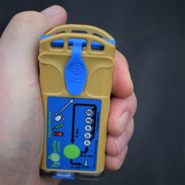
Finding safe drinking water was easy with the H2gO Purifier

by Russ Lowthian, HaveFunBiking.com

When mountain biking or hiking, it’s nice to find the right gear that can help cut down on carrying extra weight, like water. On a recent backcountry field trip into Minnesota’s north woods, I had the opportunity to use the Aqua Research H2gO Purifier. This purifier was the perfect device to provide safe drinking water without adding additional weight to the gear I packed. No regrets choosing the H2gO Purifier for this Bold North trip was easy to use and safe. This compact purifier will be a mainstay accessory in my luggage when water is questionable on future trips.

Converting natures surface water was easy with the H2gO Purifier

I planned to spend four days exploring the mammoth Beltrami Island State Forest, near Roseau, MN. Even though there were a couple of well water locations in this forest covering over 700,000 acres, five rivers with headwaters here aloud for more convenient water options. With primitive campsites along the 140-miles of logging roads and trail, I wanted to maximize my time on my off-road bike exploring the area. Using the purifier to disinfect water along the trail allowed me room to pack several other luxury items of comfort.

Stopping alongside a stream it was easy to process safe drinking water.

The H2gO Purifier is small and easy to pack and works well eliminating any harmful organisms from the lakes and streams I stopped at for water. The coffee I brewed after processing this True North water was enjoyable too. Only one time did I wish I had a filtering device along? There were some specs of sediment in the water, but a sock from an extra clean pair I had worked.

How the H2gO Purifier works

This handheld purifier works by converting table salt and water into a disinfectant through an electrolytic process. Easy to perform in the field, first I mixed the salt and water in a small applicator bottle. Once the salt dissolved, I then added the solution into the reaction trough on the front side of the H2gO Purifier. Next, I selected the amount of water I wanted to purify (1, 2, 3, 5, or 10 liters). Then holding the button for two seconds, the reaction starts. It takes approximately 15 seconds per liter to create a disinfectant concentration. Then ready, I poured the disinfectant from the purifier into the water I planned to consume. Finishing by shaking or stirring and then after 30 minutes, depending on how clear the water is, it is ready to drink killing all pathogens.


This purifier is certified by the World Health Organization (WHO) meeting their classification for Household Water Treatment Systems. A single dose from the H2gO Purifier meets WHO treatment standards for viruses and bacteria. While in-house testing shows multiple doses of in-activate protozoan cysts like Giardia and Cryptosporidium.

The purifier also has a built-in solar panel for alternative charging and an LED flashlight for added functionality. The unit can also run off your cell phone battery for charging.

The H2gO Purifier comes complete with a detailed instruction manual, salt mixing bottle, safety indicator strips, a micro USB cable with a wall charger, and a mesh carrying bag to keep everything together.

In summary

In my experience using the H2gO Water Purifier is an ideal device when the water you want to drink is questionable. This purifier creates a disinfectant to kill organisms in your drinking water. Be aware of your surroundings (mine pits, old wells, etc.) as this purifier will not remove heavy metals or sediment. In comparison to other chemical purifiers, this is far superior as the taste is better, works faster and is much easier to transport, not to mention safer.