Tag Archives: Minnesota bicycle destination

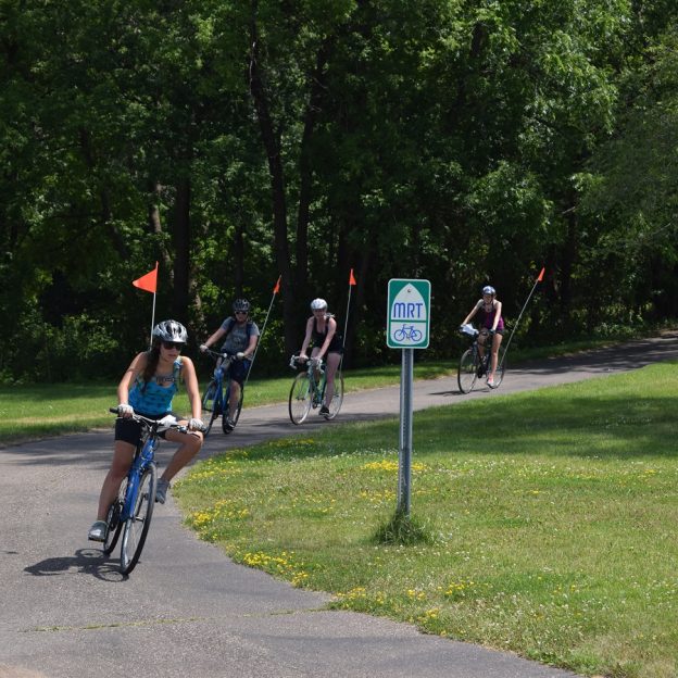
The Coon Rapids 10-mile bike loop makes it easy to connect and discover

by Russ Lowthian, HaveFunBiking.com

Named for the turbulent Mississippi River waters at the confluence of Coon Creek, the city of Coon Rapids is a fun place to explore on a bicycle. One of the nine communities in the Twin Cities Gateway, it’s a perfect destination for a bike vacation using the Coon Rapids 10-mile bike loop. Here you will find many connections to hundreds of miles of trails. The Coon Creek Trail and the Mississippi River Trail are two greenway systems here that allow you to pedal safely throughout the area. So, if you enjoy biking along rivers and creeks, we have some ideas for you, starting with the Coon Rapids 10-mile loop.

The 10-mile bike loop is fun for all levels of riders.

The Coon Rapids 10-mile bike loop

Leaving from the outer parking lot of the Muddy Cow Restaurant or a nearby hotel, the route travels in a clockwise direction. Pulling out onto Springbrook Drive, this tour safely crosses Coon Rapids Boulevard. Once across, we suggest using the paved trail that runs parallel to the street due to heavy traffic. After crossing 85th Avenue, about two miles into the loop, consider stopping at the Springbrook Nature Center.

Many roads here offer trails that parallel for added comfort and fun.

Now pedaling along the south side of 85th Avenue, at East River Road, cross the street at the stoplight and use the sidewalk on the west side, up to 85th Lane. Here enjoy the quiet neighborhood streets that connect you to the Mississippi River Trail (MRT).  At 86th Avenue, continue straight ahead on the MRT between two residences, and the real fun begins. Then, as the trail drops into the forested vegetation along the bank of the Mississippi River, it’s a whole new experience.

The visitors center here makes a great rest stop.

Following the trail along the river to the Coon Rapids Dam, you will pass several trail T’s in the park, offering more loop options. One loop in the park circles Cenaiko Lake where you will find many people fishing for trout.

The Coon Rapids Dam and Visitors Center

At the visitor’s center at the Coon Rapids Dam, you will find more information on the area and its history. The dam is another popular fishing location and a crossing point for cyclists riding the Three Rivers Trails throughout the Twin Cities Metro.

Riding across the Coon Rapids dam always offers a refreshing mist of cool air.

Turning north to Coon Creek

Riding up Egret Boulevard, you can ride in the bike lane or use the parallel pedestrian path.

Now at the Dam, the 10-mile Loop leaves the MRT and heads north out of the park on Egret Boulevard. You can ride the designated bike lane or use the pedestrian path paralleling the street on a bike-friendly road. Continuing north after crossing Coon Rapids Boulevard, at Robinson Drive, you will find the Coon Creek Trailhead. On the trail and after crossing the creek, the 10-mile loop takes a right at the trail T. If you want to add a few miles to your ride, here is another option. To your left, the trail will take you up through the Erlandson Nature Center and, further along, connects to Bunker Hills Regional Park.

The smells, sounds, and views of nature as you pedal

Now pedaling south alongside Coon Creek, enjoy the smells, sounds, and views of nature. This stretch of the trail is a tranquil wilderness setting as you pedal along the stream through the forested canopy.  After crossing over a creek bridge one more time, pass under the railroad tracks for another option. Stop for a round of bumper boats, go-karts, or miniature golf at Lilli Putt before heading east and completing the 10-mile Loop.

Enjoy the smells, sounds, and views of nature along the trail.

The trail runs parallel along Coon Rapids Extension and Boulevard for the last few miles of the route. Back at the parking lot, or your hotel, check out nearby eating establishments and plan another bike adventure in the Twin Cities Gateway Area.

Printable map and Q (cue)-sheet)

For a printable bike map of Anoka, click here

For a turn-by-turn Q-sheet of Anoka, click here