Tag Archives: Anoka County Park

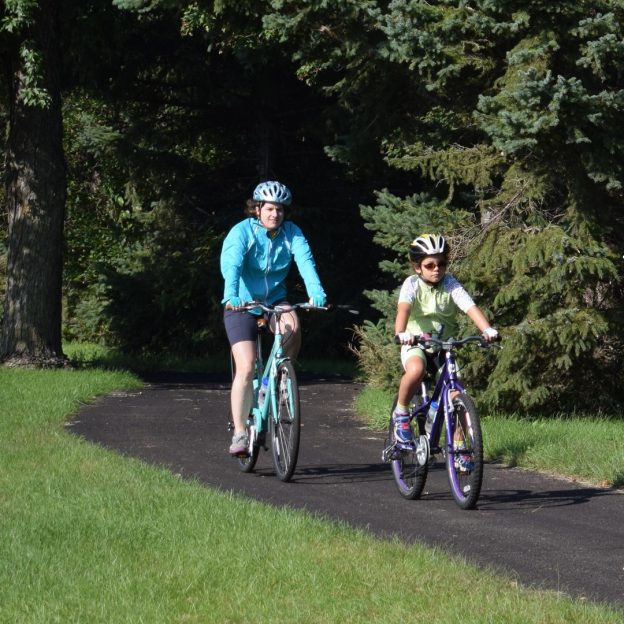
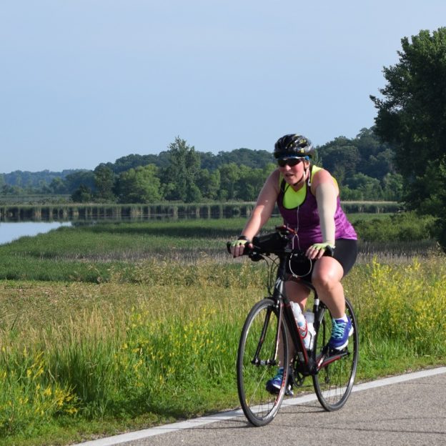
The scenic Anoka bike loop offers fun exploring the river history there

At the confluence of the Rum and Mississippi Rivers, discover Anoka, with fun at every turn along its scenic bike loop. With its river city charm and designated the ‘Halloween Capital of the World’ this bicycle-friendly community in Minnesota is a place to explore. Riding your bike on the scenic bike loop you will discover several river-front parks and historic neighborhoods. A part of the nine Twin Cities Gateway communities, in the north suburbs of the Twin Cities. You will find over 250-miles of connecting trails to enjoy. The perfect destination to visit with your bike.

The Anoka 10-mile bike loop is an adventure for all skill levels of riders.

The scenic Anoka bike loop

For this bike ride, we will start at the Gathering Place Bandshell along the river. It’s located on the east bank of the Rum River, a block west of Ticknor Hill Bed & Breakfast in Akin Riverside Park.

It’s fun riding parts of the Mississippi River Trail while in Anoka.


Traveling clockwise, the route begins by crossing over the river on the pedestrian bridge, then across Ferry Street. Now pedaling along Benton Street, you will find a picturesque lane in the Historic Whiskey Flats neighborhood, The street here is a part of the Mississippi River Trail (MRT). Soon you are on the actual trail pedaling into Mississippi River Community Park, at Kings Island.

Kings Island and park amenities

Signage along the trail as you enter Kings Island.

Arriving in the park you will find restroom facilities, a playground, and some extra trails and observation decks along the river to view nature’s settings here. On the east bank of Mighty Mississippi, the Kings Island section of the park incorporates the natural beauty of a wooded flood plain. Add to your fun by exploring the nature trails here. Along the walking paths that circles the island, view an occasional mix of wildflowers amongst riverside flora and fauna.

Up to River Bend Park on the Rum

Leaving the MRT, the Anoka 10-mile loop utilizes the trail along its northern route up through Anoka’s industrial area. After crossing Highway 10, notice the Regency Inn Hotel to your left. And those who prefer to shorten the loop to 6-mile should turn right and head east on Vista Way (see the printable Anoka Map for more details).

Back on the 10-mile loop pedaling north up to Bunker Lake Boulevard, and turn east. At the intersection of Saint Francis Boulevard (Hwy 47), you will find several rest stop options. Then, before crossing the Rum River check out River Bend Park. If you picked up a sandwich at the rest stop, this is a perfect place to stop and view the river while enjoying your lunch.

After crossing the bridge over the Rum River, another option is to stop at the Rum River Library or the Anoka Nature Preserve. Looking east, notice the trail that crosses Bunker Lake Boulevard? That trail will safely get you up in the area of the library and nature preserve.

The Anoka Nature Preserve is a 200-acre passive recreational area with low maintenance, hard-packed roads, perfect for 2-lane off-road cycling, and hiking. At the trailhead here, north of the library, you will find a playground and a restroom option. The trails in the Preserve are perfect for off-road family riding. At the riverbank to the Rum, several paths lead to wildlife observation decks.

Following the flow of the Rum River back to Anoka

Now heading south along the east bank of the Rum River, the trail offers wildlife viewing opportunities at every turn. As you get closer to the inner city of Anoka the trail merges over to the bike lane on 4th Avenue and through the historic Cutterville and Wet Flats neighborhoods. Here the 6-mile loop joins from the west and the trail route resumes along the river.

The Anoka 10-mile bike loop is fun for all ages!

The historic downtown district of Anoka

As you approach four metal grain bins along the trail you are entering the north side of the historic downtown area of Anoka. Here you will find several delicious dining establishments and many historic points of interest. Also known as the Halloween Capital of the World, the city of Anoka becomes alive with festivities each fall. Now, before taking the river trail, under Main Street and back to the band Shell, check out the observation deck at the Rum River Dam.

Downtown, don’t forget to stop at Two Scoops for ice cream.

Back at the Gathering Place Band Shell or your hotel checkout a nearby eating establishment and Two Scoops Ice Cream while planning another bike adventure in the Twin Cities Gateway Area.

Printable map and Q (cue)-sheet)

For individual bike maps of the nine Twin Cities Gateway Communities click here

For a turn-by-turn, Q-sheet of Anoka click here

The Fridley 10-mile bike loop lets visitors discover the MRT

by Russ Lowthian, HaveFunBiking.com

Named for an early settler along the east bank of the Mississippi River. Today bike-friendly Fridley, with its 10-mile bike loop, lets visitors discover art, nature, and beautiful flower gardens along the way. Here, with many cycling paths connecting to both the Mississippi River Trail (MRT) and the Rice Creek Trail, it’s easy to get around. One of the nine communities of the Twin Cities Gateway, the city of Fridley is located just north of Minneapolis and a fun place to explore. So, if you enjoy biking along the trails that Red River oxen carts once used, we have some options to explore while enjoying the Fridley 10-mile bike loop.

Fun on the Fridley 10-mile bike loop.

The Fridley 10-mile bike loop

Starting from the outer parking lot of the LivINN Hotel, (southeast corner od I-694 and Central Avenue) the Fridley route heads out in a clockwise direction. After crossing the intersection at Central Ave. drive your bike using the bike lane on 53rd Avenue for the next two miles. Now turning to the north on Main Street, once over Interstate I-694, you will pass Woodsprings Hotel. Those who would like to begin the 10-mile bike loop from this point continue north up to 61st Avenue. Here on your left, you are at the Fridley train station.

Passing through Edgewater Garden Park on the MRT.

Taking the tunnel under the RR tracks

On the east side of the Northstar-Line Fridley Station, use the elevator. Taking your bike with you down to the lower level and walk through the tunnel to the west side of the train tracks. On the main level, on the west side, the Mississippi River Trail (MRT) is right outside the door and ready for you to venture north again. An option for another day, consider boarding the Northstar Train with your bike and ride it up the Anoka, Elk River, or Big Lake, then pedal back to Fridley on the MRT. See the multi-modal train-to-trail cue sheet here.

Many roads in Fridley offer trails that parallel for added comfort.

More adventure awaits at the Locke Lake trail T

Flower gardens invite you into the Banfill-Locke Center for the Arts.

Back on the 10-mile bike loop, continue pedaling north on the MRT as the trail passes through Edgewater Garden Park. A little further on, before turning into Locke Lake Park at the trail T, you have a couple more options. If you don’t mind adding some additional miles out and back, continue on the MRT to the Banfill-Locke Center for the Arts. With rotating art exhibits, the art center is next to Manomin County Park. Another mile further, you will find the Springbrook Nature Center. These three community highlights can add more memorable moments to any bike ride.

Manomin County Park is on the same grounds as the Banfill-Locke Center for the Arts.

Back on the 10-mile bike loop, the trail connects to the Rice Creek Trail in Locke Lake Park. Use caution as you ride your bike through this area. You will need to apply both your front and rear brakes (or walk your bike) as you descend along Locke Lake on the trail. If you are riding with others, allow extra space between each, as a few sharp turns are passing under the RR tracks next to Rice Creek as it flows into the lake. Finally, at the next T, the Rice Creek Trail runs through Fridley Community Park.

Now riding east along the Rice Creek Trail.

After crossing University Avenue, at the stoplight, resume riding east on the Rice Creek Trail. In this section between University and Highway 65, the Rice Lake Trail offers an upper and lower trail segment. The 10-mile loop uses the upper trail, as it’s a bit shorter and takes you past restroom facilities in the park before reaching the tunnel under Highway 65. After the tunnel, resume the route by taking a left at the trail T to Central Ave. If you are staying at Budget Host Hotel or desire to start the 10-mile loop from here, at this trail T take a right and head south a block to the hotel.

Turning south, ice cream may soon be an option.

The trail route now, heading south, runs parallel to Central Avenue. If you have a sweet tooth and desire a delicious Ice cream treat, turn right on Moore Lake Road into Grandpa’s Ice Cream.

The flavors here are worth stopping for.

Continuing along Central Ave, as you reach Hillcrest Drive, you have one more option to cool off. If it’s a hot day, half-mile further south is Moore Lake Park, where you will find a beach for a refreshing swim. Otherwise, take a left on Hillcrest, and the route jogs through several neighborhood streets down to Matterhorn Drive. After crossing over Interstate 694, turn right on Skywood Lane and follow the freeway border wall around to the start.

Back at the parking lot or your Fridley hotel, check out the nearby eating establishments and plan another bike adventure in the Twin Cities Gateway Area.

Printable map and Q (cue)-sheet)

For a printable bike map of Fridley, click here

For a turn-by-turn Q-sheet of Fridley, click here

The Lino Lakes 10-mile bike loop is a true Minnesota experience

by Russ Lowthian, HaveFunBiking.com

Here it can feel like you are smack dab in the middle of northern Minnesota, especially while enjoying bike loops along the Rice Creek Chain of Lakes. A perfect place for your next bike vacation the Lino Lakes 10-bike loop and the many trail connections here are worth considering. One of nine Twin Cities Gateway communities, the Lino Lakes area supports a large Blue Heron rookery and hosts the annual Blue Heron Days Festival held in the middle of August. Regardless of when you visit, you are sure to see several species of wildlife to enhance your Minnesota experience while pedaling while biking here.

A true north experience!

The Lino Lakes bike loop is a true north experience

For the Lino Lakes 10-bike loop, the route travels clockwise and begins at the parking lot of the Hampton Inn. After pulling out from the hotel you will find a bike trail running parallel on the east side of Lake Drive. From there It’s a short distance before you are riding in the stunning Rice Creek Park Preserves. One of the largest preserves in the Twin Cities Area the Rice Creek Chain offers both paved and water trails. On the bike route, you are sure to see some of the most significant native wildlife habitat and water resources in the metro area.

The Lino Lakes Area is a family fun location.

Entering the trail system next to the Lino Lakes YMCA the trail circles the shoreline around Marshan Lake, before crossing over the Rice Creek, as it flows out of George Watch Lake. At the next trail T, the route takes a sharp left and runs parallel to the golf course road. After a sharp right curve and before the clubhouse a service road helps trail riders get over to the north shoreline of Reshanan Lake.

From a cottage community to the park it is an enjoyable ride

Passing the Reshanan Lake cottage community, soon Shadow Lake Drive disappears and trail riders are meandering past marshy areas with occasional patches of a forest while making their way to Centerville Lake. Now on E Street, at the boat landing, it’s a short distance along the service road here up to the beach area where you will find restrooms and a visitor center. Leaving the park take the trial to the entrance on Main Street. The Lino Lakes 10-bike loop heads north, but there is an option if you don’t mind adding a couple more miles. Consider taking the trails south along Main Street and visiting the charming little community of Centerville.

A few more options as the Lino Lakes 10-bike loop heads north

Wildlife viewing along the roads and trails here offers many opportunities.

Pedaling north on the trail parallel to Main Street you will cross Rice Creek again as it flows from Peltier Lake across the road to George Watch Lake. Here from the road look up to the northeast end of Lake Peltier and you can make out the Blue Heron Rookery. Soon you are passing the entrance to Wargo Nature Center. A place devoted to increasing the awareness and appreciation of natural and cultural resources. The center is located on a peninsula surrounded by George Watch Lake and offers activities, labs and equipment rental. For another outing, check out the available rental canoes and kayaks to experience the Rice Creek Chain of Lakes water trail.

Back in Lino Lakes for a cool beverage and fun

After a ride, many enjoy stopping in Lino Lakes for a cool beverage.

After crossing over 35W, on the wide shoulder, you are rolling back into Lino Lakes. As you turn onto Lake Drive consider stopping in at the Hammerhead Brewery before returning to the Hampton Inn. Back at the parking lot, check out the nearby eating establishments and plan another fun adventure in the Twin Cities Gateway Area.

Printable map and Q (cue)-sheet)

For a printable bike map of Lino Lakes click here

For a turn-by-turn, Q-sheet of Lino Lakes click here

The Ham Lake 10-mile bike loop makes it easy to connect and discover

by Russ Lowthian, HaveFunBiking.com

A favorite place for bicyclists to visit, getting around on the Ham Lake 10-mile bike loop makes it easy to connect and discover the area. For summer fun and winter fat biking, Ham Lake is one of the nine communities of the Twin Cities Gateway you should consider exploring. With easy trail connections, it’s a comfortable place to ride. It’s almost like there is a bike-friendly road or trail wherever you go. Along with the 10-mile bike loop, with so many options you will find several days of attractions and parks ready to discover.

Riding through the neighborhood makes it easy to connect to the trail.

The Ham Lake 10-mile bike loop

For this 10-mile bike loop, the route travels counter-clockwise and begins in the parking lot of the AmericInn on the west side of Highway 65. Riding a short distance from the hotel on the Service Road the route quickly jogs through a neighborhood, up to Bunker Lake Boulevard. The first two miles are on the paved shoulder, so for safety, drive your bike like you would a car. Then, once you see the ball field it is easy to merge onto the bike trail that parallels the boulevard. At Prairie Road, the trail crosses for an adventure in the county park.

Riding the Ham Lake bike loop.

Explore the miles of trails in Bunker Hills Park

Now in Bunker Hills Regional Park, you will find a series of trails and parkways that crisscross at several locations. The natural setting of the park offers visitors several distinctive flora covings as you ride the trail loops here. At one point you are pedaling through native prairie grassland with patches Bur Oak. Next, you are pedaling through stands of pines that will lead you to shoreline views near Bunker Lake.

The natural setting here offers visitors several distinctive flora covings in the park.

For the 10-mile Ham Lake Loop, we will follow the trail close to County Parkway C, past a series of parking lots, a playground, restroom, and the Veteran’s Memorial site. Soon our selected trail route passes Bunker Beach Water Park and then follows County Parkway A to the south gate. Here at the trail T, our selected route takes a left and heads east.

Leaving the park it may be time for ice cream?

Leaving Bunker Hills Regional Park the trail comes out at the local high school. Here the route continues in an easterly direction on Bengal Drive, out of the school parking lot. At Jefferson Street, the route jogs to the right. Here watch for the trail on your left.  In a short distance, the neighborhood trail here comes out on 127th Ave and zig-zag down to Buchanan Street. If you have a sweet tooth or looking for a cool treat, stop at Big Dipper Creamery, with 52 flavors.  If bike service is need on your ride Pioneer Cycle is across Highway 65, north of Main Street.

It’s always fun when riding in the Twin Cities Gateway to stop for ice cream.

Now heading north, the 10-mile bike loop takes you back up the Service Road along Highway 65 back to the AmericInn. Back at the hotel parking lot checkout the nearby eating establishments and plan another bike adventure in the Twin Cities Gateway Area.

Printable map and Q (cue)-sheet)

For a printable bike map of Ham Lake click here

For a turn-by-turn, Q-sheet of Ham Lake click here

For winter fun check out the Ham Lake Snow Bowl

If you’re around in February, with your fat bike, consider the annual Ham Lake Snow Bowl. The event includes a fat bike race, scavenger hunt, ice fishing, local crafts and food, and more.

The Mounds View 10-mile bike loop connect to parks and nature

by Russ Lowthian, HaveFunBiking.com

With a great mix of busy and calm the Mounds View 10-mile bike loop lets you ride your bike along creekside trails from park to park. One of nine Twin Cities Gateway communities, it’s a perfect destination for a bike vacation with all the trail opportunities and connections here. Plus, their annual Festival in the Park event is something to plan for if you want to watch bike racers testing their cycling skills with blood, sweat, and gears. Maybe you want to give it a try yourself at the events beginner race?

Enjoy watching the Festival in the Park bike races or try it yourself.

Regardless when you visit here it’s fun to pedal through many quiet neighborhoods that connect you to trails that comfortably take you from park to parks. Along the way, especially on this 10-mile route, you may catch a true Minnesota wildlife experience along the Rice Creek Trail.

The Mounds View 10-mile bike loop

This bike loop travels clockwise and begins in the parking lot of the Mermaid Entertainment Center or your nearby hotel. Leaving to the west on the paved trail, on County Road H, once you see the soccer field, turn south into Long Lake Park. Now, on  Rice Creek North Regional Trail, enjoy the scenery as you pedal along the east bank of the creek. Now heading west, over the next few miles, you will pedal along the railroad tracks. At Stinson Boulevard the trail turns to the south.

Riding the Rice Creek Trail system is an adventure in itself.

A TrueNorth touch of nature along the Rice Creek

Leaving the RR tracks you will soon be in sight of Rice Creek, as it flows towards the Mississippi River. Here you will take the trail Y to the right and resume riding along the creek to the west. This section of the trail will put you in touch with nature, the forest air, sounds, and wilderness sightings. It will open your TrueNorth senses!

Connecting to trails from bike-friendly streets is easy in Mounds View.

A sweet option, before the next section of the trail

As the trail nears Central Avenue, you have an option. If you have a sweet tooth or the weather is hot, ride 1/2-mile south on the trail parallelling Central Avenue, to Grandpa’s Ice Cream. Otherwise, the Mounds View 10-mile bike loop continues west under the Highway 65 trail tunnel.

It’s always fun when riding in the Twin Cities Gateway to stop for ice cream.

After crossing under the highway take the upper trail where you will enter into Locke County Park, with restroom facilities. A little further, just past the dog park, the route turns north over the RR tracks and comes out at 73rd Avenue. Here on the south side of the street, you will find a trail that runs parallel as the route now turns back to the east.

Another park and wildlife hatchery

With a slight jog to the northeast first, up through another peaceful neighborhood, the route turns east again to Silver View Park. On the north side of the park, you will find several rest stop options and Cars Bike Shop. The 10-mile loop utilizes the trail around the north side of the little lake here in the park. In the spring of the year, through mid-summer, it is common to waterfowl with their broods of ducklings and goslings sunning themselves along the trail.

Ducks are easily spotted throughout the summer along the trail.

Now on the trail alongside Long Lake Road, the route jogs through a few more neighborhoods on the way back to County Road H and the trail on the south side. Back at the parking lot at the Mermaid checkout a nearby eating establishment and plan another bike adventure in the Twin Cities Gateway Area. Consider the Rice Creek North Regional Trail up to a chain of lakes?

Printable map and Q (cue)-sheet)

For a printable bike map of Mounds View click here

For a turn-by-turn, Q-sheet of Mounds View click here

Enjoying nature riding the Rice Creek Trail out of Mounds View.

Discover the Rice Creek Trails natural settings out of Mounds View

If you missed the annual ‘Festival in the Park‘ celebration, with bike races, last weekend in Mounds View, MN, this Twin Cities Gateway community is still worth checking out. Here, you will find a great mix of busy and calm. Where you can ride your bike along creekside trails to visit attractions amongst mother nature. Many who visit here enjoy following the natural settings along Rice Creek and the trail near it. Another option, are the bike friendly roads to expand your coverage for more adventure – And you can start, right from your Twin Cities Gateway hotel.

Rice Creek North Regional Trail

Riding over one of the wooden bridges crossing the Rice Creek Trail

Riding over one of the wooden bridges crossing the Rice Creek Trail

Mounds View is one of the many places that gives you access to the Rice Creek North Regional Trail with the Rice Creek North Regional Trail Corridor. The Rice Creek North Regional Trail is located in the Southeast quadrant of Anoka County [see map].

In the Meadows along the Rice Creek Trail see song birds amongst the wild flower.

In the meadows along the Rice Creek Trail see song birds amongst the wild flower.


The trail provides a connection between Anoka and Ramsey counties and connects the Cities of Blaine, Shoreview and Lino Lakes. A unique feature of the trail the 8-10 foot wide paved trail passing towering trees and the creek (bearing the same name) underneath crossing quaint wooden bridges along the way. Enjoying nature riding the Rice Creek Trail out of Mounds View.

There are also several different landscapes passing through wooded areas where trail users can occasionally see whitetail deer. Then wandering through open meadows the trail greets users with array of natural flower and songbirds. Further along, cyclist will circle several low land marshy areas where it is easy to view many species of waterfall gathering for the fall migration. On the north end of the trail, one can witness prairie restoration.

On the Rice Creek Trail, as fall approaches, view waterfowl as they gather for and prepare for migration.

On the Rice Creek Trail, as fall approaches, view waterfowl as they gather for and prepare for migration.

A part of Minnesota’s Community, located on the northside of the Twin Cities it is easy to find your next bike adventure with a mix of mother nature, near your lodging choice when visiting the area.