Tag Archives: Rice Creek North Regional Trail

Shoreview offer miles of paved trail to enjoy

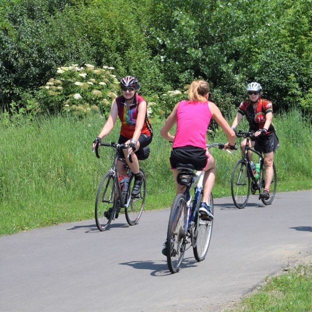
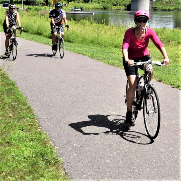
The music in Shoreview will have you dancing on your pedals to natures beat

by Andrew Ellis

The trails here in Shoreview can be your playground for you and your bike – there’s nowhere you can’t go. This Twin Cities Gateway community here offers friendly road routes, trails, and sidewalks so you can take another bike journey wherever you wish. The city also offers some off-road paved trails to get closer to nature and all the beauty the community has to offer. You may even find some smaller paths worth exploring. It’s your adventure and it all starts as soon as you leave your hotel in the Twin Cities Gateway, and don’t forget Slice of Shoreview Days, July 22-24.

A perfect vacation headquarters, the Twin Cities Gateway is a cooperative of nine communities including Shoreview and just a few bike-friendly miles north of Minneapolis. Here you can enjoy:

Concerts in the Shoreview Commons

Shoreview's Concerts in the Commons is the perfect way to get a pedal dancing rhythm for your #NextBikeAdventure.

Shoreview’s Concerts in the Commons is the perfect way to get a pedal dancing rhythm for your #NextBikeAdventure.

This summer offers free entertainment outdoors at the Shoreview Community Center concerts.  Each Wednesday, starting in June, the Center features an outside concert with a different band, each week starting at 7 pm. It’s free, so steer your bike over and get ready to tap your feet.

Rice Creek North Regional Trail

Get close to nature on all the paved trails winding through Shoreview.

Get close to nature on all the paved trails winding through Shoreview.

With more than 50 miles of paved trail (see map) there’s plenty of riding for several visits. Although it is hard to see some trail markings, these trails offer many opportunities to take wildlife pictures and discover the area’s diverse landscape while catching scents of wildflowers. As you ride you will also see and hear plenty of birds of different kinds chirping away. Every once and a while the trail crosses over the creek and you may want to consider some fishing.

Other Activities

If you want to take a short bike ride over to nearby Spring Lake Park, you can also enjoy the Shoreview Sweetroll Skate Park. The SweetRoll is a tier-one skating facility on the north side of the Community Center. The park here includes a wedge, a spine, a fun box, a quarter pipe, grind rails, and a mini ramp.

Water park

If you’re looking for a fun way to cool off, you can bike over to the Shoreview Community Center for their tropical-themed water park in the Twin Cities Gateway. This three-story water slide-equipped park features a one-of-a-kind jukebox with over 100 songs ready to play along with a light show that sliders can enjoy as they twist and turn down to the bottom. At the main pool, you can also play volleyball and there is even an adults-only whirlpool and patio area.

Disk Golf

Disc golf opportunities are always a highlight in the many parks of the Twin Cities Gateway.

Disc golf opportunities are always a highlight in the many parks of the Twin Cities Gateway.

For those wanting a round of disc golf all you have to do is ride over to Hansen Park in New Brighton. With 12 holes, this disc golf course is complemented by stands mature trees amongst open spaces to skillfully connect with the baskets. It’s a great way to take a break from biking while still enjoying the amenities of Shoreview.

And don’t forget Slice of Shoreview Days

Consider biking to the Slice of Shoreview for a weekend of fun.

Consider biking to the Slice of Shoreview for a weekend of fun.

If you’re exploring the area in July, from the 22nd to the 24th, then you will be in time for the annual Slice of Shoreview Days. This celebration. is packed with fun for the whole family. There is live music, local arts, chalk drawing, a petting zoo, pony rides, a carnival, fireworks, and more.

Visiting Shoreview with your bike can be a memorable weekend you won’t soon forget.

The Lino Lakes 10-mile bike loop is a true Minnesota experience

by Russ Lowthian, HaveFunBiking.com

Here it can feel like you are smack dab in the middle of northern Minnesota, especially while enjoying bike loops along the Rice Creek Chain of Lakes. A perfect place for your next bike vacation the Lino Lakes 10-bike loop and the many trail connections here are worth considering. One of nine Twin Cities Gateway communities, the Lino Lakes area supports a large Blue Heron rookery and hosts the annual Blue Heron Days Festival held in the middle of August. Regardless of when you visit, you are sure to see several species of wildlife to enhance your Minnesota experience while pedaling while biking here.

A true north experience!

The Lino Lakes bike loop is a true north experience

For the Lino Lakes 10-bike loop, the route travels clockwise and begins at the parking lot of the Hampton Inn. After pulling out from the hotel you will find a bike trail running parallel on the east side of Lake Drive. From there It’s a short distance before you are riding in the stunning Rice Creek Park Preserves. One of the largest preserves in the Twin Cities Area the Rice Creek Chain offers both paved and water trails. On the bike route, you are sure to see some of the most significant native wildlife habitat and water resources in the metro area.

The Lino Lakes Area is a family fun location.

Entering the trail system next to the Lino Lakes YMCA the trail circles the shoreline around Marshan Lake, before crossing over the Rice Creek, as it flows out of George Watch Lake. At the next trail T, the route takes a sharp left and runs parallel to the golf course road. After a sharp right curve and before the clubhouse a service road helps trail riders get over to the north shoreline of Reshanan Lake.

From a cottage community to the park it is an enjoyable ride

Passing the Reshanan Lake cottage community, soon Shadow Lake Drive disappears and trail riders are meandering past marshy areas with occasional patches of a forest while making their way to Centerville Lake. Now on E Street, at the boat landing, it’s a short distance along the service road here up to the beach area where you will find restrooms and a visitor center. Leaving the park take the trial to the entrance on Main Street. The Lino Lakes 10-bike loop heads north, but there is an option if you don’t mind adding a couple more miles. Consider taking the trails south along Main Street and visiting the charming little community of Centerville.

A few more options as the Lino Lakes 10-bike loop heads north

Wildlife viewing along the roads and trails here offers many opportunities.

Pedaling north on the trail parallel to Main Street you will cross Rice Creek again as it flows from Peltier Lake across the road to George Watch Lake. Here from the road look up to the northeast end of Lake Peltier and you can make out the Blue Heron Rookery. Soon you are passing the entrance to Wargo Nature Center. A place devoted to increasing the awareness and appreciation of natural and cultural resources. The center is located on a peninsula surrounded by George Watch Lake and offers activities, labs and equipment rental. For another outing, check out the available rental canoes and kayaks to experience the Rice Creek Chain of Lakes water trail.

Back in Lino Lakes for a cool beverage and fun

After a ride, many enjoy stopping in Lino Lakes for a cool beverage.

After crossing over 35W, on the wide shoulder, you are rolling back into Lino Lakes. As you turn onto Lake Drive consider stopping in at the Hammerhead Brewery before returning to the Hampton Inn. Back at the parking lot, check out the nearby eating establishments and plan another fun adventure in the Twin Cities Gateway Area.

Printable map and Q (cue)-sheet)

For a printable bike map of Lino Lakes click here

For a turn-by-turn, Q-sheet of Lino Lakes click here

The Mounds View 10-mile bike loop connect to parks and nature

by Russ Lowthian, HaveFunBiking.com

With a great mix of busy and calm the Mounds View 10-mile bike loop lets you ride your bike along creekside trails from park to park. One of nine Twin Cities Gateway communities, it’s a perfect destination for a bike vacation with all the trail opportunities and connections here. Plus, their annual Festival in the Park event is something to plan for if you want to watch bike racers testing their cycling skills with blood, sweat, and gears. Maybe you want to give it a try yourself at the events beginner race?

Enjoy watching the Festival in the Park bike races or try it yourself.

Regardless when you visit here it’s fun to pedal through many quiet neighborhoods that connect you to trails that comfortably take you from park to parks. Along the way, especially on this 10-mile route, you may catch a true Minnesota wildlife experience along the Rice Creek Trail.

The Mounds View 10-mile bike loop

This bike loop travels clockwise and begins in the parking lot of the Mermaid Entertainment Center or your nearby hotel. Leaving to the west on the paved trail, on County Road H, once you see the soccer field, turn south into Long Lake Park. Now, on  Rice Creek North Regional Trail, enjoy the scenery as you pedal along the east bank of the creek. Now heading west, over the next few miles, you will pedal along the railroad tracks. At Stinson Boulevard the trail turns to the south.

Riding the Rice Creek Trail system is an adventure in itself.

A TrueNorth touch of nature along the Rice Creek

Leaving the RR tracks you will soon be in sight of Rice Creek, as it flows towards the Mississippi River. Here you will take the trail Y to the right and resume riding along the creek to the west. This section of the trail will put you in touch with nature, the forest air, sounds, and wilderness sightings. It will open your TrueNorth senses!

Connecting to trails from bike-friendly streets is easy in Mounds View.

A sweet option, before the next section of the trail

As the trail nears Central Avenue, you have an option. If you have a sweet tooth or the weather is hot, ride 1/2-mile south on the trail parallelling Central Avenue, to Grandpa’s Ice Cream. Otherwise, the Mounds View 10-mile bike loop continues west under the Highway 65 trail tunnel.

It’s always fun when riding in the Twin Cities Gateway to stop for ice cream.

After crossing under the highway take the upper trail where you will enter into Locke County Park, with restroom facilities. A little further, just past the dog park, the route turns north over the RR tracks and comes out at 73rd Avenue. Here on the south side of the street, you will find a trail that runs parallel as the route now turns back to the east.

Another park and wildlife hatchery

With a slight jog to the northeast first, up through another peaceful neighborhood, the route turns east again to Silver View Park. On the north side of the park, you will find several rest stop options and Cars Bike Shop. The 10-mile loop utilizes the trail around the north side of the little lake here in the park. In the spring of the year, through mid-summer, it is common to waterfowl with their broods of ducklings and goslings sunning themselves along the trail.

Ducks are easily spotted throughout the summer along the trail.

Now on the trail alongside Long Lake Road, the route jogs through a few more neighborhoods on the way back to County Road H and the trail on the south side. Back at the parking lot at the Mermaid checkout a nearby eating establishment and plan another bike adventure in the Twin Cities Gateway Area. Consider the Rice Creek North Regional Trail up to a chain of lakes?

Printable map and Q (cue)-sheet)

For a printable bike map of Mounds View click here

For a turn-by-turn, Q-sheet of Mounds View click here

The New Brighton 10-mile bike loop ties history with nature

by Russ Lowthian, HaveFunBiking.com

From its early years discover the historical connection to railroads and livestock this bike-friendly community. Today the New Brighton 10-mile bike loop offers cyclists a mixture of history, nature and many attractions as you ride here. Plus it is easy to add additional adventure with trail connections that will take you throughout the Twin Cities Gateway. With all the opportunities here you will find a picture-perfect destination for your next bike vacation here.

The New Brighton bike loop is fun for the whole family.

The New Brighton 10-mile bike loop

This bike loop travels clockwise and begins at the Homewood Suites by Hilton. Taking a left out of the parking lot onto Old Highway 8, you will find a trail on the west side as you pedal south. Soon after passing Lions Park the route enters a new development on Ring Road and catches the trail. Soon you are making a big sweep through the prairie grass as the trail crosses under the RR bridge near the freeway and takes you out on Beach Road. Lake. After crossing the south shore of Long Lake experience a mix of busy and calm. Now pedaling Manning Trail, along the freeway border wall, to your right enjoy nature along the south shore of Pike Lake. If you want to explore nature along the shoreline there is an optional short loop off the path.

A fun bike loop to explore with friends.

A stop for ice cream while biking to the Rice Creek Trail

Now pedaling to the northwest through the residential neighborhoods on the west side of Pike Lake the route ventures up to the Rice Creek North Regional Trail. On your way over to Central Avenue, if it is a hot day, consider stopping by Grandpa’s Ice Cream, at Moore Lake Road. Now riding north on a trail running parallel to Central, just before at 69th Avenue you are at the Rice Creek Trailhead. Here the 10-mile loop travels back east towards the headwaters of Rice Creeks. An option for future consideration is the Rice Creek Trail West. From Central Avenue, the trail follows the winding flowage to the Mississippi River and its well-known trail, the MRT.

The flavors here are worth stopping for.

The smells, sounds, and wilderness sightings along the trail

Back on the 10-mile route, pedaling east, this section is one of my favorite parts of the Rice Creek Trail. As the route winds back and forth along the waterway under a forested canopy I am amazed. Riding this section of the trail the forest air, noises, and wildlife sightings will encompass you. At the next trail Y, the bike loop pulls away from the creek and continues along a rail line that helped establish New Brighton. After crossing Rice Creek one more time on this bike loop you will be entering Long Lake Regional Park.

Biking along the rail line brings hits from the community’s past.

Stop by the New Brighton History Center, in the park

Here in the park, you will find numerous trails circling around between the east shore of Long Lake and the south shore of Rush Lake. Follow the turn-by-turn cue sheet of the route if you don’t want to miss a turn. There are a lot of intersections in the park. After crossing a final set of RR tracks you will pass the New Brighton History Center. Here you can stop and learn more about the areas past before returning back to the start.

A great place to stay on a bike vacation.

Returning back along Highway 8, it’s just a short distance back at the parking lot at Homewood Suites. After parking your bike check out a nearby eating establishment. Then plan another bike adventure in the Twin Cities Gateway Area.

Printable map and  Q (cue)-sheet)

For a printable bike map of New Brighton, click here

For a turn-by-turn, Q-sheet of New Brighton, click here

New Brighton’s annual Stockyards Days

If your vacation plans are centered around the second week in August, consider joining the fun at the community’s annual Stockyards Day’s.

The Shoreview 10-mile bike loop easily connects to a wildlife oasis

by Russ Lowthian, HaveFunBiking.com

A community with an abundance of lakes, hence the name Shoreview, you will find an oasis for wildlife viewing opportunities along its trails. While visiting and riding the Shoreview 10-mile bike loop you will find many trail connections here for several adventures. Regardless of when you arrive, you will find bike trails around the eleven lakes here with many natural settings. One of nine communities of the Twin Cities Gateway, Shoreview is a perfect destination for a bike vacation.

Riding alone, or with friends, many wildlife viewing opportunities are waiting.

The Shoreview 10-mile bike loop

For this bike tour travel clockwise and beginning in the parking lots of the Best Western Plus and Hilton Garden Inn. Taking a right onto the bike lane along Gamsie Road, then Chatsworth as the route first travels north. At Snail Lake Road, you will find a trail running parallel on the south side as you pedal to the east. After crossing Victoria Street watch for Snail Lake Park Facilities on the north side of the road.

A broad of ducks sunning themselves along the trail.

The tunnel into Snail Lake Park

At the park entrance, the Shoreview 10-mile bike loop continues on the trail to the north. In Snail Lake Park, there are some nature trails near the lake shoreline and perfect for wildlife viewing. Back on the route the trail now heads to the northeast. So watch the turn-by-turn cue sheet link below to stay on course as you make your way up to the Highway 96 and the bike-ped trail. At the Hodgson Road crossing, for something cool, check out the Big Dipper Creamery on the northeast corner of this intersection.  A mile further, after crossing Rice Street, watch for the trail T, along the highway into Sucker Lake Park.

Enjoying the trail to Sucker Lake.

More wildlife viewing along the trail in Sucker Lake Park

Both the park and trail here are on the west shoreline of the lake and offers many activities and a hiking trail if a closer encounter with nature is of interest. If so, check out the 1.9-mile trail around the lake for a closer look as low land songbirds watch your every move. Leaving the park, the route continues south from the parking lot on Sucker Lake Road. At County Road F, turn east and use the trail on the north side. At Rice Street and then at the intersection of Hodgson/Rice/Gamsie crossing use the trail on the east side to the Grass Lake Nature Preserve a part of the Snail Lake Regional Park system.

Enjoying the trail to Grass Lake Nature Preserve.

Songbirds and wildflowers filled the Grass Lake Nature Preserve

This preserve allows cyclists and pedestrians alike a chance to view songbirds from the paved trail circling around the eastside of Grass Lake. An optional hiking trail takes you out in the wildflower-filled meadow on the west side of the lake. Back on the route the paved trail leaves the preserve and crosses the bike-ped bridge over I-694, onto County Road E. Now pedaling to the east again the 10-mile bike loop makes a sweep through one more park before returning to the starting point. After crossing Victoria Street, the trail enters Island Lake, County Park.

Songbirds and wildflowers fill the nature preserve with opportunities.

Surrounded by busy, the calm is the park in the heart of Shoreview

The park, on the east shoreline of Island Lake, is in the heart of Shoreview.  Along with the general park amenities, the walking trails here will make you feel like you are in a different area, not in the cities. The 10-mile bike loop uses the paved trails up through the park to the north end, then the park road around the upper end of the lake to the parking lot at the boat landing. Here pick up the trail again for one last look at nature in Shoreview.

Now it is over to the trail along Lexington Avenue and north for your return. Back at the parking lot, check out a nearby eating establishment and plan another bike adventure in the Twin Cities Gateway Area.

Bike Route options from Country Inn & Suites in Shoreview

Using the trail parallel to Rice Creek Parkway and then Park View Drive it is easy to get to the miles of paved trails in the Rice Creek North Regional trails system. The trail here to the east follows the Rice Creek up to its headwaters in the Rice Creek Park Preserves. From the chain of lakes here, south of Lino Lakes, both the Rice Creek and the trail corridor meanders to the west into the Mississippi River and the Mississippi River Trail (MRT). Along this trail corridor, you can connect to several other trail systems and parks through the Twin Cities Gateway.

Printable map and Q (cue)-sheet)

For a printable bike map of Anoka click here

For a turn-by-turn, Q-sheet of Anoka click here