Category Archives: Destinations

Pedal, then Paddle Gateway's Rice Creek Chain of Lakes with canoe and kayak rentals at the Wargo Nature Center.

Pedal, then Paddle the TC Gateways Rice Creek Chain of Lakes

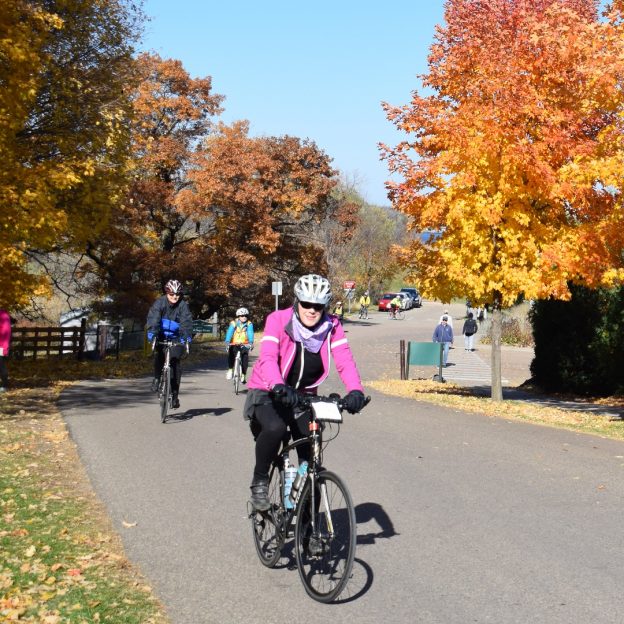
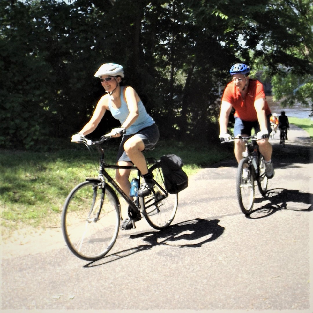
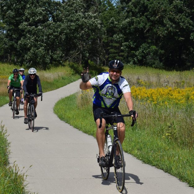
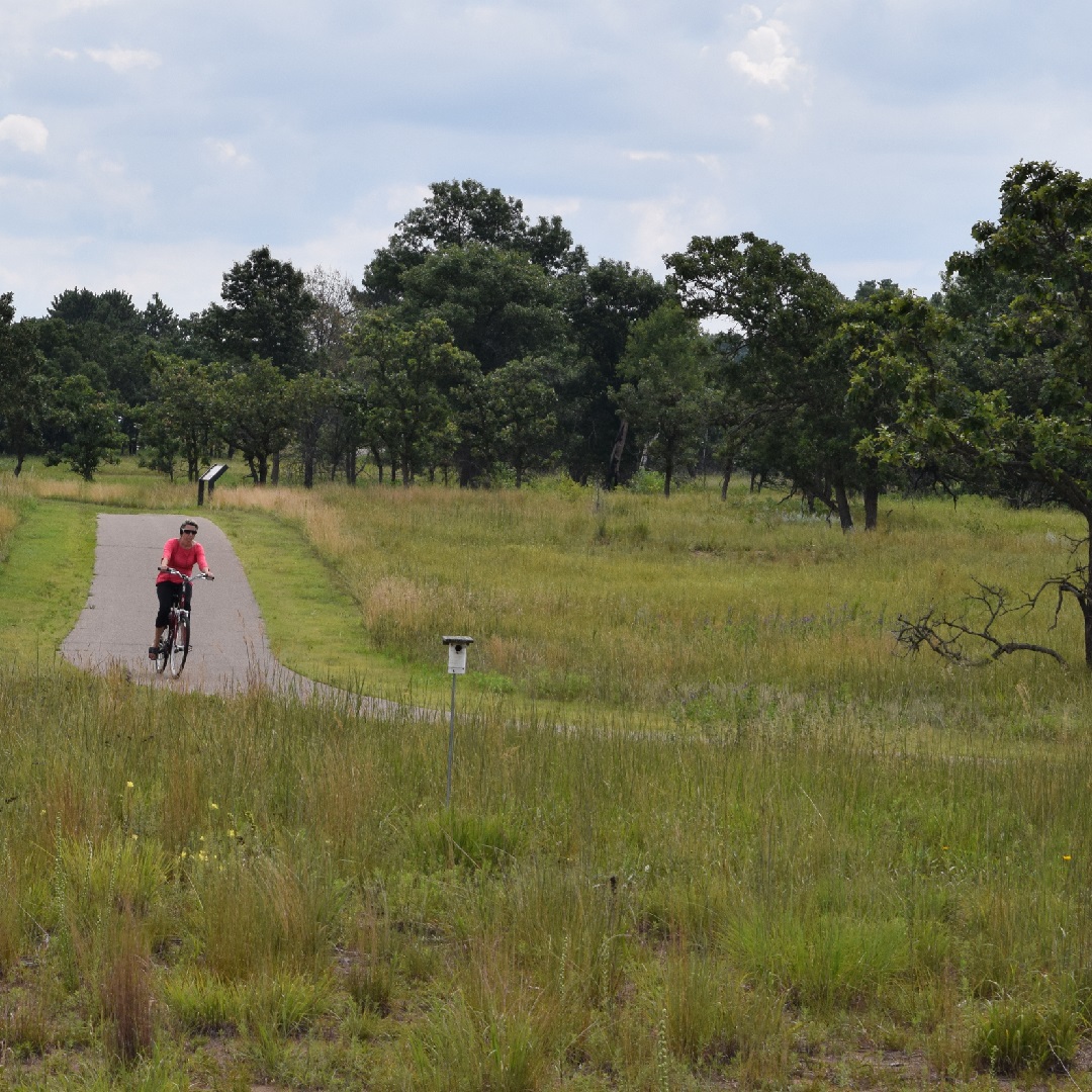
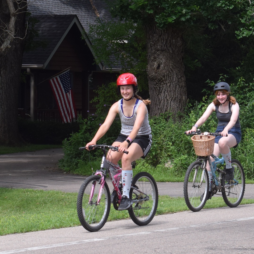
For a wildlife-rich summer, experience not soon forgotten, pedal, then paddle, the Rice Creek Chain of Lakes up in the Twin Cities Gateway Area. With an abundance of bike trails and roads to get there, you will find several options at Wargo Nature Center once arriving. Head out with a paddle, hike, or bike the trails that meander around the chain of lakes shoreline in this mammoth park reserve in the Twin City Area.

Paddling the Twin Cities Gateway's Rice Creek Chain of Lakes is a wildlife-rich experience to remember.

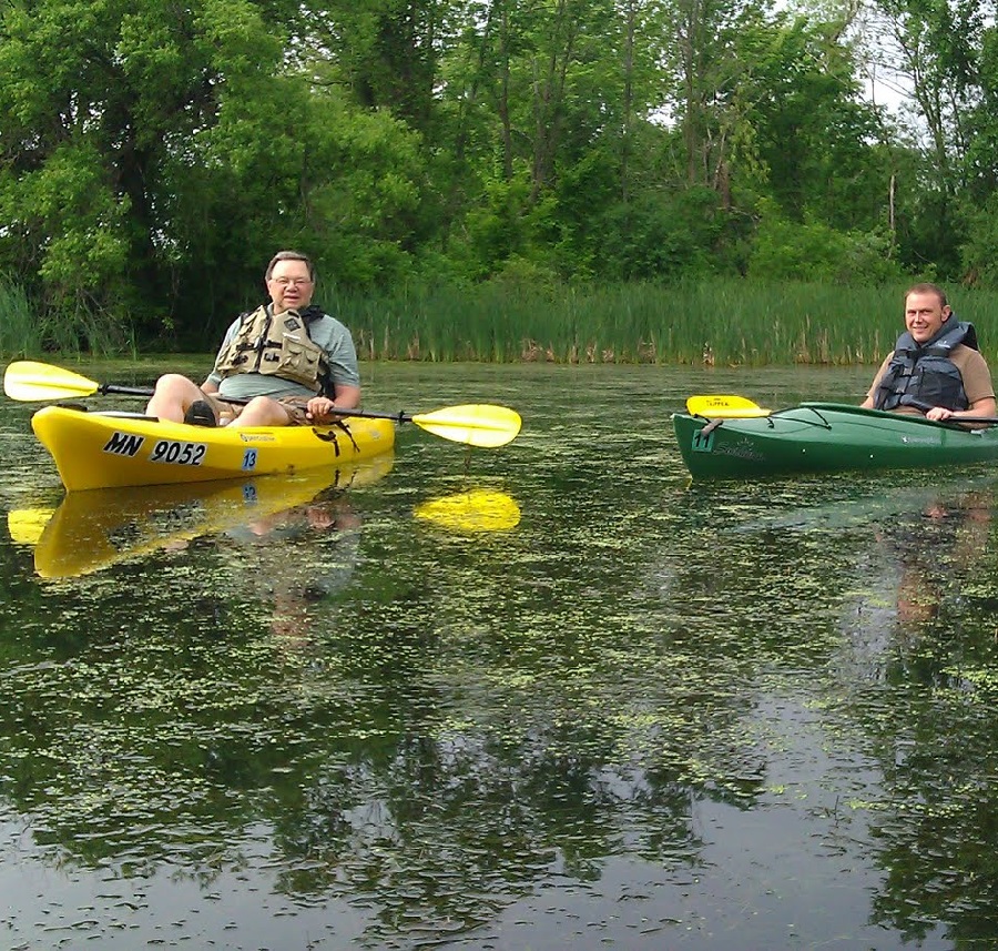
Paddling the Twin Cities Gateway’s Rice Creek Chain of Lakes is a wildlife-rich experience to remember.

You will find the Rice Creek Chain of Lakes near the community of Lino Lakes, on the south side of Interstate 35W. Once there, Nature Center can fix you up with canoe and kayak rentals to paddle Rice Creek Chain of Lakes. It is a bit of heaven in the north metro area. Being able to paddle out from the Nature Center on George Watch Lake is a tranquil experience.

What You Will See Paddling the Rice Creek Chain of Lakes

Through the summer and into the fall, you can paddle out from the dock at the Nature Center and connect to one lake after the next. Along the way, you are sure to see occasional Leopard frogs hopping off a Lilly pad. Then, perhaps you’ll ever see a Blue Heron and Snowy White Egrets lift off as you pass by.

Hawks are common spectators to the activities as you paddle along the water trail or pedal along the bike trail in the Rice Creek Reserve.

Hawks are familiar spectators watching as you paddle along the water trail or the bike trail in the Reserve.

The creek and lakes on this water trail offer excellent bird-watching opportunities. And this is the perfect place for the novice paddler. Adventurers will see plenty of raptors such as egrets and herons perching in nearby trees or forage along the shoreline. Along the way, you may see a sandpiper scampered across a sandbar.

Egrets and blue heron are also a common to see as you paddle along.

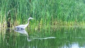
Egrets and Blue Heron are common to see as you paddle.

Maybe you’ll see a  soft-shell turtle sliding off the bank. Or perhaps an eagle, osprey, or Turkey Vulture swooping down to grab its meal as a fish jumps. It’s scenic and wild at its best, right here in the Twin Cities Gateway!


About the Rice Creek Chain

The nearly 5,300-acre Rice Creek Chain is one of two regional parks in the Twin Cities Area that offer multiple-lake paddling. According to many who paddle this north metro chain, the mix of lake and forest vegetation makes it feel like a mini-Boundary Waters Canoe Area. The other Reserve in the south metro is Lebanon Hills Park. Lebanon Hills Park is a 2,000-acre multi-lake area with only portage paths between them.

Generally, on the Rice Creek Chain, portaging is not necessary. The only exception is the occasional downed tree to circumvent, which usually happens in the spring. This rustic North Metro reserve has a water trail wandering through several lakes before reaching Rice Creek. Rice Creek is a more challenging, less-traveled stretch that flows south to Long Lake. From there, it heads to the Mississippi River.

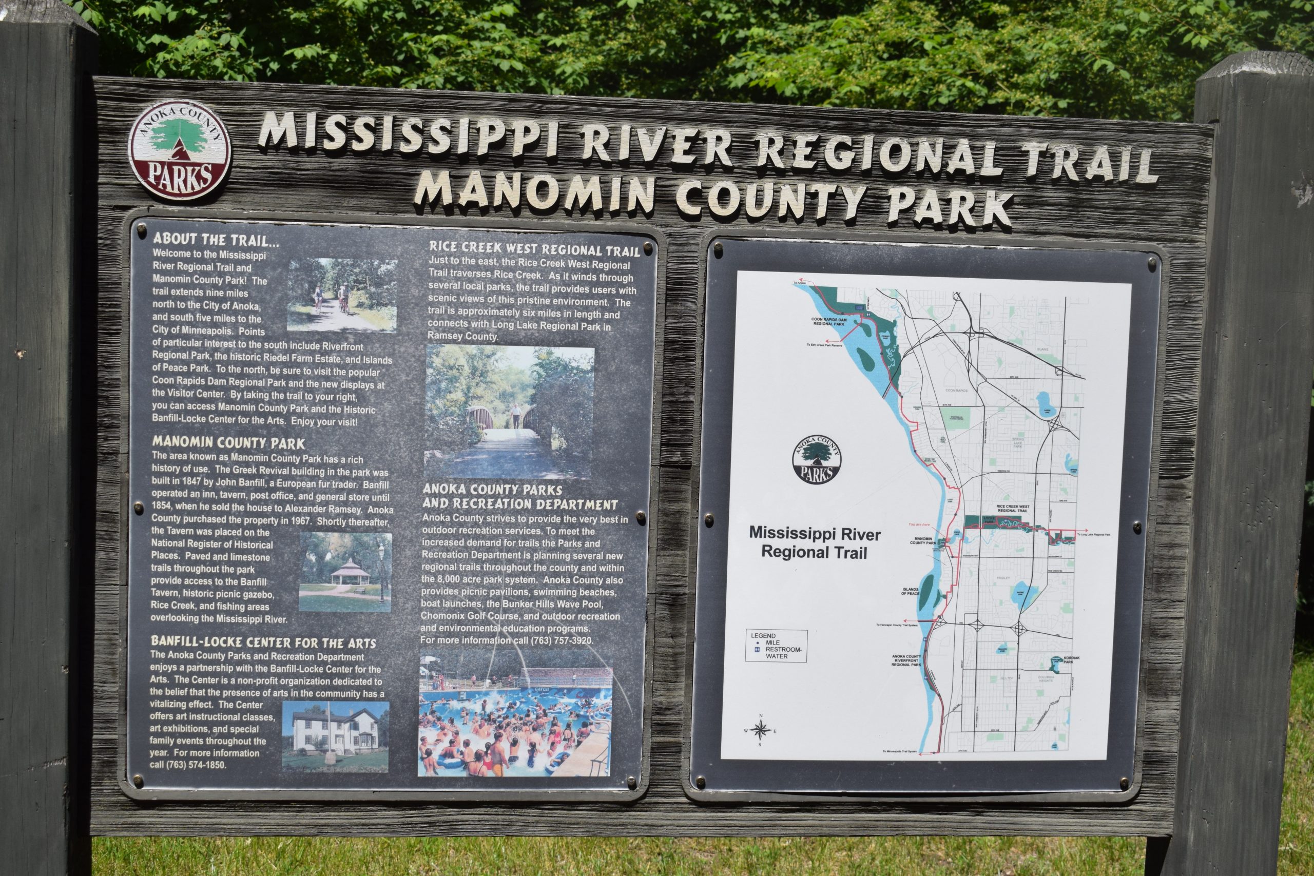
Paddlers who want a more extended trip can follow Rice Creek out the northwest corner of Long Lake in New Brighton. The creek flows to the Mississippi River at Manomin Park in Fridley. The complete paddle from the Lake Peltier boat ramp in the Rice Creek Reserve to the Mississippi River is about 22 miles.

Rice Creek Reserve rents equipment

Wargo Nature Center is the place for canoe, kayak, and life jacket rentals. Located on George Watch Lake, rentals can also be used on Peltier, Marshan, Rice, and Reshanau Lakes. Paddle craft rentals are available May through September, during regular hours. Here is their website for rental prices and times: https://www.anokacounty.us/874/Recreational-Rental-Equipment. Call 651-429-8007 to check watercraft availability, lake temperatures, and water levels.

For those who want to use their canoes or kayaks in the Reserve, paddling access points include Rice Creek crossings near: Hodgson Road, Lexington Avenue, County Road I, and County Road J.

In the winter, the Wargo Nature Center rents snowshoes for those who want to explore the park in a colder season.

The Cedar Falls area has something for both the seasoned cyclist and novice rider.

Cedar Falls, a gateway to some of Iowa’s best bike trails

by Russ Lowthian, HaveFunBiking.com

On my first visit to Central Iowa, I was amazed at the intricate network of hard surface bicycle trails the Cedar Falls Area offers. On this trip, I had the opportunity to
ride with several Cedar Valley Cyclists and enjoy some of the roads and trail loops in the area they often frequent. The Cedar Falls area has something for both the seasoned cyclist and novice rider. This is also a bike-friendly community perfect for the off-road cyclist (cyclocross, fat bike, mountain biking, and BMX), with several opportunities awaiting your arrival. Not to mention the wide array of historical, educational, and entertaining attractions to take in when not riding.

About Cedar Falls and the Valley Lake Trail options

The Ceder Valley Trail System offers several loops between Cedar Falls and Waterloo.

The Ceder Valley Trail System offers several loops between Cedar Falls and Waterloo.

The Cedar Valley Lakes Trail through Cedar Falls and Waterloo intertwine throughout the area – Offering over 100 miles of trails. As I discovered, some of these trails connect and meander through neighboring Waterloo for additional cycling opportunities. A Bronze Bike Friendly Community designation by the League of American Cyclists, see the Cedar Falls bike map for an overview of the vast trail systems and designated bike routes you can enjoy, as I did.

My first ride while visiting

On my first day there, before the rest of my group arrived from Minnesota, I had the opportunity to ride with Brian Will. A local realtor, Brian, is a member of the Cedar Valley Cycling Club. He volunteered to show me some of the trail loops and bike-friendly street routes used for connectivity. The first thing I noticed as we explored the trails, the majority of the trails are paved in concrete, with only a few patches of asphalt to remind me of home.  Our first adventure was on the Big Woods Lake Trail. This is a perfect trail loop for biking while viewing birds and wildlife.

Stopping at the Hearst Center For The Arts & Sculpture Garden along the trail.

Brian Will stopping at the Hearst Center for a view of the Arts & Sculpture Garden along the trail.

In the afternoon, after stopping for lunch on Cedar Falls ‘promenade’ (Main Street), we went out and rode sections of the Prairie Lakes Trail. A part of the American Discovery Trail System, we found several loops that took us into some charming and historic neighborhoods in Cedar Falls. Further along, from the trail, we viewed the agricultural test field at the University of Northern Iowa. We then stopped at the Hearst Center’s Arts & Sculpture Garden before returning to the promenade to check out the new brewery downtown.

Road Bike and Trail Touring Options

Gathering for a ride on the Promenade in Cedar Falls.

Gathering for a ride on the Promenade in Cedar Falls.

The next couple of days, with a group of my friends now in town from the Twin Cities, we joined the Cedar Valley Cycling Club on several rides. With several of their members showing up, we explored the trails and roads in the area. First, we visited Waterloo and a couple of other outlying communities. Periodically stopping to visit, they shared information on the communities Bike to Work, Bike to Play program.

Mountain Bike, Cyclo-Cross, and BMX Fun Opportunities

If you prefer the off-road side of cycling, you may be surprised at the number of mountain bike trails in the Cedar Falls and Waterloo area. They include George Wyth State Park, Katoski Green Belt, Riverview Park, Tondro Pray Bike Park, and Ulrich Park.

Tondro Pray Bike Park is your headquarters for off-road fun.

Tondro Pray Bike Park is your headquarters for off-road fun.

At the Tondro Pray Bike Park, you have several additional options along with the mountain bike trails there. The park amenities here include a: BMX/pump track, a mountain bike skills area, and a cycle cross course.

Things to do in Cedar Falls Area after your ride

For this trip, to accommodate 18 of my cycling friends from the Twin Cities, we used one of the hotels on the west side of Cedar Falls, not far from the University of Northern Iowa. Being a bike-friendly community, the AmericInn we stayed at was convenient. The hotel was only a couple of blocks, on quiet streets, to the trailhead and less than 20 minutes, by bike, to the promenade.

Cedar Falls is a great place for cyclists to gather.

Cedar Falls is a great place for cyclists to gather.

Coming off the trail, I noticed the Ice House Museum as I approached downtown, Cedar Falls. This building along the Cedar River was built in 1921. The museum houses an extensive collection of ice harvesting archives that visitors can view while learning what life was like before refrigerators.

On the promenade, you will find a wide assortment of local shops and unique restaurants that will entertain you for hours. Shops include everything: repurposed antiques; two bike shops; contemporary clothing; a cupcake shop; breweries; fair-trade artisan products from around the world; and more.

Things to do in Waterloo

The John Deere Museum offers many example of agricultural history, from household appliances to early farm equipment.

The John Deere Museum offers many examples of agricultural history, from household appliances to early farm equipment.

A 10-minute commute by car or a 30-minute train ride, Waterloo offers several more opportunities when not in the saddle. One of the must-sees when in the area is the John Deere Tractor & Engine Museum. The newest exhibit here highlights the history and contribution John Deere has made to agriculture and their farm families through their nearly 100-year operation in Waterloo.

Here at the museum is a John Deere bicycle, from the 70's, displayed.

Here at the museum is a John Deere bicycle, from the ’70s, displayed.

Another option if you are into plants and flowers is the Cedar Valley Arboretum & Botanic Gardens. This 40-acre beauty center features an award-winning Children’s Garden, 4-acre Butterfly Meadow; a Rose Garden; a stunning day lily and Hosta collections; unique Mosaiicultures; and a 1-acre Master Gardener’s Orchard.

Check here for more attractions and museums in the area, and plan your #NextBikeAdventure to Cedar Falls, Iowa.

The scenic Anoka bike loop offers fun exploring the river history there

At the confluence of the Rum and Mississippi Rivers, discover Anoka, with fun at every turn along its scenic bike loop. With its river city charm and designated the ‘Halloween Capital of the World’ this bicycle-friendly community in Minnesota is a place to explore. Riding your bike on the scenic bike loop you will discover several river-front parks and historic neighborhoods. A part of the nine Twin Cities Gateway communities, in the north suburbs of the Twin Cities. You will find over 250-miles of connecting trails to enjoy. The perfect destination to visit with your bike.

The Anoka 10-mile bike loop is an adventure for all skill levels of riders.

The scenic Anoka bike loop

For this bike ride, we will start at the Gathering Place Bandshell along the river. It’s located on the east bank of the Rum River, a block west of Ticknor Hill Bed & Breakfast in Akin Riverside Park.

It’s fun riding parts of the Mississippi River Trail while in Anoka.


Traveling clockwise, the route begins by crossing over the river on the pedestrian bridge, then across Ferry Street. Now pedaling along Benton Street, you will find a picturesque lane in the Historic Whiskey Flats neighborhood, The street here is a part of the Mississippi River Trail (MRT). Soon you are on the actual trail pedaling into Mississippi River Community Park, at Kings Island.

Kings Island and park amenities

Signage along the trail as you enter Kings Island.

Arriving in the park you will find restroom facilities, a playground, and some extra trails and observation decks along the river to view nature’s settings here. On the east bank of Mighty Mississippi, the Kings Island section of the park incorporates the natural beauty of a wooded flood plain. Add to your fun by exploring the nature trails here. Along the walking paths that circles the island, view an occasional mix of wildflowers amongst riverside flora and fauna.

Up to River Bend Park on the Rum

Leaving the MRT, the Anoka 10-mile loop utilizes the trail along its northern route up through Anoka’s industrial area. After crossing Highway 10, notice the Regency Inn Hotel to your left. And those who prefer to shorten the loop to 6-mile should turn right and head east on Vista Way (see the printable Anoka Map for more details).

Back on the 10-mile loop pedaling north up to Bunker Lake Boulevard, and turn east. At the intersection of Saint Francis Boulevard (Hwy 47), you will find several rest stop options. Then, before crossing the Rum River check out River Bend Park. If you picked up a sandwich at the rest stop, this is a perfect place to stop and view the river while enjoying your lunch.

After crossing the bridge over the Rum River, another option is to stop at the Rum River Library or the Anoka Nature Preserve. Looking east, notice the trail that crosses Bunker Lake Boulevard? That trail will safely get you up in the area of the library and nature preserve.

The Anoka Nature Preserve is a 200-acre passive recreational area with low maintenance, hard-packed roads, perfect for 2-lane off-road cycling, and hiking. At the trailhead here, north of the library, you will find a playground and a restroom option. The trails in the Preserve are perfect for off-road family riding. At the riverbank to the Rum, several paths lead to wildlife observation decks.

Following the flow of the Rum River back to Anoka

Now heading south along the east bank of the Rum River, the trail offers wildlife viewing opportunities at every turn. As you get closer to the inner city of Anoka the trail merges over to the bike lane on 4th Avenue and through the historic Cutterville and Wet Flats neighborhoods. Here the 6-mile loop joins from the west and the trail route resumes along the river.

The Anoka 10-mile bike loop is fun for all ages!

The historic downtown district of Anoka

As you approach four metal grain bins along the trail you are entering the north side of the historic downtown area of Anoka. Here you will find several delicious dining establishments and many historic points of interest. Also known as the Halloween Capital of the World, the city of Anoka becomes alive with festivities each fall. Now, before taking the river trail, under Main Street and back to the band Shell, check out the observation deck at the Rum River Dam.

Downtown, don’t forget to stop at Two Scoops for ice cream.

Back at the Gathering Place Band Shell or your hotel checkout a nearby eating establishment and Two Scoops Ice Cream while planning another bike adventure in the Twin Cities Gateway Area.

Printable map and Q (cue)-sheet)

For individual bike maps of the nine Twin Cities Gateway Communities click here

For a turn-by-turn, Q-sheet of Anoka click here

Through the seasons nature calls riding along the trails in Coon Rapids

Named after the creek that meanders through the area and flows into the Mississippi River, just below the dam, Coon Rapids offers a great mix of wildlife viewing spots here. Two of my favorite trail systems, especially in the spring and fall, are the Coon Creek Reginal Trail and the Mississippi River Trail below the dam. Both trail systems, when the foliage is minimal, offer some spectacular birding and wildlife viewing. In the winter months, the trails are great for fat bike riding, cross-country skiing, or snowshoeing to view birds of prey and other wildlife along the waterways. Look for signs of the abundant wildlife that live in or visit the areas described below (mink, beaver, hawks, osprey, deer, turtles, and river otters, to name a few). 

Riding the trails and roads of Coon Rapids

Fun on the MRT, viewing nature, east of the Coon Rapids Dam

Herewith a great mix of paved trails and bike corridors with wide shoulders, You can navigate the city on your bike pretty easily. Just use this handy Coon Rapids bike map and take a tour of the area. It’s easy to connect from your hotel to Bunker Hills Regional Park or the Coon Rapids Dam through the Coon Creek Trail.

The Sand and Coon Creek Trails

A north/south paved nature corridor and waterway offer many viewing spots along the way. The Sand Creek/Coon Creek Trail System stretches over 15-miles from Bunker Hills Regional Park down to the Coon Rapids Dam. In Bunker Hills, you’ll find another trail system winding through beautiful prairie areas with patches of Oak Savanna forests.

You will find miles of paved trails running through parks and along major roads here.

You will find miles of paved trails running through the Bunker Hills Regional Park.


The lower portion of the Coon Creek Trail takes you through Erlandson Nature Center and Robinson Park before reaching the Coon Rapids Dam and the Mississippi River Trail.

The Mississippi River Trail (MRT southern loop)

The Coon Rapids Dam Visitors Center is a picturesque place to stop and wonder around.

The Coon Rapids Dam Visitors Center is a picturesque place to stop and gather more information.


Below the Coon Rapids Dam and Park Area is another favorite of mine. Using the paved trail (MRT), you are surrounded by a mix of nature. Forests running into both prairie and wetland environments, only minutes away from the main road. The trail here is very well marked with MRT signage, so getting lost won’t be an issue. At the south end of the park, along the trail between the Dam and the riverfront neighborhoods, is a favorite haunt.

Where to eat, stay and play when visiting Coon Rapids

After exploring the trails, the next adventure is finding the perfect dining option in the Twin Cities Gateway.

The options are endless when spending time visiting Coon Rapids and the other eight neighboring Twin Cities Gateway communities in the north suburbs of Minneapolis and St. Paul. Similar to the early 1800s, when Coon Rapids was a stopping point on the Oxen Trail from the Red River Valley to St. Paul, hospitality is still key, along with its wildlife corridors, though the trails have changed. Check out their website here, and enjoy!

The Fridley 10-mile bike loop lets visitors discover the MRT

by Russ Lowthian, HaveFunBiking.com

Named for an early settler along the east bank of the Mississippi River. Today bike-friendly Fridley, with its 10-mile bike loop, lets visitors discover art, nature, and beautiful flower gardens along the way. Here, with many cycling paths connecting to both the Mississippi River Trail (MRT) and the Rice Creek Trail, it’s easy to get around. One of the nine communities of the Twin Cities Gateway, the city of Fridley is located just north of Minneapolis and a fun place to explore. So, if you enjoy biking along the trails that Red River oxen carts once used, we have some options to explore while enjoying the Fridley 10-mile bike loop.

Fun on the Fridley 10-mile bike loop.

The Fridley 10-mile bike loop

Starting from the outer parking lot of the LivINN Hotel, (southeast corner od I-694 and Central Avenue) the Fridley route heads out in a clockwise direction. After crossing the intersection at Central Ave. drive your bike using the bike lane on 53rd Avenue for the next two miles. Now turning to the north on Main Street, once over Interstate I-694, you will pass Woodsprings Hotel. Those who would like to begin the 10-mile bike loop from this point continue north up to 61st Avenue. Here on your left, you are at the Fridley train station.

Passing through Edgewater Garden Park on the MRT.

Taking the tunnel under the RR tracks

On the east side of the Northstar-Line Fridley Station, use the elevator. Taking your bike with you down to the lower level and walk through the tunnel to the west side of the train tracks. On the main level, on the west side, the Mississippi River Trail (MRT) is right outside the door and ready for you to venture north again. An option for another day, consider boarding the Northstar Train with your bike and ride it up the Anoka, Elk River, or Big Lake, then pedal back to Fridley on the MRT. See the multi-modal train-to-trail cue sheet here.

Many roads in Fridley offer trails that parallel for added comfort.

More adventure awaits at the Locke Lake trail T

Flower gardens invite you into the Banfill-Locke Center for the Arts.

Back on the 10-mile bike loop, continue pedaling north on the MRT as the trail passes through Edgewater Garden Park. A little further on, before turning into Locke Lake Park at the trail T, you have a couple more options. If you don’t mind adding some additional miles out and back, continue on the MRT to the Banfill-Locke Center for the Arts. With rotating art exhibits, the art center is next to Manomin County Park. Another mile further, you will find the Springbrook Nature Center. These three community highlights can add more memorable moments to any bike ride.

Manomin County Park is on the same grounds as the Banfill-Locke Center for the Arts.

Back on the 10-mile bike loop, the trail connects to the Rice Creek Trail in Locke Lake Park. Use caution as you ride your bike through this area. You will need to apply both your front and rear brakes (or walk your bike) as you descend along Locke Lake on the trail. If you are riding with others, allow extra space between each, as a few sharp turns are passing under the RR tracks next to Rice Creek as it flows into the lake. Finally, at the next T, the Rice Creek Trail runs through Fridley Community Park.

Now riding east along the Rice Creek Trail.

After crossing University Avenue, at the stoplight, resume riding east on the Rice Creek Trail. In this section between University and Highway 65, the Rice Lake Trail offers an upper and lower trail segment. The 10-mile loop uses the upper trail, as it’s a bit shorter and takes you past restroom facilities in the park before reaching the tunnel under Highway 65. After the tunnel, resume the route by taking a left at the trail T to Central Ave. If you are staying at Budget Host Hotel or desire to start the 10-mile loop from here, at this trail T take a right and head south a block to the hotel.

Turning south, ice cream may soon be an option.

The trail route now, heading south, runs parallel to Central Avenue. If you have a sweet tooth and desire a delicious Ice cream treat, turn right on Moore Lake Road into Grandpa’s Ice Cream.

The flavors here are worth stopping for.

Continuing along Central Ave, as you reach Hillcrest Drive, you have one more option to cool off. If it’s a hot day, half-mile further south is Moore Lake Park, where you will find a beach for a refreshing swim. Otherwise, take a left on Hillcrest, and the route jogs through several neighborhood streets down to Matterhorn Drive. After crossing over Interstate 694, turn right on Skywood Lane and follow the freeway border wall around to the start.

Back at the parking lot or your Fridley hotel, check out the nearby eating establishments and plan another bike adventure in the Twin Cities Gateway Area.

Printable map and Q (cue)-sheet)

For a printable bike map of Fridley, click here

For a turn-by-turn Q-sheet of Fridley, click here

Ride your bike around Lakeville and discover its cycling treasures

Your vacation time is precious, and that’s not something Lakeville takes lightly. Located on the southside of the Twin Cities, the bike-friendly small town is the perfect getaway for those wanting a break from the big city noise.

In Lakeville, you can breathe in all the fresh Minnesota air you want as you enjoy your favorite outdoor activities. Ride your bike along its many trails and loops, go for a nice hike, or just lay by the beach and soak in the rays (remember the sunscreen). And this is all within a bikeable distance.

More About Bike-Friendly Lakeville

One of the best parts about Lakeville is its location. It may feel as if you’re far away from the city, but you’re really only 30 minutes away from downtown Minneapolis. So even if its a last a minute getaway you need after a long week at work, Lakeville is ready to help you take your worries away.

You can also steer your bike into historic downtown Lakeville and discover its many locally-owned shops, restaurants, and more. And if you want to pair your tastebuds on this adventure, then check out the town’s local brewery and winery.

Riding options when visiting Lakeville

There are plenty of opportunities when pedaling around Lakeville. Its road and trail routes will help you get around town. And for off-road adventure checkout, the West Marion Lake Mountain Bike Trails with challenges for all skill levels. , and other easier trails taking you on a tour of the towns. No matter what kind of biker you are you’ll find a course path, full of nature and lakes, for your next adventure in Lakeville.

Murphy-Hanrehan Park Reserve

You don’t have to go far for some good mountain biking. Murphy-Hanrehan has a single-track section full of trails for all skill levels. The easy trail is just under one mile, the intermediate trail is just under 2.5 miles, and the advanced trail is nearly 7 miles. Also, the trails are connected so you can ride all three if you want to take on all levels.

Buck Hill Mountain Bike Skills Park

Buck Hill may be best known for its skiing, but the summer attracts the mountain bikers as well. It’s the perfect place for beginners, and there are even sections for those with more experience. Switching from trail to trail is easy as one connects to at least one of the others.

Lebanon Hills Regional Park

The largest park in the Dakota County park system also has plenty of mountain biking. Located at the park’s West Trailhead, there are different areas for all skill levels. Each course features different obstacles for its level of difficulty. Riders will have to face challenges such as riding over a pile of logs, rocks, sharp turns, and more. Maps are located throughout the courses to help navigation.

Road Biking

Getting around on your bike in Lakeville is relatively easy as well, especially in historic downtown Lakeville. Most of the roads have a trail running alongside them so you don’t have to worry about sharing the road with motorists.

Ritter Farm Park for hiking

If you’re looking to get some walking miles in, but also want to take it easy, give the trails at Ritter Farm Park a try. Along the way, you’ll see colorful flowers and the trail connects to another trail that takes you along Marion Lake.

An At-A-Glance Look at Lakeville

Be sure to check out our At-A-Glance Lakeville Article for more details on where to stay, play, and explore for your hand-held devices. As this story and the At-A-Glance Article are mobile-friendly for your convenience, have fun!

The Lino Lakes 10-mile bike loop is a true Minnesota experience

by Russ Lowthian, HaveFunBiking.com

Here it can feel like you are smack dab in the middle of northern Minnesota, especially while enjoying bike loops along the Rice Creek Chain of Lakes. A perfect place for your next bike vacation the Lino Lakes 10-bike loop and the many trail connections here are worth considering. One of nine Twin Cities Gateway communities, the Lino Lakes area supports a large Blue Heron rookery and hosts the annual Blue Heron Days Festival held in the middle of August. Regardless of when you visit, you are sure to see several species of wildlife to enhance your Minnesota experience while pedaling while biking here.

A true north experience!

The Lino Lakes bike loop is a true north experience

For the Lino Lakes 10-bike loop, the route travels clockwise and begins at the parking lot of the Hampton Inn. After pulling out from the hotel you will find a bike trail running parallel on the east side of Lake Drive. From there It’s a short distance before you are riding in the stunning Rice Creek Park Preserves. One of the largest preserves in the Twin Cities Area the Rice Creek Chain offers both paved and water trails. On the bike route, you are sure to see some of the most significant native wildlife habitat and water resources in the metro area.

The Lino Lakes Area is a family fun location.

Entering the trail system next to the Lino Lakes YMCA the trail circles the shoreline around Marshan Lake, before crossing over the Rice Creek, as it flows out of George Watch Lake. At the next trail T, the route takes a sharp left and runs parallel to the golf course road. After a sharp right curve and before the clubhouse a service road helps trail riders get over to the north shoreline of Reshanan Lake.

From a cottage community to the park it is an enjoyable ride

Passing the Reshanan Lake cottage community, soon Shadow Lake Drive disappears and trail riders are meandering past marshy areas with occasional patches of a forest while making their way to Centerville Lake. Now on E Street, at the boat landing, it’s a short distance along the service road here up to the beach area where you will find restrooms and a visitor center. Leaving the park take the trial to the entrance on Main Street. The Lino Lakes 10-bike loop heads north, but there is an option if you don’t mind adding a couple more miles. Consider taking the trails south along Main Street and visiting the charming little community of Centerville.

A few more options as the Lino Lakes 10-bike loop heads north

Wildlife viewing along the roads and trails here offers many opportunities.

Pedaling north on the trail parallel to Main Street you will cross Rice Creek again as it flows from Peltier Lake across the road to George Watch Lake. Here from the road look up to the northeast end of Lake Peltier and you can make out the Blue Heron Rookery. Soon you are passing the entrance to Wargo Nature Center. A place devoted to increasing the awareness and appreciation of natural and cultural resources. The center is located on a peninsula surrounded by George Watch Lake and offers activities, labs and equipment rental. For another outing, check out the available rental canoes and kayaks to experience the Rice Creek Chain of Lakes water trail.

Back in Lino Lakes for a cool beverage and fun

After a ride, many enjoy stopping in Lino Lakes for a cool beverage.

After crossing over 35W, on the wide shoulder, you are rolling back into Lino Lakes. As you turn onto Lake Drive consider stopping in at the Hammerhead Brewery before returning to the Hampton Inn. Back at the parking lot, check out the nearby eating establishments and plan another fun adventure in the Twin Cities Gateway Area.

Printable map and Q (cue)-sheet)

For a printable bike map of Lino Lakes click here

For a turn-by-turn, Q-sheet of Lino Lakes click here

The Blaine 10-mile bike loop can add more memories to a sporting event

by Russ Lowthian, HaveFunBiking.com

With miles of connecting bike trails around the city of Blaine, sports fans and visitors alike will find many phenomenal sights while bicycling here. One of the nine communities of the Twin Cities Gateway this city is a perfect destination for a bike vacation tied to a sporting event. The city offers many trail opportunities surrounding the sports facilities here. So, whether you are an athlete looking for a fun way to get a pre-game workout. Or, a visiting sports fan looking for some added memories we have some ideas starting with the Blaine 10-mile bike loop.

The Blaine 10-mile bike loop can add more fun to your game visit.

The Blaine 10-mile bike loop

A perfect bicycle tour before or after a game this bike loop begins in the parking lot of the National Sports Center(NSC). The route heads south using the service road between NSC and Schwan Super Rink and passes through several parking lots south to 101st  Avenue. Traveling in a clockwise direction drive your bike south on Davenport to the stoplight at 99th Avenue and cross Highway 65. If you are staying at the Asteria Inn & Suites, on 93rd Ave, this is a great place to meet up with the 10-mile loop. it is a short 1/4-mile ride, north on Baltimore Street, from the hotel to 99th Avenue.

The Blaine 10-mile bike loo is fun for all ages.

Crossing the highway and enjoying the trails in Blaine

If you prefer staying off the streets after crossing the highway the trail that runs parallel on 99th Avenue, on the south side, for your added comfort.  On Clover Leaf Parkway, take a right and you are soon on a sequence of city trails up through several neighborhoods. For the next couple miles the route meanderers to the north. As you pedal along the trail you will pass several small neighborhood ponds where it is common to view wildlife.

Many roads here offer trails that parallel for added comfort.

At 113th Ave. the route relies on a combination of roads (with parallel trails). These quiet, low traffic city streets connect you to more neighborhood trails on the route up to Paul Parkway. The last stretch on this section takes riders through the Blaine Baseball Complex with several trail options circling the ball fields. One option, if you don’t mind adding more mileage to your ride is taking a left at the trail T to Bunker Hills Regional Park. On the 10-mile loop turn to the east on Paul Parkway where you will find a trail running parallel with the street.

A sweet tooth option at the 6-mile mark

It’s always fun when riding in the Twin Cities Gateway to stop for ice cream.

If you don’t mind adding a couple of extra miles, take a left on Ulysses Street for ice cream. It is approximately a mile, each way, that you will have to add to your total mileage, But the Big Dipper Creamery is worth the extra miles with 52 flavors to choose. For any bike service needs, while touring here, Pioneer Cycle is across Highway 65, north of Main Street.

Enjoying nature along the trail.

Continuing east on Paul Parkway the route crosses over Highway 65 and turns south on Aberdeen St, again with a trail running parallel on the west side. If you have worked up an appetite for breakfast, lunch or some pie,  Carol’s Restaurant is an option. Her homemade cooking is always a treat when I stop there!. Further south, the 10-mile loop jogs to the east and meanders past some more picturesque trail setting that takes you over a wooden bridge.

Returning back to the NSC or your hotel

After the round-a-bout at 113th, the route continues south on Club W. Parkway. For those staying at the Best Western Plus or  Fairfield Inn & Suites in Blaine, take a right on 108th Ave. The Hotel is south of Target, on the east side to Baltimore Street. If you missed the Big Dipper Creamery option, above you will find ice cream next door to the hotel. For bike touring visitors staying at Asteria Inn & Suites, on 93rd Avenue, continue south using the cue sheet link below.

The 10-mile Blaine loop continues south on Davenport, below 105th Avenue and into the National Sports Center parking lot. Back at the NSC or your hotel checkout a nearby eating establishment and plan another bike adventure in the Twin Cities Gateway Area.

Printable map and Q (cue)-sheet)

For a printable bike map of Blaine click here

For a turn-by-turn, Q-sheet of Blaine click here

Border Bike Ride makes it easy to explore towns in Iowa and Minnesota

The Border Bike Ride allows all levels of cyclists the opportunity to ride on two trails, with several communities along the way. The fun begins in Riceville, in northeast Iowa, at the trailhead and welcome center of the Waspi-Great Western Line (WGWL) Trail on Saturday, August 22nd. With many Border Bike Ride route options, recreational riders of all levels have several opportunities. The 56-mile route option crosses the border into Minnesota and to visit communities along the Shooting Star Trail.

The Border Bike Ride options

A multiple bike route event with a choice of:

  • Two family routes (22 miles round trip, entirely on the WGWL Trail)
  • Intermediate Routes (40 miles or 50 miles, on WGWL Trail and county hard-surface roadways)
  • Advanced Route (56 miles, on WGWL Trail, Shooting Star Trail, and paved county roadways)

Ride highlights

The Border Bike Ride crosses the Wapsipinicon River twice.

Experience a biking environment that includes the following scenic views:

  • With miles of winding trail, the former WGWL railroad bed travels through the towns of Riceville and McIntire and twice crosses the Wapsipinicon River. Along the way also experience an 800-foot boardwalk that hovers over the flood plain that borders the river.
  • Also along the trail, take a peek at two ghost towns of the former villages of Acme and Bailey.
  • An added opportunity may include exploring the side trail that runs through the park next to Lake Hendricks.
  • As you pedal, travel next to Mennonite and Amish farms with a view of dairy cows and draft horses grazing in the pasture. You will also pass by several Mennonite greenhouses that supply the area resident and visitors with flowers, fruit and vegetable products.
  • Seasoned cyclists on the 56-mile route will cross the border from Iowa into Minnesota with pleasant views of lady slipper flowers, Lake Louise State Park and the Upper Iowa River while riding along the Shooting Star Trail.

Some of the sweet treats along your ride

The Border Bike Ride allows all levels of cyclists the opportunity to ride, visiting several towns along the way.

The delicious Heavenly Apples will be included with registration and served at Bailey station. Further along, enjoy homemade bars and ice cream at Lylah’s Marsh from 2-5 p.m. Then upon your return, ice cream sundaes/floats will be available for purchase at WGWL Trailhead/Welcome Center, from 2-6 p.m.  With maps provided you will find further refreshments and treats available at bike sponsor stations along the routes.

Registration

Border Bike Ride fun

Register online at https://borderbike.wgwltrail.com/. The cost is $12 to ride and $22 to ride with an event shirt.  Please note, event shirt is only available if pre-ordered by August 9th for Summer Farewell Border Bike.

Bike on your own or in a group.  Group departures from the WGWL Trailhead (110 East Main Street Riceville IA 50466) are at the quarter past the hour from 7 a.m. until 5 p.m. Shuttle available upon request.

Ride Benefits

Border Bike Ride fun

Proceeds support the existence of the Wapsi-Great Western Line – a linear park preserving the past for the future, giving active people a safe place to run, hike and bike.

The Ham Lake 10-mile bike loop makes it easy to connect and discover

by Russ Lowthian, HaveFunBiking.com

A favorite place for bicyclists to visit, getting around on the Ham Lake 10-mile bike loop makes it easy to connect and discover the area. For summer fun and winter fat biking, Ham Lake is one of the nine communities of the Twin Cities Gateway you should consider exploring. With easy trail connections, it’s a comfortable place to ride. It’s almost like there is a bike-friendly road or trail wherever you go. Along with the 10-mile bike loop, with so many options you will find several days of attractions and parks ready to discover.

Riding through the neighborhood makes it easy to connect to the trail.

The Ham Lake 10-mile bike loop

For this 10-mile bike loop, the route travels counter-clockwise and begins in the parking lot of the AmericInn on the west side of Highway 65. Riding a short distance from the hotel on the Service Road the route quickly jogs through a neighborhood, up to Bunker Lake Boulevard. The first two miles are on the paved shoulder, so for safety, drive your bike like you would a car. Then, once you see the ball field it is easy to merge onto the bike trail that parallels the boulevard. At Prairie Road, the trail crosses for an adventure in the county park.

Riding the Ham Lake bike loop.

Explore the miles of trails in Bunker Hills Park

Now in Bunker Hills Regional Park, you will find a series of trails and parkways that crisscross at several locations. The natural setting of the park offers visitors several distinctive flora covings as you ride the trail loops here. At one point you are pedaling through native prairie grassland with patches Bur Oak. Next, you are pedaling through stands of pines that will lead you to shoreline views near Bunker Lake.

The natural setting here offers visitors several distinctive flora covings in the park.

For the 10-mile Ham Lake Loop, we will follow the trail close to County Parkway C, past a series of parking lots, a playground, restroom, and the Veteran’s Memorial site. Soon our selected trail route passes Bunker Beach Water Park and then follows County Parkway A to the south gate. Here at the trail T, our selected route takes a left and heads east.

Leaving the park it may be time for ice cream?

Leaving Bunker Hills Regional Park the trail comes out at the local high school. Here the route continues in an easterly direction on Bengal Drive, out of the school parking lot. At Jefferson Street, the route jogs to the right. Here watch for the trail on your left.  In a short distance, the neighborhood trail here comes out on 127th Ave and zig-zag down to Buchanan Street. If you have a sweet tooth or looking for a cool treat, stop at Big Dipper Creamery, with 52 flavors.  If bike service is need on your ride Pioneer Cycle is across Highway 65, north of Main Street.

It’s always fun when riding in the Twin Cities Gateway to stop for ice cream.

Now heading north, the 10-mile bike loop takes you back up the Service Road along Highway 65 back to the AmericInn. Back at the hotel parking lot checkout the nearby eating establishments and plan another bike adventure in the Twin Cities Gateway Area.

Printable map and Q (cue)-sheet)

For a printable bike map of Ham Lake click here

For a turn-by-turn, Q-sheet of Ham Lake click here

For winter fun check out the Ham Lake Snow Bowl

If you’re around in February, with your fat bike, consider the annual Ham Lake Snow Bowl. The event includes a fat bike race, scavenger hunt, ice fishing, local crafts and food, and more.