
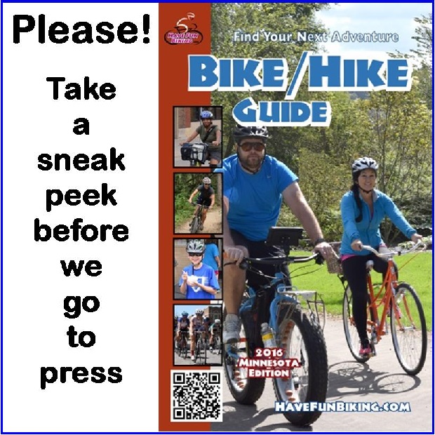
As we prepare for press, we invite you to take a sneak peek of the Minnesota Bike/Hike Guide and let us know what you think. As we add more links and helpful information to assist you in finding your next adventure, please page through all the bike events, maps and helpful tips and let us know if we missed something.
Flip through the pages on your computer screen, book the site for future reference and take it with you for your mobile devices when you are on the go. In both our print and quarterly digital editions you will find a full schedule of bike event listings with links, helpful tips to have a safe journey and plenty of maps showcasing bike friendly destinations for planning and riding into your next adventure.
And check back regularly for our HaveFunBiking ‘Pic of the Day’
Now, rolling into our 10th year as a bicycle tourism media our goal is to continue to encourage more people to bike, while showcasing unforgettable places to ride. As HFB searches and presents more fun cycling related photos, many worth a grin, scroll through the information and stories we have posted – it may help you find your next adventure. Then, while out there exploring, if you see us along a paved or mountain bike trail, next to the route you regularly commute on, or at an event, be prepared to smile. You never know where our camera’s will be and what we will post next!
Do you have a fun bicycle related photo of yourself or someone you know that you would like to see us post on HaveFunBiking? If so, please send it our way and we may use it. Send your picture(s) to: [email protected] with a brief caption (of each), including who is in the photo (if you know?) and where it was taken. Photo(s) should be a minimum of 800 pixels wide or larger for us to consider using them. If we do use your photo, you will receive photo credit and an acknowledgment on Facebook and Instagram.
As HaveFunBiking continues to encourage more people to ride, please reference our blog and the annual print and quarterly digital Minnesota Bike/Hike Guide to find your next adventure. We are proud of the updated – At-a-Glance information and maps we are known for at the HFB Destination section on our website and in the guide. Now, as the Guide goes into its seventh year of production, we are adding a whole new dimension of information, now available for mobile devices.
So bookmark HaveFunBiking.com and find your next adventure – we may capture you in one of the next photos we post.
Have a great day!
Comments
5 responses to “Take a sneak peek of the 2016 MN Bike Hike Guide”
Bike Guide Feedback:
Make more Mobile friendly and interactive, than just pages. Most people will access on thier mobile phone or tablet.
Add Search and easier ways to navigate to and save favorite maps.
Link maps and trails to Google Maps, to keep current and have available to mobile users.
Add Social Suggestons, Comments, Rating and Reviews on all maps and articles. More blog posts from users and editors.
List calendar, community and ride get togethers, anyone can post to.
ROOT RIVER volunteer opportunities?
good guide that has a lot of information. It would be helpful with distance measurements for point to point on some of the regional trails so that you can plan routes. Also cover some of the northern MN trails. The orientation of the map on page 8/9 (East on top) is really confusing.
I don’t see the MS150 ride ( June 10, quick, 12h listed under June events ?
Otherwise I really like this publication and use it often for referencing my next ride!
In looking at the map for Lakeville, it shows there is a trail along the road for Co Rd 68 and none along Eagle Creek Ave. The opposite is true. Co Rd 68 has very narrow shoulders but Eagle Creek has a paved trail that parallels the road on the north side all the way to Co Rd 27.
The trail along Co Rd 8 (210th St) doesn’t extend as far as it shows, but will be extended this year when the road is rerouted.
There is no trail going east of Highview and Cedar and there is no trail along Dodd Road from Cedar west to somewhere east of Highview.
I hope this is helpful.