Tag Archives: Central Lakes Trail

Alex a bike-friendly getaway you can make on one tank

By Russ Lowthian, HaveFunBiking

There is no shortage of fun in Minnesota, and looking at the latest MN Bike/Hike Guide, with all the maps, we wanted to see how Alex (Alexandria) stacked up as a one-tank, multi-modal, round-trip destination. With increased gas prices taking a bite out of every motorist’s wallet, we found that the Alexandria Lakes Area fits the criteria well. The perfect place to visit, park the car at the selected lodge and use a bicycle to get around. On this trip, we found the Cedar Rose Inn charming and a great place to relax. This allowed us to easily reach the local bike routes, trails, historic downtown attractions, and several restaurants within easy walking distance.

The welcoming Cedar Rose Inn B & B

With the bikes loaded and gear packed, Alexandria is proximately 130 miles (about a two-hour drive) northwest of Minneapolis on I-94.

See a whole lot more biking in Alexandria

Using the Alexandria Bike Map, on pages 50-51 of the MN Bike Guide, you will find options for routes to ride comfortably around town and scenic loops that take you out and around many lakes in Douglas County. Looking at the map and planning your next visit, check out the Explore Alexandria website for many other fun outdoor activities the area offers.

The 8-mile Historic Alexandria Route

Big Ole, at the Central Lakes Trailhead in Alexandria, MN

From the Central Lakes Trail, north of the downtown area, the scenic Alex Loop uses the quiet north/south neighborhood streets that parallel the main highway or Broadway Street from 30th Avenue. If you start at the trailhead, take a selfie with Big Ole, then visit the Runestone Museum, Fort Alexandria, and the Legacy of the Lakes Museum & Gardens. Further along this loop, the route passes the Douglas County Historical Society and several parks where ducks, geese, and pelicans are close by to view.

The 22-mile loop to Garfield returning on the Central Lakes Trail

Touring the scenic bike-friendly roads in the Alexandria Lakes Area

The Garfield Loop uses a series of streets and county roads around a couple of lakes up to the town of Garfield. Here you will find the Central Lake Trail to return to Alex.

The 35-mile North Lakes Loop

This route winds around the picturesque lakes north of Alex, offering wide paved shoulders on the designated bike-friendly routes. As you ride your bike past the lakefront communities, options for stops include Carlos Creek Winery, the 23 Northman Brewery, or several eating establishments along the way.

Prefer staying on the Central Lakes Trail?

From Big Ole, head east to Osakis or west on the Central Lakes Trail to the many towns before Fergus Falls.

To the east, Osakis is 11 miles and connects to the Wobegon Trail. To the northwest, Garfield is 8 miles, Brandon is 14 miles, and Fergus Fall, at the far end, is 44 miles.

Mountain biking in the Alexandria Area

Prefer to bring your mountain bike on your next visit to Alex? Mountain biking is a growing sport in the Alexandria Area, and you can find great riding out at Kensington Runestone County Park and Lake Brophy County Park.

Mountain Biking the forest trail

Runestone Park is near Kensington, and the mountain bike trails here are tons of fun with easy-to-follow signs and many add-on loops to make a ride a little longer if you want. See map and further details here.

Mountain Biking on the prairie single-track trail

Lake Brophy Park is a relatively new multi-use trail system wandering through the upland prairie fields that take you to some of the best views in the county. A highlight of the park is that using the main trail gets you to the high point. At the top of the hill, 140 feet above Lake Brophy, you can choose from the easy, medium, and challenging trails to descend for an adrenalin fun experience. See map and further details here.

Where to stay

We stayed at the Cedar Rose Inn Bed & Breakfast for this trip to Alexandria. It is located at 422 7th Ave. West and Cedar St. is a very charming B & B, and the delicious breakfast Brenda serves each morning makes your visit to Alexandria even more special.

A blueberry brioche with maple syrup drizzled over

For more places to stay and things to do, see Explore Alexandria.

Here this cyclist is enjoying Minnesota's peak riding time on the Minneapolis Greenway Trail.

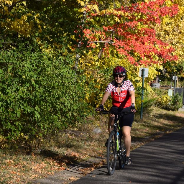
Minnesota’s Peak Riding Time Is Fall: Part Two

Autumn Is Minnesota’s Peak Riding Time: Central Minnesota

With the summer season officially off the calendar, fall is a great time to extend your bike riding adventures here in Minnesota. As the trees change colors along the miles of paved and mountain bike trails, cyclists will find a kaleidoscope of colors along the way. With the abundant rainfall this year, colors are predicted to be spectacular. If the weather remains mostly sunny during the day and cool at night, conditions will favor a stunning ride while exploring Minnesota. It’s no surprise that Minnesota’s peak riding time is in the fall and now.

Each year the fall color peak normally arrives in the northern one-third of the state in mid-September to early October. This year the peak cycle, statewide, is running a week or so later than normal due to ideal summer conditions – so enjoy!

To get a more accurate gauge to the change in colors in areas of Minnesota that you would like to visit, a color report is available online or through a weekly e-newsletter from Explore Minnesota Tourism each Thursday afternoon during the fall season.

This section is part two of a three part series.

Trails to Enjoy in Minnesota’s Peak Riding Season

Central Lakes: This trail offers 55 miles of pedaling opportunities through rolling landscapes. It provides cyclists with views of the many lakes and countryside from Fergus Falls to Osakis. Then, it is at Osakis where it connects with the Lake Wobegon Trail. See more information on the Central Lakes Trail here.

Glacial Lakes: This scenic trail through the Little Crow Lakes region starts at the Civic Center at the northeast edge of Willmar and winds 22 miles northeast, passing the big, festive beach on Green Lake in Spicer, then New London and Hawick. Then, from New London, cyclists can ride three miles west to Sibley State Park. See more information at: Willmar Tourism.

Lake Wobegon: Offers 46 miles between St. Joseph (just west of St Cloud), up to Osakis where the trail connects to the Central Lakes Trail. Along the way, the main section of the Lake Wobegon passes a series of picturesque old churches. These churches are in the towns that inspired the stories of Garrison Keillor. Then, in Albany, a spur extension allows cyclists the option to travel north up through Holdingford. Then, cyclists can go across the Mississippi River to U.S. Hwy 10 just below Little Falls. See more information on visiting the Wobegon Trail at: Granite County Tourism. For the north spur section see: Little Falls Tourism.

Luce Line State Trail is a 63 mile long former rails to trail route that starts in the Plymouth and for 30 miles west it is a limestone surfaced trail that runs out to Winsted. From Winsted to Hutchinson the trail is paved, See more at: Hutchinson Tourism.

Still More Trails

Prairie Waters: In this area, in the Upper Minnesota River Valley, there are miles of quiet country roads to see the fall colors. Also, taking these trails allows spectacular wildlife viewing opportunities. Plan a bike trip around Lac qui Parle Lake, or travel on the Minnesota River Valley National Scenic Byway roads. Here, in this four county area, many of the route loops allow you to ride past wildlife refuges and parks for bird viewing and historic points of interest. Additionally, several of the Prairie Water cities also offer paved trails for family fun, in addition to trails for mountain biking. See more at: Prairie Waters Tourism.

Twin City Trails

Gateway/Brown’s Creek: This trail is a recreational jewel of the East Metro Area of the Twin Cities. The Gateway section runs 18 miles from Lower Downtown St. Paul to Pine Point Park. The recently acquired 5.9 mile Brown’s Creek Trail connects before Pine Point Park on the Gateway Trail. This enables trail users to go to the scenic St. Croix River Valley, in downtown Stillwater. See more about this area at: Stillwater Tourism.

Grand Rounds: This national scenic byway through Minneapolis includes 51 miles of bicycle trails. Since these trails go around the lakes and along Minnehaha Creek and the Mississippi River, they can be extra fun. See more at: Minneapolis Tourism.

Lakeville Trails:  On the southern edge and close to many Twin Cities attractions, Lakeville is a family friendly mecca for bicycling trails. And, it’s also great for fall color scenery. With more than a 100 miles of paved trails, many parks and several great road routes, both visitors and residents alike will find plenty of safe riding opportunities here. See more information at: Lakeville Tourism.

Still More Trails

Minneapolis Northwest: At  the northwest corner of the Twin City Metro Area is Brooklyn Center, Brooklyn Park and Maple Grove offer a huge number of trails that connect to other metropolitan communities, Elm Creek Regional Park and the Mississippi River Trail, See more information at: Minneapolis Northwest Tourism.

Twin Cities Gateway: Situated on the north side of the Mississippi River from Downtown Minneapolis, the Anoka County Gateway Trails offers families and touring cyclists hundreds of miles of paved trail to grasp all the river valley colors at their peak.  See more at: Twin Cities Gateway Tourism.

Staying safe in Minnesota’s peak riding season:

Even on off-road trails, bicyclists need to wear helmets. Since you are much more likely to fall on your head by locking wheels with another bike or by stopping suddenly than you are to be hit by a vehicle, keep on those helmets!

Also, don’t forget to stop at stop signs on the trail, even if it’s just a driveway or gravel road.

Have Fun and check back this Thursday for part three of Minnesota’s Peak Riding Time!