Welcome. We're your premier source for fun places to explore by bicycle or on foot. Offering guides, maps and articles on road and trail riding for the novice to seasoned cyclist - helping you find your #NextBikeAdventure
If you are looking at slipping out to some warm weather destinations to get away, explore and play, here is D.C. Rainmaker’s Blog to give you some ideas. D.C, who travel around the world for work has been sharing his travels the last few years in his blog.
Mexico City now has nearly 40 miles of dedicated bike lanes and plans for many more. photo by: Jason Margolis
Every week is a new country and a new continent for him. In his blog, he tries to show folks a different side of the city during his visit – be it while swimming/cycling/running, or just enjoying the sight. While he doesn’t write about every single trip the places he has chronicled are organized by geographic region (mostly continents).
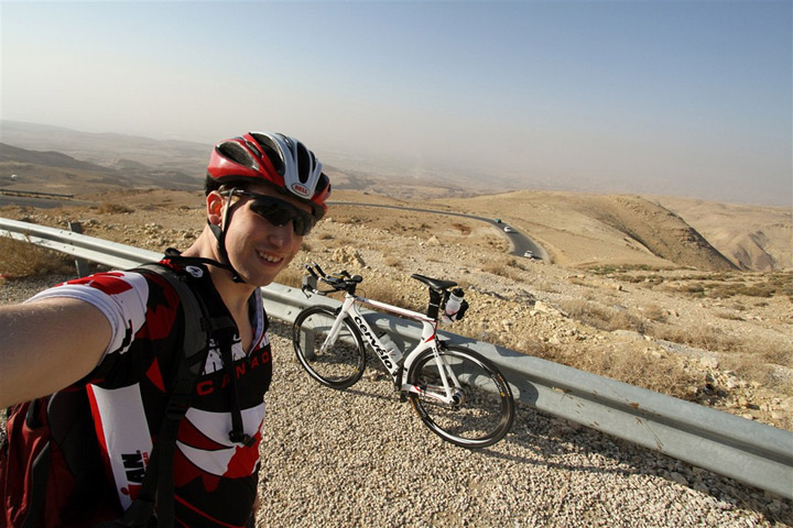
Here is a selfie of D.C. Rainmaker on one of his adventures
So, as the snow lingers here in most of the upper tiered regions of the United States, check out his list of travel favorites and enjoy!
Hope you found some good ideas? And if you do find a way to escape the cold and enjoy some outdoor activities in a warmer place, hopefully with your bike and maybe with a friend or two, please share your adventures, along with photos with us at: havefunbiking.com.
from Ted Young,
Fat Tire Bike is catching on as an exciting new winter sport. In response to this the Gunflint Trail’s Boundary Country Trekking, this winter, is introduce – Yurt to Yurt Fat Tire Biking . According to Barbara Young, co-owner of Boundary Country Trekking, “it is an eight mile bike between the Tall Pines Yurt to the Croft Yurt. On this new adventure you head west on a one mile bike along the Little Ollie Road then travel three miles along a snowmobile trail across Poplar Lake and onto the four mile Moose Trail to the Croft Yurt Camp.”
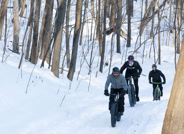
Fat biker leave Boundary Country Trekking for a day of fun riding
Something about the two yurts sites where bikers will be staying – for centuries, the people of the Mongolian plateau have found yurts to be comfortable, convivial dwellings. These round peaked-roofed, canvas-covered huts are warm and cozy. Each comes equipped with a wood-fired stove, dishes and utensils, pots and pans, LP gas stove with oven, prep area, dining area, sleeping bags and bunk beds. An outhouse is nearby. The Tall Pines yurt even has a wood fired Finnish sauna. And, while you bike between the yurts your gear and food are transported for you.
Young went on to say, “We had a few fat tire bikers, for the first time, last winter at our Bed and Breakfast and at the Tall Pines Yurts. One fat tire biker brought up the idea of biking between the yurts in the winter. So this winter we are going to give it a try.”
Checkout Cuyuna Country State Recreational Areanear Brainerd. Here you will find a world class single track mountain bike system that is becoming very popular for winter fat biking enthusiasts. For more info. when planning a visit here check out the HaveFunBiking, Cuyuna Lakes Area At-A-Glance Article.
by Roger Phillips
You’ve probably seen these in a bike shop, in a bike rack, or even hanging from the ceiling of a bar or restaurant and wondered, “What the heck is that?”
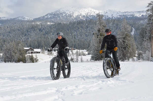
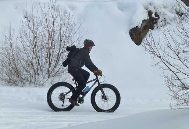
Steve and Kathy Muench of McCall ride the trails at Jug Mountain Ranch, near McCall – Roger Phillips
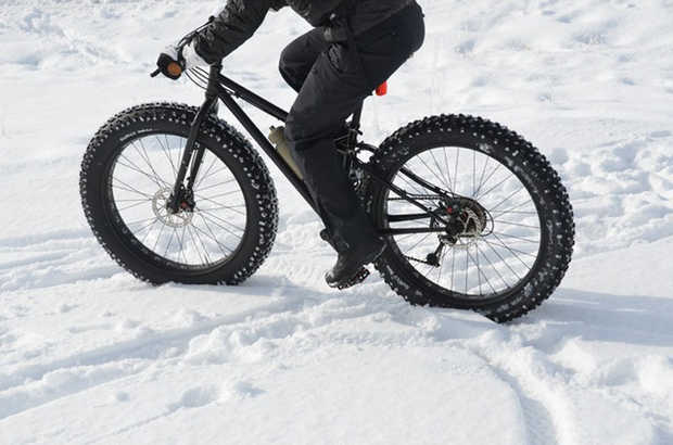
They’re known as “fat bikes,” rather than “fat tire” bikes, which was an early nickname for all mountain bikes. These bikes sport oversized balloon tires specially designed to ride on packed snow and other surfaces that run at low air pressures. So what’s it like to ride one?
See this Video or in short, it’s like riding a bicycle. There’s no special technique involved. You just get on and ride and that’s what makes them fun. While they’re sometimes called “snow bikes,” they’re actually more versatile and used for all kinds of riding on snow and sand and even for winter commuting.
Fat bikes get their name from their oversized tires, which are nearly twice the width of standard mountain bike tires – Roger Phillips
Kathy Muench and her husband Steve, of McCall, Idaho were looking for another activity to do during winter. It was at this time that a pair of fat bikes caught their attention. “We were pretty excited from the get go,” she said. “You look at these things and go – ‘Oh my gosh look at that bad boy!’”
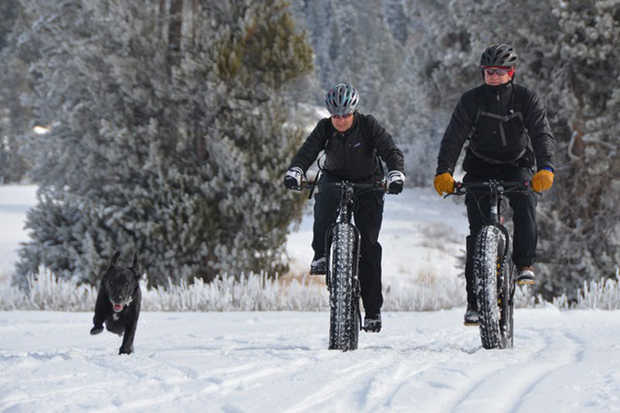
Not only are fat bikes welcome on Jug Mountain Ranch trails, but so are dogs, which make the ride even more fun — Roger Phillips
They started riding on snow — both groomed cross-country trails and snowmobile trails. Then, they branched to frozen lakes, firm snow during spring, as well as dirt roads, singletrack, and even beaches.
“The more you’re on them the more fun it gets,” Kathy said. “This last February, it was the trails up at Jug Mountain Ranch, near McCall, that lured us back onto bikes in winter. Since then we were on our bikes more than we were on skis this last winter.”
Fat bikes give you another way to enjoy winter and the awesome scenery it provides.— Roger Phillips
I borrowed the fat bike of Jug Mountain Ranch Manager, David Carey and joined Kathy and Steve on the trail system about two miles east of Lake Fork. (For directions go to jugmountainranch.com/location.) Carey welcomes the bikes on Jug Mountain’s groomed trail system and he’s experimenting with a smaller, narrower groomer that compacts some of the ranch’s singletrack trails so they can be used during winter.
Carey sees fat bikes as another opportunity for winter recreation, a way to extend the bike riding season in the McCall area and another way for people to enjoy Jug Mountain Ranch’s trails. Interested in riding the ranch’s 15 miles of groomed trails and additional singletrack trails? When conditions allow, you can buy a $10 daily trail pass to ride.
“Adding the fat bike to the overall Jug Mountain Ranch trail experience is a great fit,” Carey said. “We are firm believers that this is not a fad and can significantly increase winter trail use to a new demographic.” Carey rents his personal fat bike and plans to add more to a rental fleet this coming winter.
If you go Gravity Sports, in McCall, also rents them for $35 for a half-day, $40 for a full-day and $45 for 24 hours. Bikes are available on a first-come, first-served basis. And according to Michelle Reagan, owner there: “We almost always have bikes available for people.” For other places to stay and play when visiting the area checkout the McCall Tourism Bureau.
Jug Mountain Ranch and Gravity Sports hosts the Snowy 45 Fat bike Relay in early March each year and Reagan said riders are already signed up for the next event. They also host a fat bike demo day in mid-February where you can try the Surly brand fat bike. All the details haven’t been finalize as of so check jugmountainranch.com or the Ranch’s Facebook page in the coming months.
The interest in fat bikes isn’t limited to McCall and other mountain towns. Jeremy Whitman, manager of Meridian Cycles, in Boise, Idaho has five fat bikes in the shop’s rental/demo fleet along with many sales last winter. He sees fat bikes on Foothills trails and even in downtown Boise increasing.
The cartoonish large tires and stocky, rigid frames make them look like throwbacks to the original mountain bikes and also something entirely different than what people are used to seeing. “On any given day, I will have five customers come in the shop just to look at a fat bike,” Whitman said. “It’s not the young, fast and fit looking for a second, third, or even fourth bike. It’s common for middle-aged rider to ride them because they’re stable, simple, durable and fairly low-maintenance bikes”.
“They’re kind of built like a tank,” Kathy Muench said. The bikes were originally built for the Iditabike, an endurance race in Alaska that’s run there during the winter.
“Their popularity has exploded in Alaska,” according to Dave and Sharon Sell, who split their time between Boise and Anchorage. Fat bike riders are as common as Nordic skiers on the trail systems and the two sports can complement one another because most skiers prefer softer snow, while firmer conditions favor bikes. “When the skiing is bad, the snow biking is good,” Sharon says.
While the sale of fat bikes has grown in Idaho and around the country it’s still a niche sport, and people are figuring out new ways to use the bikes.
Like mountain biking 30 years ago, fat bikes — especially riding on snow — is fairly new to Idaho, and it will likely grow and evolve.
“It’s the early stage for us, and the early stage for the sport,” Carey said.
FAT BIKE TIPS
I’m no expert, but I also wanted to pass on some things I learned as a first-time fat bike rider.
Riding
• Relax. It’s just a bike, and although it looks big and burly, it feels like a regular bike. It’s not as nimble as your average mountain bike, but there’s nothing about a fat bike that should intimidate you if you know how to ride a bicycle.
• For your first time, go with flat pedals and warm shoes or boots. As you become more comfortable on the bike, you might switch to clip-in shoes and pedals.
• Soft or fresh snow is harder to ride than groomed, hard-packed or crusty snow. Fat bikes aren’t powder machines, which is good because there are lots of other fun things to do on fresh snow.
• A higher gear works better to plow through soft snow. You’re more likely to break traction in a lower gear, but you don’t want to burn yourself out in a higher gear. Find a compromise.
• Stay off the front brake on the down hills. Descend slowly until you become comfortable with the traction, or lack thereof. Brake far in advance of corners, steep down hills, or obstacles.
• If you’re losing traction while climbing, shift your weight toward the rear tire so it gets better grip.
Other
• Dress for exertion. Wear lighter layers than you would normally wear for cold weather. Also, breathable fabrics so you don’t get damp from sweat. Remember to factor in the wind chill when you’re going downhill. If you start feeling hot, peel a layer, especially before a prolonged climb. Then , for the descent, put it back on.
• Pedal seated rather than trying to stand and grind up a steep section. You will maintain more consistent traction and balance.
• Enjoy the scenery. Fat bikes go slower than your average mountain bike goes on dirt. Pedal, relax and enjoy the fact you’re riding on snow in a beautiful environment.
Reminders
• Not all groomed cross-country ski trails are open to fat bikes. Jug Mountain Ranch and Tamarack Resort allow them on their trails, but they’re not allowed on the Bear Basin cross country trails west of McCall, or on the trails at Ponderosa State Park, in Idaho. Check with local and state regulations in the area you plan to ride.
• Do not ride on the ski tracks set by the groomer. They are needed for traditional cross-country skiers. Also, yield to skiers like you would hikers.
• You can ride fat bikes on groomed snowmobile trails, but snowmobilers probably won’t expect you out there. So ride with caution. Consider using a headlight and/or red flashing rear light to make yourself more visible, especially on an overcast day. Remember, parking lots and trail grooming are paid directly by snowmobilers. You’re a guest on their trails.
Please Note: Check with local and state regulations in the area you plan to ride. At this time some states do not permit fat bikes on designated snowmobile trails.
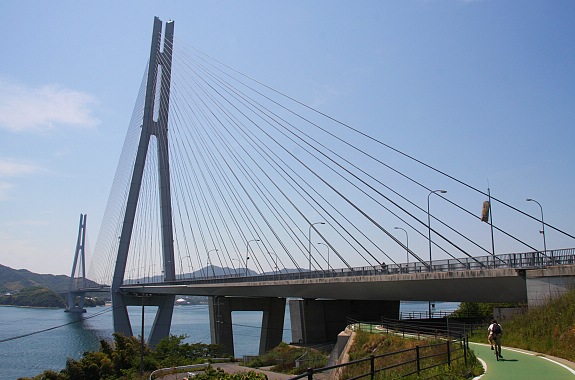
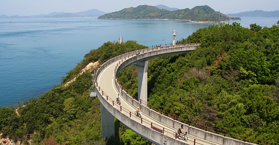
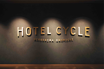
International cyclists touring Japan and on the lookout for a hotel catering to two-wheelers can book a room at Hotel Bicycle. Yes, that’s its name and its location in Onomichi, Japan, takes advantage ofan area popular with cyclists.
The city is famous for its many temples, especially the Buddhist Senko-ji Temple founded in the ninth century. Add a 70-kilometer bicycle route that connects Japan’s main Island of Honshu to the island of Shikoku, in the Seto Inland Sea draws customers to the hotel. The route separated from the expressway passes over six small islands via a set of bridges. See more photos of Japan’s bicycle paths, bridges and scenery here.
Each room here at the hotel provides wall mounted bike racks for added convenience
Hotel Bicycle offers accommodations that attract cycling tourists. For example each room comes with a wall rack to securely store bikes and offers a small store that sells accessories and other items for cyclists. The hotel will also handle receiving and shipping for those who would like to send their bikes to the hotel. Nightly rates range from about $156 to $200.
See more of Hotel Bicycle in the JapanChannelDcom YouTube Video here.
If you have a unique destination that caters to bicycling tourists please share it with us at HaveFunBiking.com
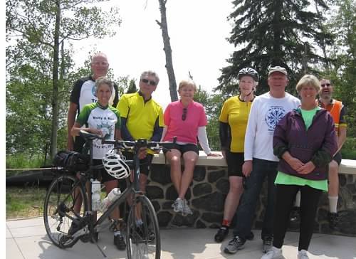
I really enjoyed exploring Minnesota’s North Shore Bicycle Tour, circling through the Arrowhead Region of the state. Operated by Bike Tour Vacation, I found the this ride on the Events calendar at HaveFunBiking.com and it turned out to be the highlight of my summer.
Ride participants on the North Shore Bicycle Tour
If they hadn’t listed the tour I probably would not have found it on my own, since it is a the tour company is out of Michigan. On this remarkable ride we had only seven bicyclists to two guides and virtually all expenses were included in the lodge to lodge tour fee on this trip, except two lunches.
Because of the abundant restaurants options in a couple areas of the trip, the leaders wanted us to explore and compare. The owner of the company, Jim was one of the leaders so he could immediately fix any unexpected situations.
One guide bicycled with us and the other drove the SAG (support and gear) vehicle. Since the gear trailer was pulled by the SAG van, it was easy to store extra clothes at the next rest stop or pick up needed supplies from one’s bag. The weather and temperatures were almost perfect with the only heavy rain one night, this was after all the riders were in.
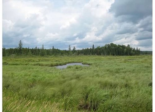
Landscape scenery on the way to Virginia
Sunday afternoon we met in Duluth, Minn. at the Edgewater Inn. Then, Monday morning everyone was shuttled north of town to Island Lake to begin riding. This shaved off 20 miles of bicycling and a huge climb. Those of us who aren’t good hill climbers appreciated this. Along the journey on the first day we spent much of the route on quiet roads bicycling through woods areas arriving in Virginia for the night.
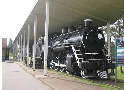
This old steam train is the centerpiece of the Tower Train museum
One of the highlights here on the Iron Trail was eating dinner in “jail.” This is the name of the party room, with bars on it, in a local Mexican restaurant in Virginia. The next morning, when breakfast at the hotel turned out to be just Danish and coffee our tour leader took everyone to a local café for a real iron miners breakfast.
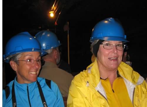
Bike riders touring the Soudan Underground Mine wearing miners helmets
After leaving Virginia on the Mesabi Trail and passing through Gilbert and Biwabic, the highlight of Tuesday was a visit to Soudan Underground Mine State Park. Arriving about three in the afternoon, the Underground Mine here was donated to the state of Minnesota after it closed in 1965. Today, visitors can don a hard hat and pretend to be miners. Our tour began with a short film and safety warnings. Then visitors board a rickety old elevator and descend one-half mile down where a shuttle train transported everyone another three-quarters of a mile to where miners once worked to extract the iron ore. After the group acclimated to the surroundings the guide turned out the lights for a few minutes to allow visitors the experience of what early mining was like – when they worked in the darkness. Fortunately, he lit a candle and explained more of the mining process with some light. Those who are claustrophobic or afraid of the dark may want to avoid this mine tour.
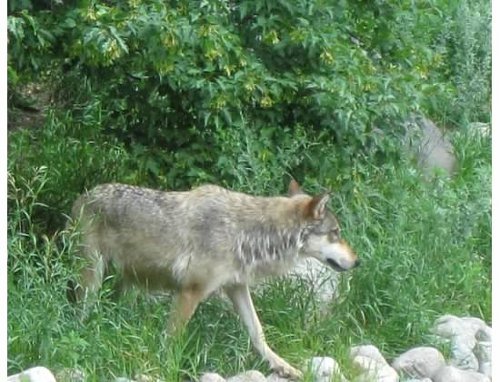
Behind a glass viewing station, at the International Wolf Center in Ely, a wolf roaming the woods
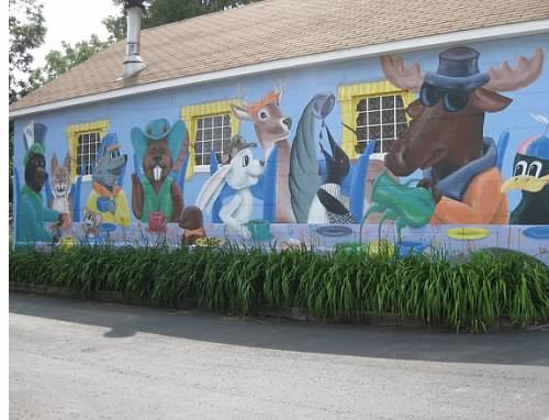
On Wednesday, we rode a short 30 miles from our overnight at Boise Forte Casino, in Tower, to Ely. This gave us all a full afternoon to try out the cuisine of Ely and explore the town. I enjoyed a visit to the International Wolf Center and finding several interesting murals in town.
This mural in Ely is a MN interpretation of the Alice in Wonderland tea party using wildlife such as moose, deer and beaver.
Thursday was a long 70 mile bike ride to Beaver Bay. Half the riders started at 7:30 a.m. with one guide. The rest were shuttled the first 20 miles for a shorter distance. This allowed the slower riders to get a head start on the fast riders, so we all arrived for lunch about the same time. One of the fun parts of the day along this section of the tour was the 10% downhill grade into Tettegouche State Park, along the shoreline of Lake Superior.
Several of our group posed with the sign here in downtown Beaver Bay, along Highway 61 Bay.
On Friday, we started out riding a 15 mile stretch of the Gitchi Gami Trail out of Beaver Bay. The trail meanders along the undulating shoreline past the Split Rock Lighthouse and then to Gooseberry Falls State Parks. Some stretches along the shore had incredible views of Lake Superior. After going through Gooseberry Falls most of the route to Two Harbors was riding the shoulder lane along Highway 61, with a posted speed limit for traffic set 50 MPH. After Two Harbors, the route follows the North Shore Road. This area had many dining options. Then we picked up the Lake walk in Duluth, back to the Edgewater.
I can’t wait to see what rides will be listed on the HaveFunBiking.com Events Calendar for next year – Thanks!
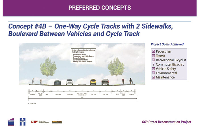
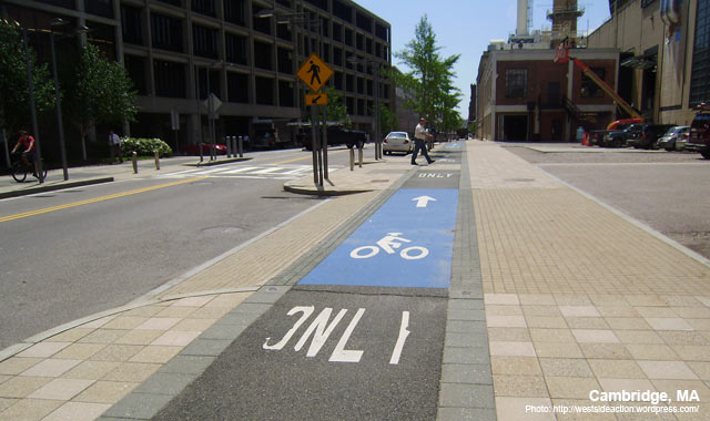
With widespread community pride in being a bike-friendly city, the Richfield, Minnesota Transportation Commission approved Concept 4B, including a Cycle Track (protected bike lanes) for the 66th Street project between 35W and Cedar Avenue, last night.
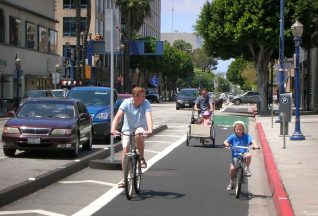
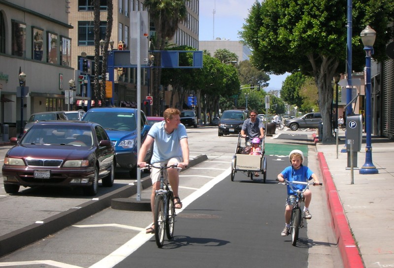
All ages and levels of bikers can find comfort riding on a cycle track. Photo from downtownseattle.com
With much debate amongst the forward thinking Richfield commissioners, many open house events and surveys were conducted to help them come to a unanimous vote to approve Concept 4B. Now with the roadway design defined, engineers from both the city of Richfield and Hennepin County will look at the best use styles for intersections running along the 66th Street corridor. Then it is on to the city council for final approval.
“This is a huge step forward as we nail down the future for 66th Street,” stated Sean Hayford Oleary, Richfield’s bike advocacy chair.
What is a cycle track or protected bike lane you ask?
It is a lane(s) for bicycles that is a part of the roadway and separated from motorists by painted boarders with plastic or metal poles and sometimes by a row of parked cars as the barricade. That puts the cyclists between parked cars and the sidewalk. The protected lanes can also be a raised bed (Cycle track) next to the street, as proposed in Richfield and planned for a short segment of Washington Avenue, in Minneapolis, next year. According to many experts throughout the U.S and Europe, the protected bike lane adds a level of comfort while bicyclists gain confidence to riding on streets. See the two styles provided by the Richfield Bike Advocates below:
Option 4B
This option is a one-way protected cycle track lane on both sides of the roadway, separated from the roadway by the grassy boulevard. There would be no bike lanes in the 66th Street roadway itself. It would look something like this, although the roadway itself would be wider
Option 2
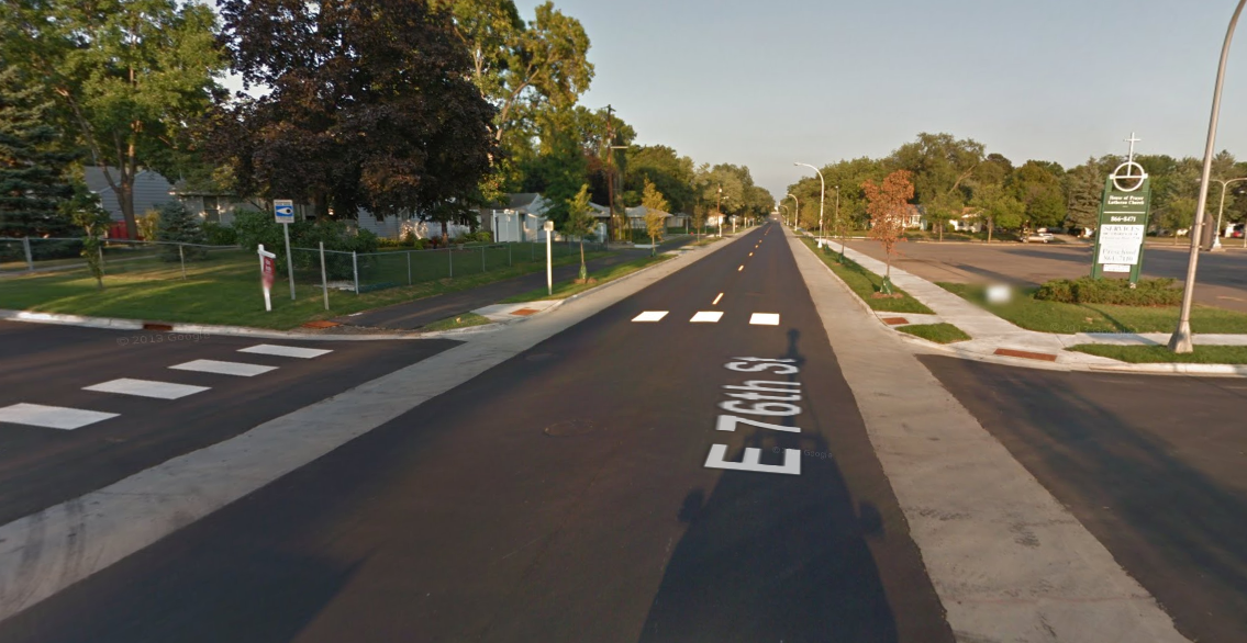
This is a traditional bike lanes in the gutter pan on both sides of the roadway, plus a wider shared-use path on one side. It would look much like 76th Street bike corridor in Richfield today, although all sections would be wider and have a higher speed limit.
According to national supporters like the People for Bikes, Green Lane Project, which has supplied technical help to a dozen cities nationally including Minneapolis, the number of protected lanes has quadrupled nationally since 2010. In those cities where designated cycle track lanes have been established more and more people are riding their bikes to local schools, patronizing more neighboring businesses, etc. with confidence.
Richfield is located on the south side of Minneapolis, near the Minneapolis–Saint Paul International Airport and the Mall of America. On October 15, 2013, the city of Richfield was honored by the League of American Bicyclists for its commitment to improving bicycling, by naming it a Bicycle Friendly Community. The designation means Richfield improved conditions for bicycling through investment in bicycling promotion, education programs, infrastructure and pro-bicycling policies.
On a recent summer morning, I jumped on my bike and pedaled to the boat launch at Lions Park on St. Charles Street, in bike-friendly Winona, MN. The sun, several hours high, bent between scuttling clouds, and the river gleamed with muted light. Above my head, turkey vultures rode the wind currents, and around my feet, yellow and white wildflowers trembled in the wind. As I stopped, I took a deep breath, smelling the river mud the floodwaters left behind. I watched the water swirl between the rocks for a few minutes. Then I got on the bike again.
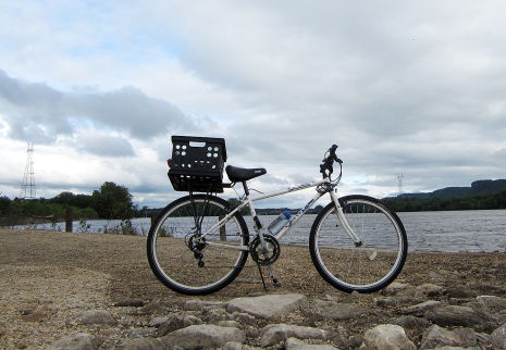
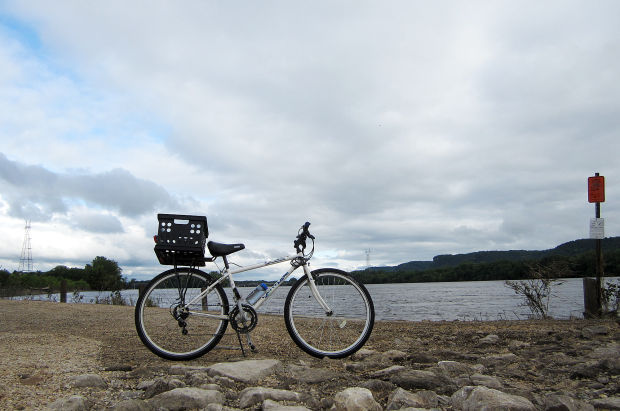
Bicycle next to a lake in Winona, MN
Biking options in and around Winona
I’ve been using a bike to get to the parks here in Winona for as long as I can remember.
I do have one tricycle memory, in which I careened down a gradual hill and fell near the bottom, prey to the tricycle’s lamentable lack of brakes. But soon after, I learned how to use two wheels. My first bike was a $1 Goodwill find. The second one, with 20-inch tires, was a $10 garage-sale bargain. I loved each one. There was nothing quite like the freedom of biking to the park with my mom and brothers or going around the neighborhood looking for kids to play with or riding to meet Dad on his way home from work. No license required.
Riding a bike in a place creates a sense of belonging and Winona is no exception. With its many quiet streets lined with trees, some of which arch over the road like the name of a cathedral. I could spend hours looking at the Victorian and Queen Anne architecture of the houses near downtown. On my bike, I catch glimpses of wildlife, if they’re not startled by the whir of the chain. Once, as I rode, a bald eagle banked against the wind just a few dozen feet above my head. I’ve seen turtles and deer. Once I almost ran over a squirrel.
I’ve biked and run most of Winona’s streets over the past few years, thanks to a marathon training regimen, lack of a car and a general sense of curiosity about the place in which I live. I’ve racked up quite a list of favorite streets and trails.
Now that it’s summer in Winona again, long days call for long adventures to fill them and lukewarm weather means it’s not too hot to jump on a bike and call it a day trip. So I mapped out a route that hits many of my favorite spots and offers ample opportunities to take it slow, grab a snack, or spread a blanket and take out a book.
The length of this loop I designed is about 16 miles, and I completed it at a medium pace in about 2½ hours. I don’t go very fast on my bike, a hand-me-down hybrid with a jerky front brake and a milk crate tied to the rack behind the seat (perfect for a picnic.) The route is mostly flat and paved, and I tried to include many of Winona’s more bike-friendly streets on this route.
St. Charles Street boat launch
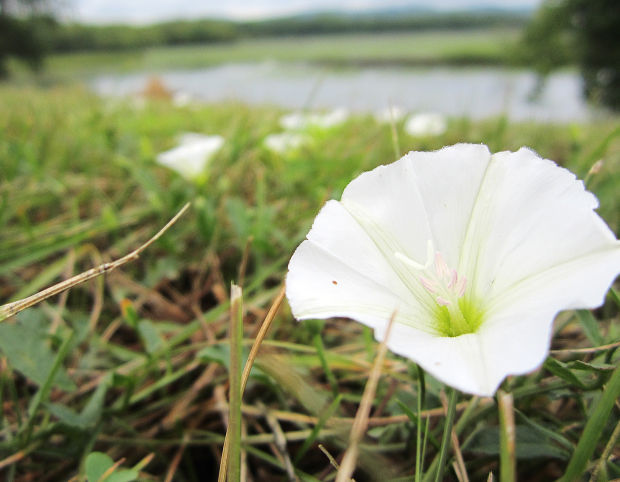
I start the loop at the boat launch at Lions Park because it’s just a few blocks from where I live on the east side of town. It’s a perfect sunrise and sunset spot because it provides a rocky perch and a distant view of the interstate bridge and smaller bridge behind Latsch Island. Here look for wild morning glories on the rocks.
Then, from the launch, take St. Charles Street and turn right on Second Street. At Walnut Street, take a right to get to Levee Park.
Levee Park
I love to swing by Levee Park at least a few times each week to look at the river. When I lived on campus at Winona State University, it was the perfect 20-minute out-and-back run to get me going in the morning. I love to catch the sun rising here as well, slowly leaking over the river and onto the rooftops of Winona.
Riverview Drive/Minnesota Marine Art Museum
Return to Second Street, and then head right on Riverview Drive. Ten minutes from downtown, you can stop at the Minnesota Marine Art Museum, for the art of course, or the view of Yeomans Pond. There’s also a preponderance of wildflowers and birds. Then it’s back on the road again.
This part of the bike tour requires a Whitmanic excitement toward commerce and industry, with its views of soaring grain elevators and constant truck traffic. Plenty of interesting distractions, anyway — or you can keep your eyes on Prairie Island Road until you get there.
Prairie Island Road
Blooming morning glories by the side of Prairie Island Road in Winona, MN
Turning right off Riverview Drive onto Prairie Island Road takes you away from the traffic and straight into sprawling views of wetlands and backwaters. Wild morning glories bloom over the banks leading down to the water, and water lilies abound. When I run or bike back here, I usually can’t keep a goofy grin off my face. Prairie Island itself offers ample opportunities to take a breather, spread a picnic and watch some deer or bald eagles. There’s a handy water fountain by the picnic shelter — and a portable toilet.
Mississippi River Trail
The Mississippi River Trail is a bike route that follows the Mississippi from Lake Itasca to New Orleans. Signage was completed in Winona last fall, and my route includes a short piece of it. Turn right out of Prairie Island Park and follow the left fork of the road (the right leads to McNally’s Landing) down a long straightaway. Watch for waterfowl — the National Wildlife Refuge surrounds you.
Verchota Landing
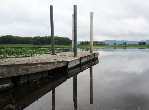
Verchota landing on the Mississippi River, Winona, MN
The view of the backwaters here is unreal, with miles of lily pads and bulrushes beneath a full sky. Take in the sight of Wisconsin’s bluffs, and watch for eagles. On calm mornings, the water makes a perfect mirror, as it did for my latest visit. Continuing on your way, take a right out of the parking lot and follow the Mississippi River Trail as it loops up a steep hill into a neighborhood. Then go left on Wenonah Road.
Wenonah Road
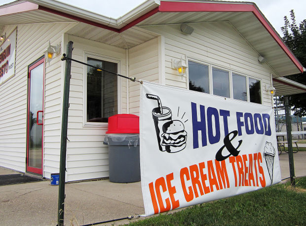
This part of the route is more of a connector, but it still offers a low-traffic, mostly low biking environment and views of the bluffs on either side. As you bike through Goodview back toward Winona, you’ll come to a stop sign that features Airport Lake on the left and Penguin Zesto West on the right. Here you will find a couple of choices for a mid-route refreshment on your ride.
Airport Lake
I close my eyes every time I let go of that rope. Reflexes, I guess.
From the lake, take 54th Avenue to West Sixth Street, and make a left. After going through Goodview past Goodview Park and Pelzer Street, the road will come to a Y-intersection, and I suggest the left fork, continuing onto West Fifth Street. This road is busier than most of the others, so stick close to the shoulder and hop in the bike lane once it starts.
Bob Welch Aquatic Center
If jumping off a rope into a lake is not your idea of fun, you can also cool off here. Just turn left on High Street and go two blocks north.
Windom Park
This park, set at the intersection of Fifth and Huff streets, always feels European to me. It’s fun to run the diagonals, but I would not suggest sailing through on a bike. Instead, take time to sniff the flowers and avoid mowing down pedestrians.
Lake Winona
From Fifth Street, take a right on Main Street and use the bike lane to get to the lake. I find the lake another excellent spot for daydreaming and catching my breath after a long day.
Back home — or a wild card
Penguin Zesto West, Winona, MN
At this point, you’re back in town, sweaty, happy — so it’s time to add your personal stop to the bike route, then head to wherever home is.
Other popular Winona bike touring loops
Rollingstone Route: 12 miles
Arches/Farmer’s Park Route: 17 miles
Gilmore Valley Route: 16 miles
Pleasant Ridge Loop: 18 miles
East Burns Valley Loop: 13 miles
Pickwick Loop: 25 miles
Richmond Ridge Loop: 16 miles
Apple Blossom Loop: 17 miles