Tag Archives: Lake Wobegon trail

Explore Minnesota’s paved and surface bike trails

With more than 4,000 miles of paved Minnesota bike trails, the state has become a world-renowned bicycle touring destination for all to enjoy. Making considerable strides in connectivity, so in some areas, you can pedal distances of up to one hundred and fifty miles without leaving the trail. For example, in southeastern Minnesota, the Root River Trail connects to the Harmony-Preston trail for 60 miles of scenic enjoyment. In central Minnesota, the Central Lakes Trail connects to the Lake Wobegon Trails for over 120 miles of Rail-to-Trail touring pleasure.

As you plan your next adventure, look through the following list of Minnesota bike trails for miles of fun memories. Many of the trails listed are available in the Minnesota Bike/Hike Guide maps for your riding pleasure.

It’s fun riding with friends on all the Minnesota Bike Trails

With Minnesota’s bike trails listed here, find your next adventure

Blazing Star shooting State Trail  –  6 paved miles

The Blazing Star State Trail is paved and runs from Albert Lea Lake in Albert Lea to Myre-Big Island State Park, approximately six miles. The trail currently connects to Albert Lea’s city trail system.

Brown’s Creek State Trail  – 8 and 6 paved miles

This beautiful railroad-grade trail connects the Gateway State Trail in the city of Grant to Stillwater and the city’s round-the-river loop there.

Cannon Valley Trail – 20 paved miles (Rail Pass Required)

The Cannon Valley Trail follows the Cannon River in southeast Minnesota to the Mississippi River, using the abandoned Chicago Great Western Railway corridor from Cannon Falls to Red Wing.

Casey Jones State Trail  – an eight and six-mile stretch is paved

The Casey Jones State Trail consists of three segments, with the most extended section of former railroad grade between the city of Pipestone and the Pipestone/Murray county line. The segment from Pipestone to County Road 67 is paved, and the third portion of the trail offers a paved loop between Lake Shetek State Park and the city of Currie.

Fun along the Central Lakes Trail

Central Lakes State Trail – 55 paved miles

This trail begins in the city of Fergus Falls. It ends in the city of Osakis, where users will enjoy the many different landscape views, ranging from open grassland/prairie, lakes, wetlands, farmland, and forested rolling hills. Towns to visit along the trail include Evansville, Brandon, Garfield, and Alexandria. The Central Lakes Trail at Osakis connects to the Lake Wobegon Trail for another 65-mile stretch to St. Cloud.

Cuyuna Lakes State Trail – 8 paved miles

This trail, abandoned by mining companies over 35 years ago, runs from Crosby to Riverton, inside the Cuyuna Country State Recreation Area. Many of the lakes along this trail system were former mine pits and now offer a world-class single-track mountain bike trail system around them.

David Dill/Arrowhead State Trail – 69-mile long multi-purpose unpaved trail

This long-distance, natural surface trail near Tower, MN, is suitable for horseback riding, mountain biking, and hiking in the summer.

David Dill/Taconite State Trail – 6 paved miles

This trail stretches 165 miles from Grand Rapids to Ely and intersects with the David Dill/Arrowhead State Trail just west of Lake Vermillion. The first six miles from Grand Rapids are paved for biking and in-line skating and connect to the Mesabi trail.

Gateway State Trail – 18 paved miles

The popular east metro trail begins in St. Paul, travels northeast through Maplewood, North St. Paul, and Oakdale, through Washington County, and ends at Pine Point Regional Park. Here, the Browns Valley Trail connects and runs to the city of Stillwater. Located on a former Soo Line Railroad bed, the trail is generally level and wheelchair accessible.

Gitchi-Gami State Trail – 86 miles, with on 33-miles paved, not continuous

This trail is considered a moderately challenging route and features one scenic view of Lake Superior after another. The trail parallels Highway 61, using the road’s wide 10-foot shoulder along undeveloped segments. The opportunity to spot wildlife is also a common occurrence here.

Goodhue Pioneer State Trail – Two paved segments, four and 5.5-mile

This trail is popular with hikers, bikers, horseback riders, and snowmobilers. Currently, there are two sections of the trail. The northern portion is a paved trail between Red Wing and the Hay Creek Unit of the Richard J. Dorer State Forest and connects with Red Wing city trails and the Cannon Valley Trai. The southern segment of the trail features 4.5 miles of paved trail and is used by hikers and bikers. This segment starts in the city of Zumbrota and connects to the city’s trail system.

Great River Ridge State Trail – 13 paved miles

Located in the beautiful southeastern Minnesota river valley, this trail system follows a former railroad grade with picturesque views of river bluffs. The trail is generally level and accessible and is famous for bicycling, hiking, and in-line skating. Currently, the trail begins in Plainview, traveling south through the town of Elgin, and ends at County Road 9.

Heartland State Trail  – 49 paved miles in two connecting segments

This was one of the first rail-to-trail projects in the country. The trail is located entirely on a level abandoned railroad grade, with the 27-mile segment connecting Park Rapids and Walker and the 22-mile segment connecting Walker and Cass Lake. The Park Rapids to Walker segment also has a parallel natural surface trail for horseback riding, hiking, and mountain biking. The Heartland State Trail also connects with the Paul Bunyan State Trail and other regional trail systems.

The Lake Wobegon covered bridge near Holdingford.

Lake Wobegon State Trail – 65 paved miles

The trail runs west from St. Cloud, through Waite Park, Avon, Albany, Freeport, Melrose, Sauk Centre, and up to Osakis, where it joins the Central Lakes Trail and continues to Fergus Falls. At Albany, a paved spur heads north to Holdingford, then to the Mississippi River Trail below Little Falls.

Luce Line State Trail – 63 miles, mostly packed limestone

This former railroad-grade trail stretches across the varied landscapes of metropolitan and rural Minnesota. Primarily crushed limestone surface with a parallel Treadway.

Matthew Lourey State Trail – 80-mile long multi-purpose unpaved trail

The gravel-surfaced trail passes through forests linking St. Croix State Park with ChengwatanaSt. Croix, and Nemadji state forests. The entire trail is open to hiking in the summer. Mountain biking is allowed in some sections of St. Croix State Park.

You will find many trail towns along the Mesabi Trail

Mesabi Trail – 150 paved miles  (Rail Pass Required)

Stretching from the Mississippi River in Grand Rapids to the Boundary Waters near Ely, the Mesabi Trail is like no other in the country. Cutting through the forests of northeast Minnesota, your adventure will take you past lakes, creeks, and ponds, by vast red pits of old iron ore mines now filled with emerald green water.

Mill Towns State Trail – 3 paved miles

This trail currently connects with the city of Northfield trails system near Babcock and Riverside Park on the north end and follows the Cannon River to the city of Dundas, where the trailhead connects to other local trails.

Minnesota Valley State Recreation Area – 6 paved miles, 36 unpaved miles

Not far from the Twin Cities. Watch for wildlife as you travel the multi-use trail, which is paved for six miles from Shakopee to Chaska and unpaved from Chaska to Belle Plaine.

The scenery along the Paul Bunyan Trail can add to the experience.

Paul Bunyan State Trail – 115 paved miles

The Paul Bunyan State Trail is 115 miles long, not including a couple of short on-road connections through the cities of Baxter and Bemidji. Extending from Crow Wing State Park to Lake Bemidji State Park, it is the longest of Minnesota’s state trails and the longest continuously paved rail-to-trail in the country. It connects with the 8-mile Heartland State Trail. At Lake Bemidji State Park, it connects to the Blue Ox Trail, an unpaved motorized trail for snowmobiling and off-highway vehicle riding that extends northeast to International Falls.

Root River State Trail – 42 paved miles

Discover the dramatic bluff lands of southeastern Minnesota on this popular trail. Very accessible, except for some hills near Houston on the east end. Along the trail west, visit the towns of Rusgford, Peterson, Whalon, and Lanesboro before reaching the western trailhead at Fountain. Before Fountain, the Root River Trail connects to the Harmony-Preston Valley State Trail.

Harmony-Preston Valley State Trail – 18 paved miles

Come and enjoy Minnesota hospitality, southeastern style. The paved Harmony-Preston Valley State Trail is a beautiful 18-mile-long multiple-use trail connecting Harmony and Preston communities with the existing Root River State Trail. Main summer uses are hiking, biking, and in-line skating. The trail is groomed for cross-country skiing in the winter.

Sakatah Singing Hills State Trail – 39 paved miles

The Sakatah Singing Hills State Trail is a paved, 39-mile multiple-use trail developed on an abandoned railroad grade. The trail begins at Lime Valley Road near State Highway 14, joins the Minnesota River Trail in Mankato, follows a signed route on city streets through Waterville, passes through three miles of Sakatah Lake State Park, and ends east of Interstate 35 in Faribault. It is generally level and wheelchair accessible. Horses can use a parallel treadway, from Lime Valley Road to the County Road 12 bridge.

Shooting Star State Trail –  29 paved miles

The Shooting Star State Trail is currently paved for about 29 miles between LeRoy and Austin. It begins in the city of LeRoy, travels north through Lake Louise State Park, then west toward the communities of Taopi, Adams, and Rose Creek. There is a short break in the trail in Rose Creek between City Hall and Rose Creek Wayside Park. It picks up again in Rose Creek Wayside Park and travels west and north, primarily in state and county highway right-of-way, until it reaches the intersection of 28th Street NE and I-90. Just across the 28th Street bridge over I-90 is a paved path connecting to the Jay C. Hormel Nature Center in Austin. When complete, the trail will also connect with the community of Lyle (south of Austin) and the Wapsi-Great Western Trail in Iowa (south of Taopi).

You will want to stop often along the Willard Munger Trail for the spectacular scenery.

Willard Munger State Trail –  70 paved miles

This 70-mile Willard Munger State Trail segment is a completely paved trail. Beginning south of Hinkley, the trail first passes through the towns of Finlayson, near Banning State Park, then Rutledge, Willow River, near General C.C. Andrews State Forest, Sturgeon Lake, Moose Lake, and Moose Lake State Park, and Barnum. At  Carlton, the northeast portion of the trail transforms, offering some spectacular scenery at Jay Cooke State Park and along the St. Louis River, to the twin ports of Duluth and Superior. 

See more trails in Minnesota if off-road riding is your preferred choice

Here is today's bike pic on this beautiful Saturday. Now that summer is here get ready for your #nextbikeadventure and make some memories.

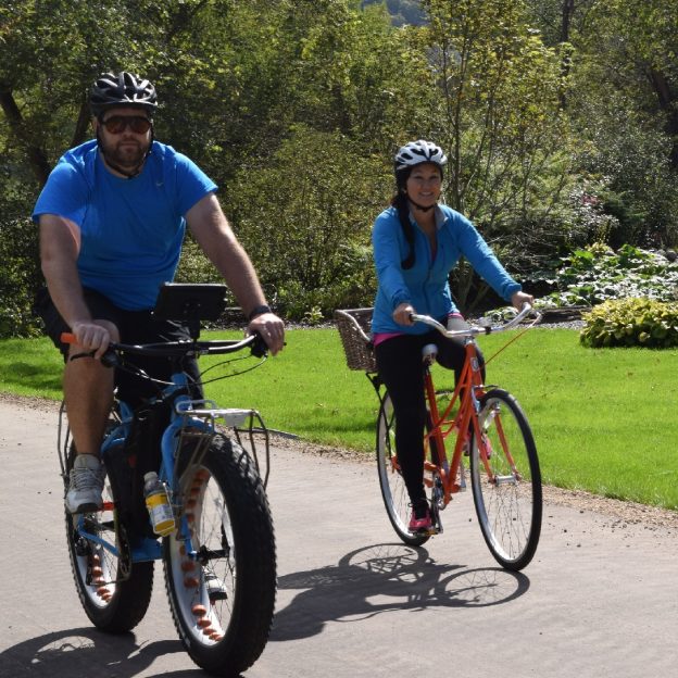
Bike Pic June 23, summer memories are being made on the bike trail

Here is today’s bike pic on this beautiful Saturday. Now that summer is here get ready for your #nextbikeadventure and make some memories.

What better way to start your riding season fun then to plan your next adventure. View all the great ideas and bike destinations in the latest Minnesota Bike/Hike Guide. Then plan your next outing with family and friends in one of the HaveFunBiking Destinations.

Thanks for Viewing Our ‘Bike Pic’ of the Day  

Now rolling into our 11th year as a bike tourism media, our goal is to continue to encourage more people to bike and have fun. While highlighting all the unforgettable places for you to ride. As we continue to showcase more destinations you can have fun at we hope the photos we shoot are worth a grin. As you scroll through the information and stories we have posted, enjoy!

Do you have a fun bicycle related photo of yourself or someone you may know that we should post? If so, please send your picture(s) to: [email protected]. Include a brief caption (for each), of who is in the photo (if you know?) and where the picture was taken. Photo(s) should be a minimum of 1,000 pixels wide or larger, to be considered. If we do use your photo, you will receive photo credit and acknowledgment on Facebook and Instagram.

As we continues to encourage more people to bike, please view our Destination section at HaveFunBiking.com for your next bike adventure – Also, check out the latest  Bike Guide, mobile friendly as we enter into our 9th year of producing print and digital guides.

So bookmark HaveFunBiking.com and find your next adventure. Please share all our pic’s with your friends and don’t forget to smile. We may be around the next corner with a HFB camera ready to document your next move while you are riding and having fun. Capturing you in one of our next ‘Pic of the Day’ posts.

Have a great week!

Bicycles and cars

Bike around Saint Cloud and discover all the parks and trails

by Andrew Ellis

The sun is warming the morning air as you ride along the Mississippi River Trail (MRT) through Saint Cloud, MN. Now in Granite Country, you are looking for a change in scenery as you pass a group of buildings, then realize its St. Cloud State University (SCSU). Across the Mississippi River and easy to reach crossing the bridge with your bike is the popular Munsinger/Clemens Gardens. This area, as the river bends to the southeast, is prime and ready to give you and your friends or family many biking opportunities when visiting here.

The Lake Wobegon Trail is a family friendly paved path system offering everyone a fun time.

The Lake Wobegon Trail is a family friendly paved path system offering everyone a fun time.

Saint Cloud is labeled a city, but don’t let that scare you away. The area’s spacious layout provides plenty of room to escape from all the noise of everyday life that can bombard many with stress. The area offers many parks, family friendly trails and other attractions to give you memories that will last a lifetime.

More about bike-friendly Saint Cloud

Now with the Lake Wobegon Trail running through Saint Cloud and stretching 63 miles to Sauk Center, you can visit three colleges along the way. Besides SCSU, the Granite County Area is also home to Rasmussen College, the College of Saint Benedict and Saint John’s University. Their presence in the area and the communities they create, along the trail system, helps add to the area’s welcoming atmosphere and unique points of interest for cyclists visiting throughout the year.

The Munsinger Gardens is unique botanical experience along the MRT where you can stroll the winding paths and brick pathways as you experience this Saint Cloud treasure.

The Munsinger Gardens is unique botanical experience along the MRT where you can stroll the paths experiencing its treasure.

The Saint Cloud Area is also a bike-friendly community, awarded by the League of American Cyclists. This gives you the assurance there are plenty of places for you to comfortably roam around using designated bike lanes and trails. And while there are plenty of fun things to do on west side of the river. Don’t forget to cross the river and explore the jaw-dropping and joy-spreading Munsinger and Clemens Garden’s.

Biking trail opportunities in and around Saint Cloud

Granite Country has many opportunities for you to put your tires to the pavement, or whichever surface you prefer to ride on. There are many trails tucked into the area’s various parks, several chances to put your mountain biking skills to the test, trails that take you beyond the city limits, and more. No matter what kind of adventure you’re looking for, Granite Country has you covered. For more information see At-A-Glance St. Cloud and our HaveFunBiking map of the area.

Long Rides

Riding the Mississippi River Trail through the neighborhoods as the route rolls into Saint Cloud.

Riding the Mississippi River Trail through the neighborhoods as the route rolls into Saint Cloud.

If you go west out of St. Cloud you can take the Lake Wobegan Trail and stop along at one of the many trailheads along the way. You can also travel along the famous Mississippi River Trail as you explore St. Cloud and everything you meet along the river’s edge. There even points to cross the river and see what the other side has to offer. For more bicycle touring loop options see Central Minnesota Bicycle Club’s many mapped bike routes.

Quarry Park and Nature Reserve

The largest park in the Stearns County Parks System is bound to have a plethora of biking opportunities. The trails will give you a great overview of the reserve has to offer and they all connect in some way so it’s easy to switch when you want to. There is also some section for mountain bikers to pedal over granite bedrock that is a billion years old.

Pineview Park BMX

Freestyle cycling fun at Pineview BMX

Freestyle cycling fun at Pineview BMX

Saint Cloud also has its own BMX park. You can hit the tracks, watch races on the weekends, and work on your skills if you are there during the week.

Mountain Biking

Riding out on the Jail Trail is one of several mountain biking options in Granite Country.

Riding out on the Jail Trail is one of several mountain biking options in Granite Country.

In addition to the Quarry Park and Reserve, the area has a few more mountain biking opportunities for you. The Jail Trail is an intermediate level mountain bike loop system located east of Saint Cloud. The main loop has some easy elevation challenges, but overall stays pretty flat. There are also additional side loops that add some technical difficulty. Then there’s the heavily wooded Plum Creek Trail, which is an exhilarating five mile-plus ride on a very narrow single-track filled with its share of hills.

Other Off-Road Opportunities

If you don’t want to battle mountain bike trails, but still want to go an adventure you’re in luck. You can hop on the Oxcart Trail that starts at Southside Park and travels north through Lions Park, Municipal Park, and Island View Park. Then there’s the Mayhew Creek Park Trail, Sauk Rapids’ newest trail, which consists of two loops and gives you just over one mile of riding. Also, the secluded crush aggregate Rotary Trail takes you through a wooded wetland complex that goes north of Bob Cross Park to the Bob Cross Nature Preserve. There are boardwalks and observation decks along the way.

Other opportunities when not biking in Saint Cloud

There are plenty of other ways to navigate your way around Granite Country on you bike. Some of the routes lead to downtown St. Cloud where you can explore its many shops and restaurants. See more at Visit Granite Country.