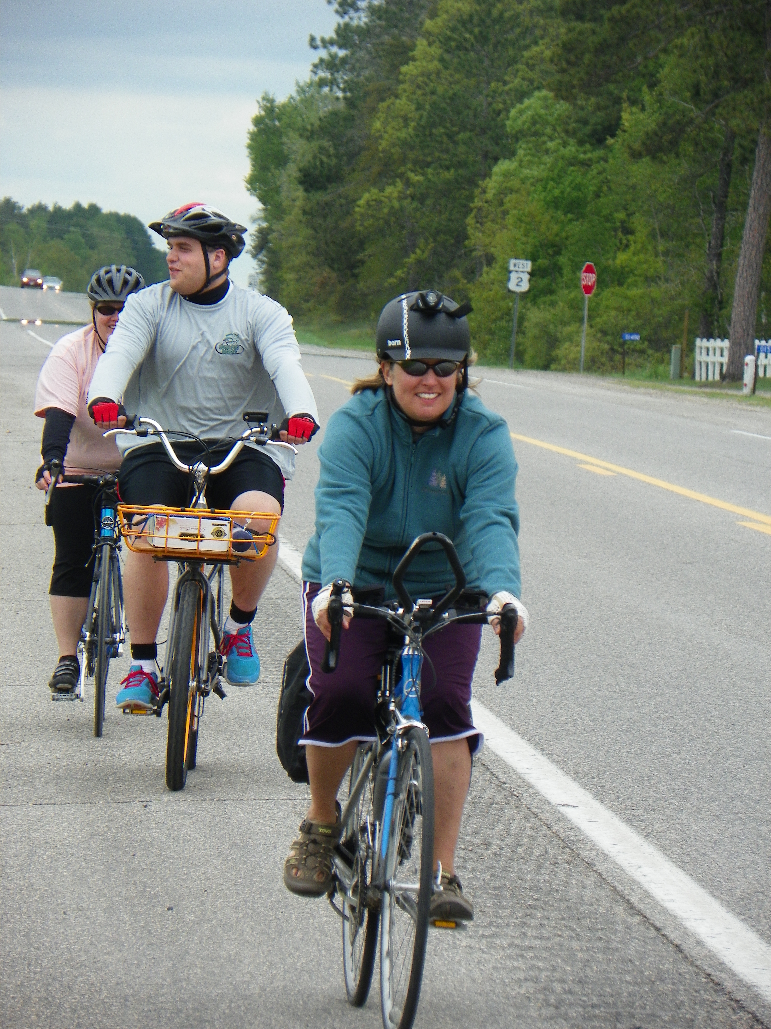
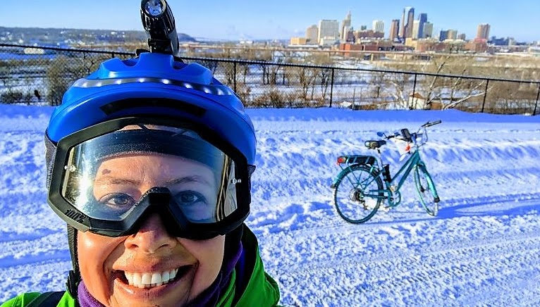
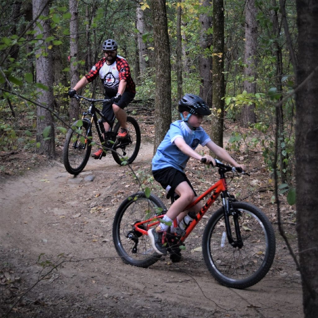
Welcome. We're your premier source for fun places to explore by bicycle or on foot. Offering guides, maps and articles on road and trail riding for the novice to seasoned cyclist - helping you find your #NextBikeAdventure
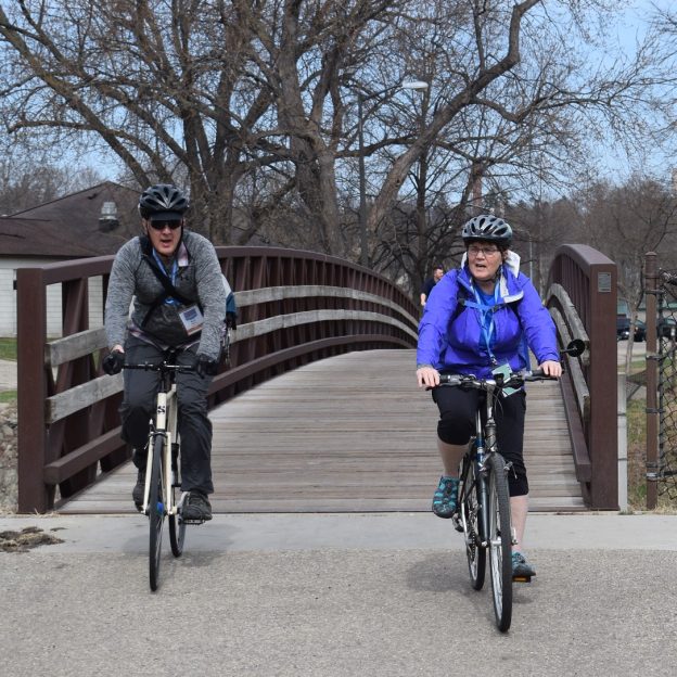
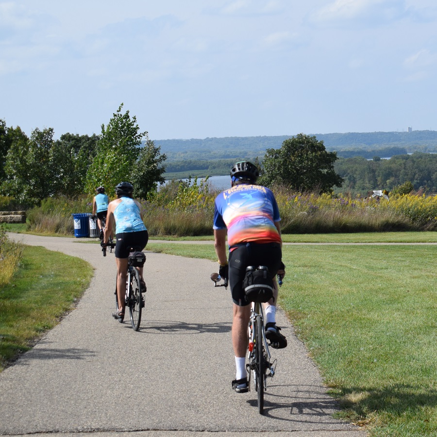
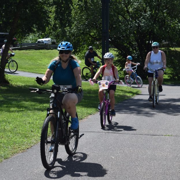
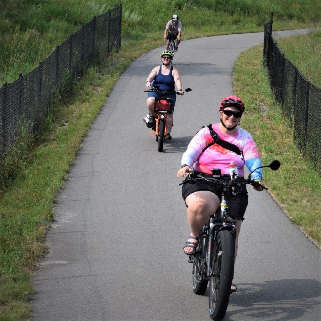
Join “We Bike Rochester” in southeast Minnesota as they celebrate the incredible trail network that meanders around the city with Med City Meander (MCM). For years, “We Bike Rochester” has been working to bring community engagement around biking and walking. MCM has partnered with the Bicycle Alliance of Minnesota (BikeMN) to create an event highlighting local businesses, beautiful natural areas, and outdoor fun in Rochester. Register today and save!
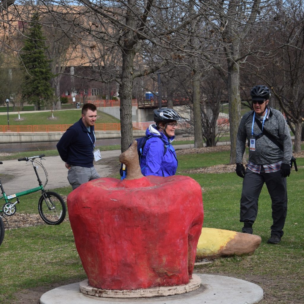
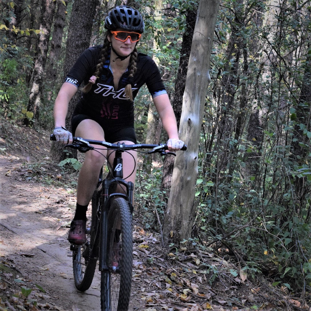
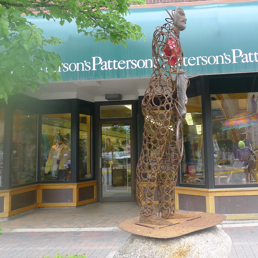
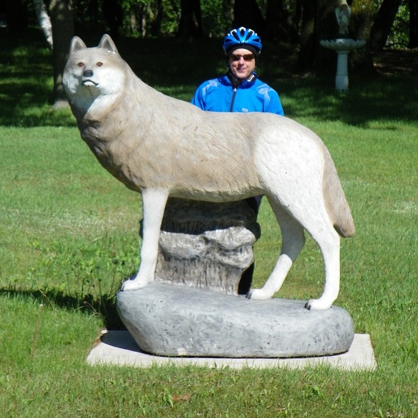
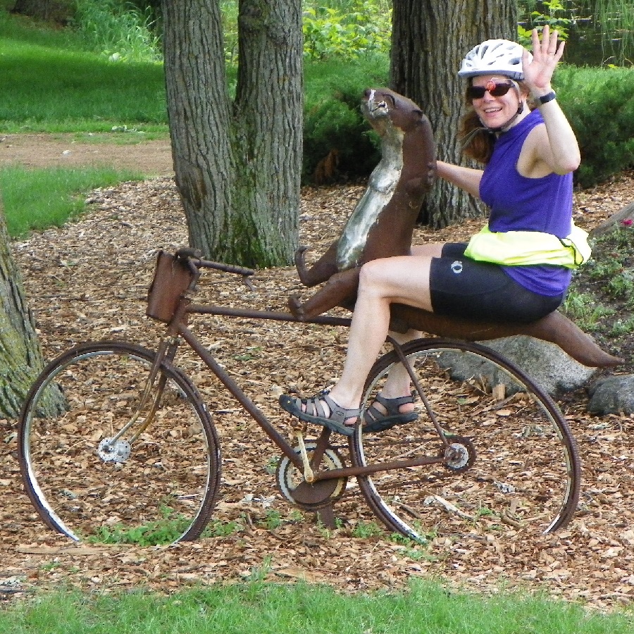
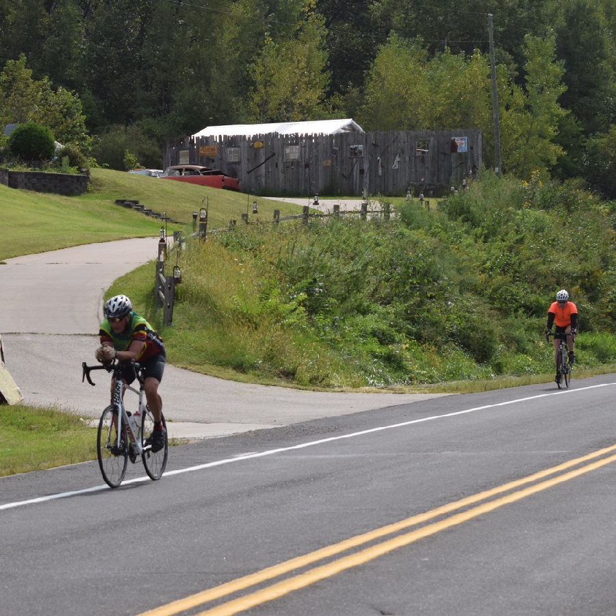
One of many art sculptures to enjoy when riding Rochester’s trails
A new annual tradition coming in May to southeast Minnesota
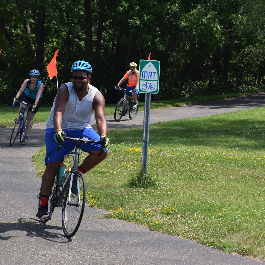
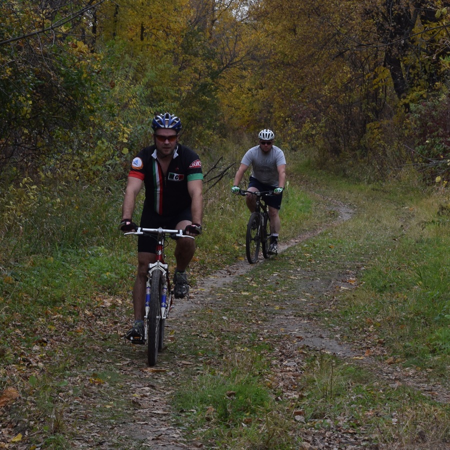
The Med City bicycle tour starts and ends at Cascade Lake Park on Saturday, May 25, in Rochester, MN. The MCM ride features a signature 32-mile relaxed tour of Rochester’s trail system, highlighting what makes the “Med City” a dynamic and vibrant community. From tree-canopied riverside paths to gentle driftless bluffs, this carefully curated route will feature convenient rest stops along the way! The city offers a vast network of trails and bike lanes. Ride the North and South Trails, along Cascade Creek, Bear Creek, and more! Check out some of the trails on the City of Rochester’s Parks and Recreation Map or the “We Bike Rochester” route library.
All MCM routes are on paved trails
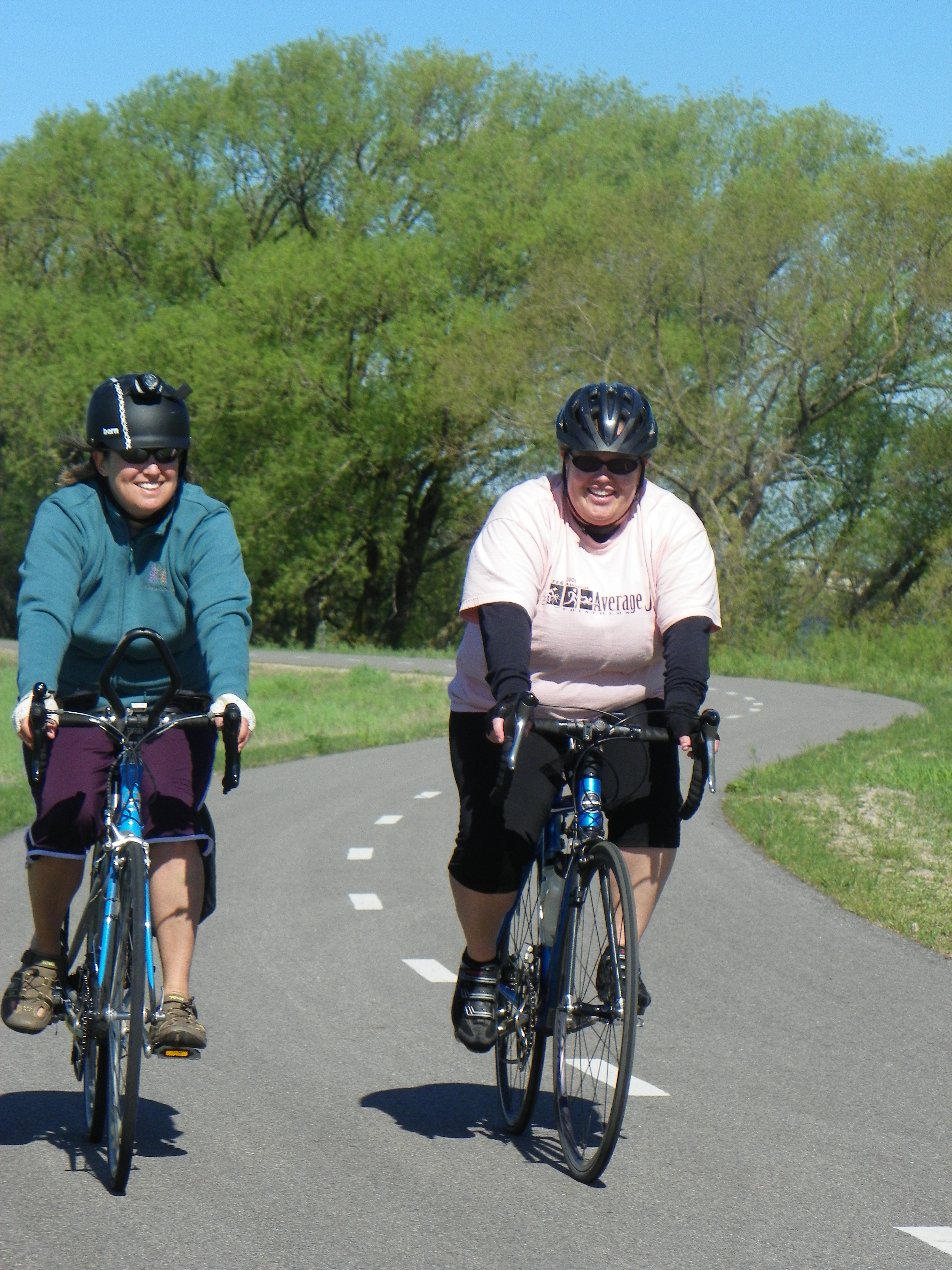
The MCM features a signature relaxed tour of Rochester’s trail system, highlighting what makes Med City a dynamic and vibrant community. You can also do as many laps (2.5 miles) around Cascade Lake as you’d like. Registering is unnecessary if you only want to ride this lake loop. Just show up and have fun.
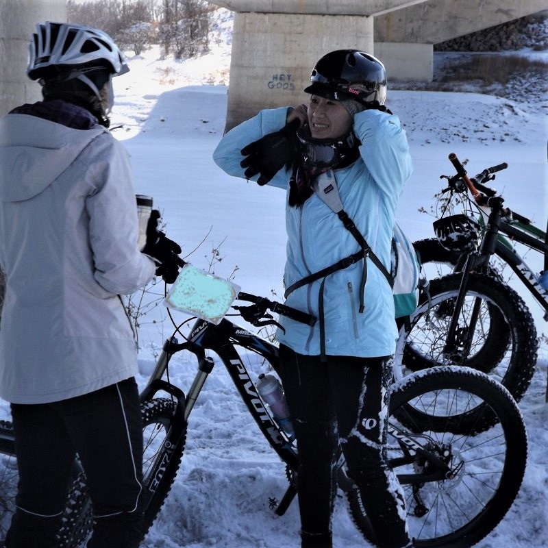
On the MCM 32-mile route, check-in is from 9 to 10 a.m. All riders should be underway by 10:15 a.m. Rest stops and SAG support services end at 2 p.m. Riders will enjoy food and drink at rest stops along the route. Helmets are required. Protect your melon! Safe cycling to all Meander riders!
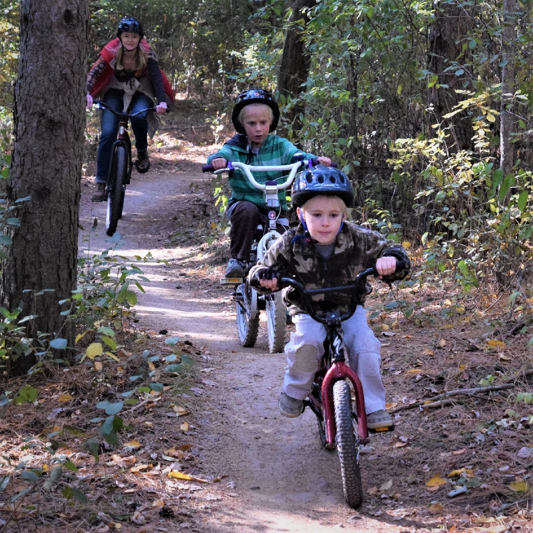
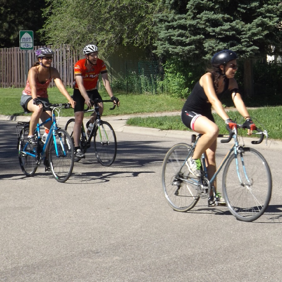
All bikes are welcome!
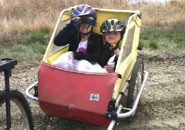
Electric assist bikes, as outlined in the Minnesota definition of e-bikes in Class I, II, or III. All bikes with pedals are welcome to join BikeMN rides. On the ride, no charging stations are provided, so make sure your battery is fully charged and the route you select suits your battery’s range. Analog bicycles, adaptive bikes, tandems, recumbents, tricycles, cargo bikes, burley-style kid trailers, and even well-behaved (and leashed) pets are welcome!
You are also encouraged to familiarize yourself with your bicycle before the ride and feel comfortable riding with larger groups.
Where to stay when visiting Rochester
Are you visiting Southeast Minnesota, and exploring more of the fun trail system here? Check out the lodging suggestions here at Experience Rochester.
About the Bicycle Alliance of Minnesota (BikeMN)
BikeMN is working to make Minnesota a state where bicycling is safe, easy, fun, and cool for everyone. The mission of BikeMN is to provide leadership and a unified voice for bicycle education, advocacy, and efforts to make Minnesota more bicycle-friendly so that more people will ride bicycles more often. See more at www.bikemn.org.
About “We Bike Rochester” Bike and Walk Advocates (WBR)
We Bike Rochester is a non-profit 501(c)3 and a chapter of the Bicycle Alliance of Minnesota. WBR encourages individuals and families to walk and bike as part of a healthy lifestyle. “We Bike Rochester” works with city, county, and state governments, businesses, and non-governmental organizations to improve the community’s infrastructure. To add new opportunities for walking and biking. This new ride is new, and profits from the Med City Meander will go to improve signage, outdoor kiosks, mountain bike trail construction, and other improvements in the Rochester area.
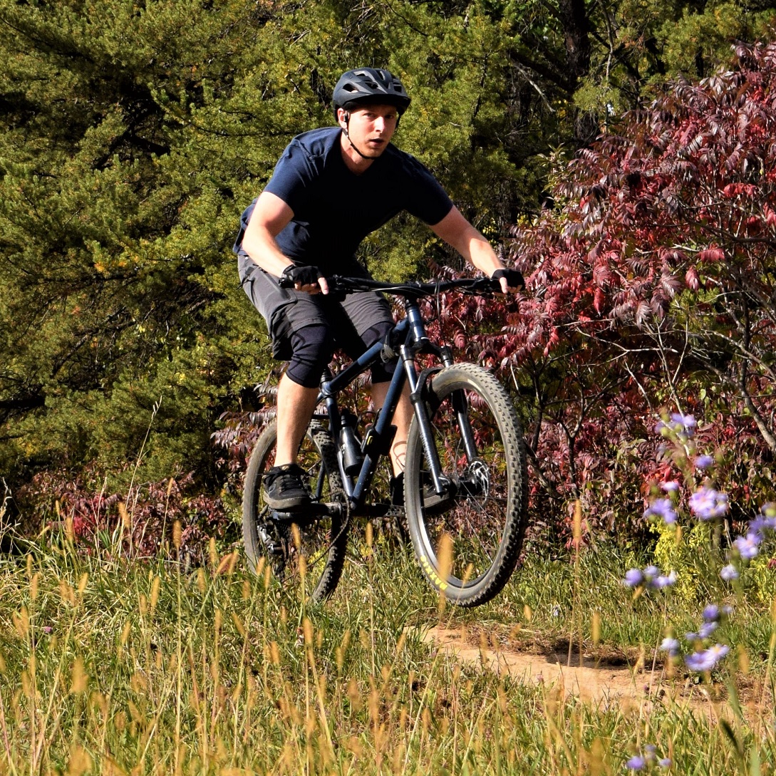
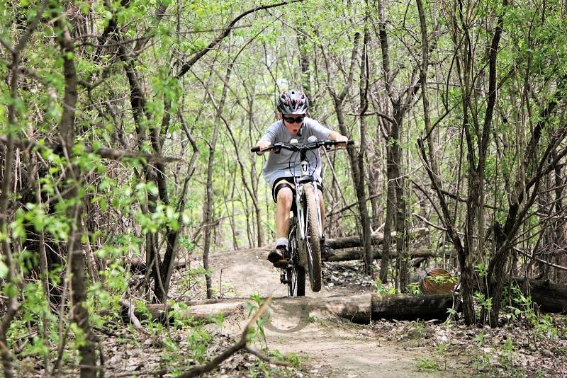
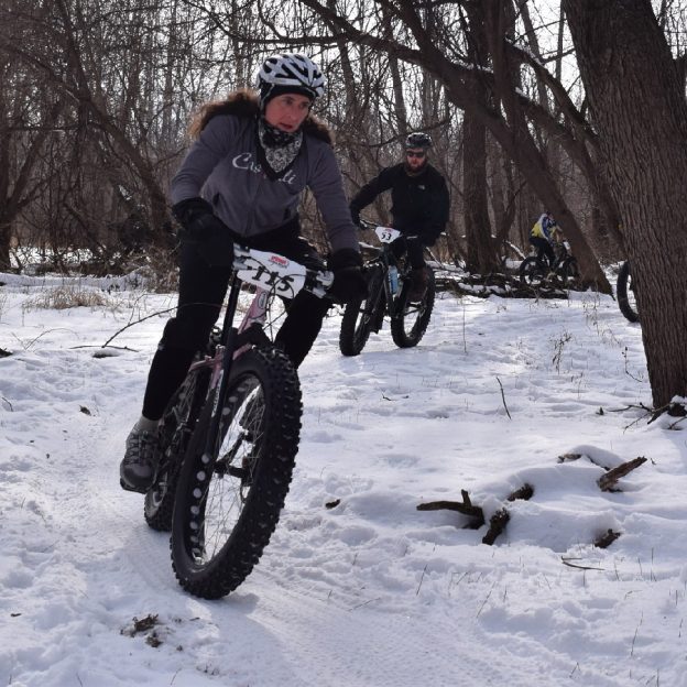
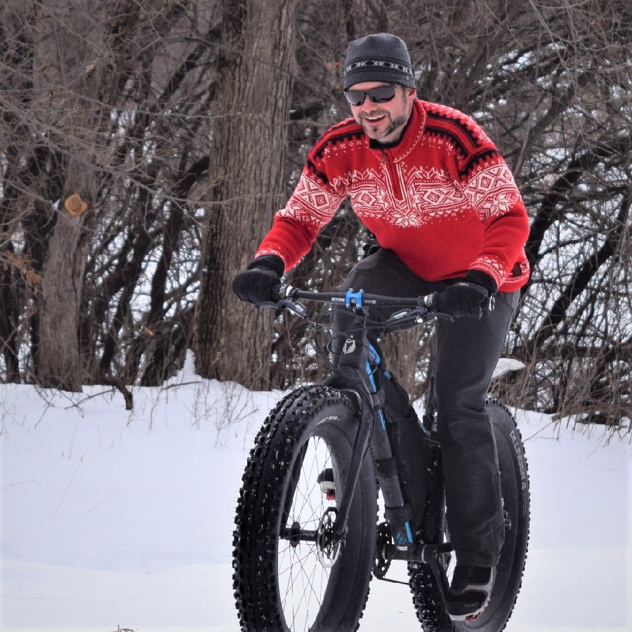
Whatever your riding style, downhill, cross-country, or a leisurely ride after work, you’ll find plenty of mountain biking trails to choose from. Minnesota offers many off-road trails to shred. No matter your skill level, you will find plenty of glaciated ridges: lush forests, and open prairies to explore. Plan your next outdoor adventures with our list of mountain bike trails in Minnesota. You will find many fun opportunities year-round, as many of these trails are open for fat biking throughout winter. Thanks to the Minnesota Off-Road Cyclist (MORC) and several other community organizations who maintain these trails.
Fat bike fun on Minnesota’s Mountain Bike Trails
From lift-served downhill and legendary red dirt trails of the North to the open-air feel of the prairies further south, you’ll find outstanding mountain bike trails across Minnesota.
Minnesota mountain bike trails in the North
You will find many trail options when visiting Northern Minnesota.
In Northern Minnesota’s vast forests, find an extensive network of rugged singletrack and easy-to-moderate mountain bike trails to enjoy. Explore the following list, with many state, regional, and city parks that maintain off-road trails to provide riders at every skill level with a fun experience. Whether seeking a serene roll or a challenging thrill, Minnesota has no shortage of mountain bike trails to explore. For that next Northern Minnesota adventure you want to plan, click here for over 25 trail systems to shred.
Minnesota’s Central Region
Enjoy the mix of prairie and forested trails regardless of your skill level.
In Minnesota’s heartland, find an extensive network of rugged singletrack and easy-to-moderate mountain bike trails to enjoy. Explore the following list, with many state, regional, and city parks that maintain off-road trails to provide riders at every skill level with a fun experience. Whether seeking a serene roll or a challenging thrill, Minnesota has no shortage of mountain bike trails to explore. For that next Central Minnesota adventure you want to plan, click here for over 15 trail systems to shred.
Minnesota’s Twin Cities Metro Area
The TC Trails here are perfect for the beginner and the serious rider.
In the Twin Cities, mountain bikers will find trails to enjoy year-round. No matter your skill level, you will find the singletracks trails flowing in the summer. Then in the winter months, they are groomed for fat biking. Explore the following list, with many regional and city parks that maintain off-road trails to provide riders at every skill level with a fun experience. Whether seeking a serene roll or a challenging thrill, Minneapolis-St has no shortage of mountain bike trails. Paul Area. For the next mountain bike adventure you want to plan in the Twin Cities Metro, click here for over 15 trail systems to shred.
Minnesota’s South
Southern Minnesota awaits your arrival from the driftless area to the open prairies.
In Southern Minnesota’s open prairies, meandering rivers, and stunning bluffs, find an extensive network of rugged singletrack and easy-to-moderate mountain bike trails to enjoy. Explore the following list, with many state, regional, and city parks that maintain off-road trails to provide riders at every skill level with a fun experience. Whether seeking a serene roll or a challenging thrill, Minnesota has no shortage of mountain bike trails to explore. For the next mountain bike adventure you want to plan in the Twin Cities Metro, click here for over 15 trail systems to shred.
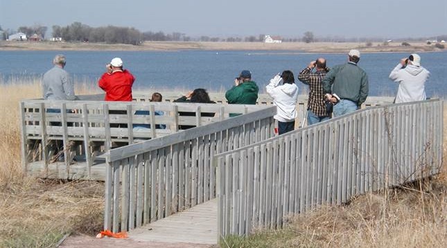
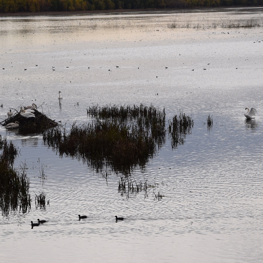
With temperature predicted to return into the 60’s, you will find the 46th Annual Salt Lake Birding Weekend on April 27th. Located in Western Minnesota, you will find this event is bike-friendly, and the perfect way to explore the bird haunts. Consider packing up the bikes and family for a spring birding weekend in the Prairie Waters Region area for fun activities. With many birding haunts on local gravel roads, both fat and gravel-tire bikes work well to quietly approach and view the many species of birds returning to the area.
Bird watchers, looking out at several species of waterfowl on Salt Lake.
More on the Salt Lake Birding weekend
Volunteers are available to guide birders around Lac qui Parle and southern Big Stone counties over the weekend. Perfect bird viewing spots are around Salt Lake, in Big Stone Refuge, and many other lakes, wetlands, and native prairie areas. The event is free and open to all interested people – plus, no pre-registration is needed.
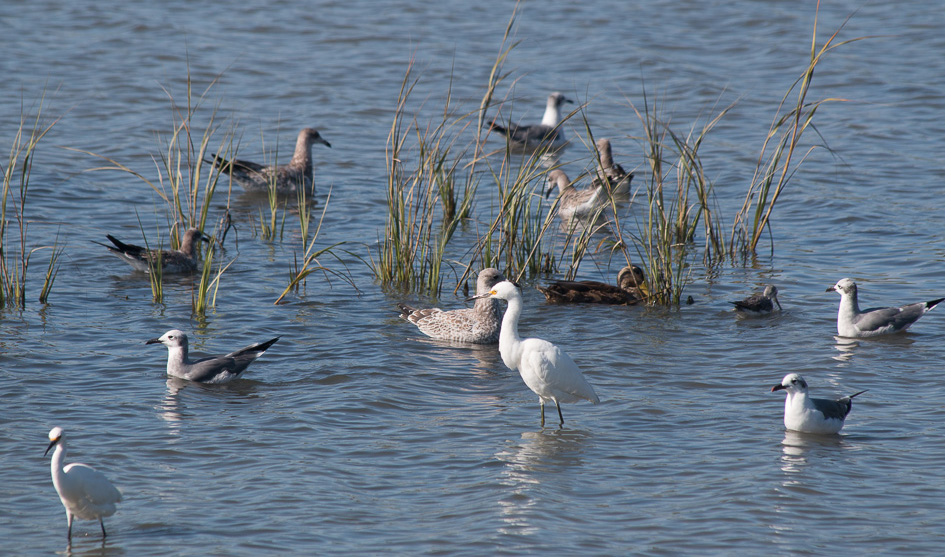
Each year birders will see many species of waterfowl, including Common Goldeneye and American Black Ducks. Also been spotted in past years. were Snowy and Cattle Egrets and White-faced Ibis. A number of birders located Bald Eagles and Great-horned Owls on nests in the area. Plus, birds usually found later in the year, including Black Tern, Least Flycatcher, and Black and White Warbler. The most unusual find was a Say’s Phoebe, the first time it’s been found by Salt Lake Birders here in Minnesota. Last year, over 90 birders found 143 different species of birds over the weekend. Check out this photo gallery of some of the birds you may see.
A number of species of waterfowl are out in front of the viewing platform, feeding.
It all happens on Saturday, April 29, with breakfast, at 7 a.m. at the Marietta American Legion. Located one block west of the intersection of County Road 7 and State Highway 40 (11 miles west of Madison).
In the Twin Cities, you will find an extensive network of mountain bike trails, offering rugged single-track and easy-to-moderate trails to enjoy. Explore the following list, with many regional and city parks that maintain off-road trails to provide riders at every skill level with a fun experience. Whether seeking a serene roll or a challenging thrill, there’s no shortage of mountain bike trails in the Minneapolis-St. Paul area. For that next Adventure you are planning, here are more than 25 trail systems to shred.
Plenty of trails to shred.
Fun riding Twin Cities Mountain Bike Trails
Bethel
Bethel Haunted Forest Trails: 6 miles
A series of interconnected loops in an 80-acre wooded area, one mile south of the town of Bethel. Rated easy to intermediate with advanced sections featuring hills, twists, and log crossings. Trails are shared with hikers and are open for fat biking and snowshoeing in the winter. Map
Spring, summer, fall, or winter, the River Bottoms is a fun place to ride.
Bloomington
Minnesota River Trail: 11 miles
Another Twin Cities mountain bike trail system is nicknamed Minnesota River Bottoms. You will find mostly singletrack winding through wooded areas along the river bank. The trails can be challenging and muddy after rain. Plenty of jumps (optional) and some obstacles. Trails are shared with hikers and are groomed for fat biking in the winter. Map
Burnsville
Buck Hill: 6 miles
This is a beginner to an intermediate system that includes two downhill flow trails. The skills park here features a bermed course with drops, a rock garden, skinnies, and a dragon tail. Map
Terrace Oaks: 2.3 miles
A fairly technical, intermediate singletrack trail system with many climbs and amazing descents. Map
Cottage Grove
Cottage Grove Bike Park
West Draw Park is a work in progress with the Cottage Grove Bike Park. Setting on 26 acres, this family-friendly park currently includes a 4x track, two pump tracks, and a complete dirt jump plaza. Info
Cambridge
Springvale County Park: 3 miles
A flowing singletrack trail system offers banked turns and a beautiful rolling jump while weaving up and around a lake, then traversing streams, swamps, forests, and a glacier moraine berm. Elevation gain is just under 160′ but these trails are fast and are great for beginner to intermediate riders. Constructed drops, teeter-totters, rolling jumps, boardwalk sections, and rock gardens keep the ride interesting. Trails can be accessed from both the North and South parking lots. There is a bike repair station along with a bathroom and drinking fountain in the South parking lot. Groomed for fat bikes in the winter. Map
Chaska
Hawk’s Ridge Mountain Bike Trail: 4 miles
Hawk’s Ridge occupies a narrow sliver of land just east of Pioneer Ridge Middle School. It’s primarily an open, hilly, multi-use trail hand-built by volunteers of the Carver Trails group. Trails are beginner and intermediate levels with great views, challenging corners, and verticals carved into the hillside. There is a green (easy) trail around the perimeter of the park and a short black (most difficult) trail also. Note: Parking is available across the street at Pioneer Ridge Middle School during off-school hours only. Since there’s no parking on any residential streets around Hawk’s Ridge, riders must park at nearby city parks and ride in during school hours. Map
Eagan
Lebanon Hills Regional Park: 11 miles
This course is a favorite for many in the region, with some beginner trails but mostly intermediate. With a good mixture of rolling hills and technical singletrack. Woods provide a secluded feel in the south suburban area. Groomed for fat bikes in the winter. Map
Great jumps along the switchbacks.
Elk River
Hillside Park: 6 miles
The park here is mostly posted with advanced to expert trails that are either climbing or descending for the entire course. A great park for skills practice. with quick/tight switchbacks, rock rolls, drops, berms, and good jumps. Groomed for fat bikes in the winter. Map
Inver Grove Heights
Salem Hills: 4.4 miles
Gently rolling hills through woods and reclaimed prairie consisting of three loops: Harmon Park, Sawmill, and Foul Pond Loop. Map
Lake Elmo
Lake Elmo Park Reserve: 8 miles
A beautiful park for beginners to intermediate with a pleasant view of Eagle Point Lake. This is a multi-use trail with many fun features with some hard-packed singletrack and grassy trail. Be prepared to share the park with horseback riders. Fat bikes are allowed on Big Bluestem Trail in the winter. Map
Reid Park Trails: 1 mile
On 30 acres, this beginner-friendly trail is a work in progress. Map
Sunfish Lake Park: 5 miles
This park offers three loops with distinct ratings of easy, intermediate, and advanced skill levels. Features include a bridge, logs, and switchbacks. Note that other trails exist in this park, and biking is only allowed on the singletrack trails. Groomed for fat bikes in the winter. Map
Find trails for beginners to advanced.
Lakeville
West Lake Marion Trail: 5 miles
On the west side of Lake Marion, near Casperson Park,
The hard-packed singletrack course flows through rolling wooded and open field terrain. Find a pump track at the trailhead. Groomed for fat bikes in the winter. Map
Lino Lakes
Rice Creek Chain of Lakes Regional Park: 3.2 miles
Here you will find two separate, one-way singletrack trail loops. One on the east side of the park (Sherman Lake Loop) and one on the west side (Rice Lake Trail), about two miles apart. Both are continuous loops with a single entry and exit point connected to existing paved trail riders will use to access the loops. The two trails ride similarly with a flowy design, but a slightly different feel. Both are entry-level trails suitable for most riders. The trail loop on the west side features a few challenging climbs combined with fun, flowy segments for a total length of approximately 1.4 miles. The 1.8-mile east side loop features a few jump opportunities with some downhill segments that should add a little thrill for gravity trail fans. The plan is to eventually have additional miles of trails in separate nodes across the park. Map
Maple Grove
Elm Creek Park Reserve: 12.7 miles
Built to accommodate all skill levels of riders with Interconnected singletrack loop trails. the system is mostly intermediate, with short sections of easy and advanced trails. Map
Minneapolis
Theodore Wirth Park: 12 miles
A great trail system consisting of several separate loops, just minutes from downtown. The singletrack trails are Intermediate to advanced, offering twists and turns with many technical features. Groomed for fat bikes in the winter. One more of the Twin Cities mountain bike trails to check out. Map
Minnetonka
Lone Lake Park: 5 miles
This trail system is designed to accommodate a variety of mountain biking skill levels. It offers ample challenges, from the steep topography to the fast, flowy single-track. The trail is also open to hiking and trail running in dry months, as well as snowshoeing and fat biking in the winter. Two trailheads provide users easy access from Rowland Road, in the park’s southwest section, or Shady Oak Road, in the east. Map/Info
Here you will find many features to keep the ride interesting.
Monticello
Bertram Chain of Lakes Regional Park: 14.25 miles
This system offers many options for all skill levels, including fast singletrack, switchbacks, and a meandering double track. Be ready to deal with logs, roots, and wooden bridges. Map
Montiview Challenge Course: 2.75 miles
As the name implies, this trail demands good bike-handling skills. A very tight and twisty singletrack route with many short, steep hills runs through the woods and some open spots with great views of the surrounding area. Jumps, bridges, teeters, rock gardens, boulder piles, and other features keep the ride interesting. The park also features a sculpture by a local artist and a bike repair station. A work in progress; look for more trails to be added in the future. Parking and a restroom are available near the trailhead at the top of Holy Spirit Trail, and the park can also be accessed from the off-road paved path off Jason Ave. Groomed for fat bikes in the winter. Info
Oak Park Heights/Stillwater
Valley View Trails: 3.2 miles
Intermediate singletrack with some beginner and advanced sections. Features include a bridge, boardwalk, rock garden, and switchbacks. Trails are one way with an estimated 400′ elevation change. Map
Rockford
Lake Rebecca Park Reserve: 13.25 miles
Easy to advanced singletrack loops through the wooded landscapes with wetlands. Start at the Hilltop picnic area. Map
Saint Paul
Battle Creek Regional Park-West: 8 miles
Battle Creek features a wide selection of trails within its boundaries for Intermediate to advanced riders. including both 3.3-mile multi-use trails and 4.5 miles of singletrack. Thickly wooded, with some limited visibility on turns. One more of Twin Cities mountain bike trails to check out. Map
Fort Snelling State Park: 10 miles
Enjoyable riding for beginners along the Dakota County side of the river. Generally flat trails but scenic. Starts as a wide double track then narrows to singletrack. Trails are multi-use and perfect for fat biking in the winter. Map
Savage
Murphy-Hanrehan Park Reserve: 10 miles
This trail system features glacial ridges, hilly terrain, and an extensive, lush forest. This is a challenging trail and a favorite for mountain bikers. Map
Shakopee
Excel Energy Mountian Bike Park: 4 miles
The loop trails circling Quarry Lake are rated beginner to intermediate. The singletrack course weaves between the tree cover and a larger prairie area, taking advantage of natural and constructed topography. This trail was designed and built to be ridden in any kind of weather, so it doesn’t close when it’s wet. One special feature is the so-called chicken foot, a fallen oak tree that’s been cut flat for riders to balance on as they ride across it. The park also has a pump track. Map
Waconia
Monarch Singletrack: 10 miles
This trail system at Carver Park Reserve comprises five connected loops that accommodate all experience levels. Easy Rider features wider tread and few sharp turns and climbs, making it ideal for hand cyclists and beginners. The Raptor Ridge loop has flowy trails and a highlight of the entire singletrack: A vista overlooking Parley Lake followed by berms and a roller descent. Paradise Trail has the longest climb of the system and an expert feature area with a concrete rollout, jumps, a slalom section, and a shorter, technical climb. It offers bypasses for the difficult features to accommodate intermediate-level riders. Groomed for fat bikes in the winter. Info/Map
Enjoy the twisty stacked loop of intermediate single-track trail here.
Woodbury
Carver Lake Park: 4 miles
Carver Lake Park is a nice twisty stacked loop of intermediate singletrack. It’s never too technical, but there are several places where a short advanced side trail leaves the main trail, then rejoins it again shortly.
One more of the Twin Cities mountain bike trails to check out. Offering great flow, it’s easy to get a couple of full laps in less than 1.5 hours with the three sections or loops. Or, add an extra lap on your favorite loop. The trail dries out faster than others in the Twin Cities as well, which makes for a shorter downtime after it rains. There is water (during the warm months) and an outhouse and repair station available at the trailhead. You will also find a well-developed skills park here. The trail is also groomed for fat bike riding in the winter. Map
by Russ Lowthian
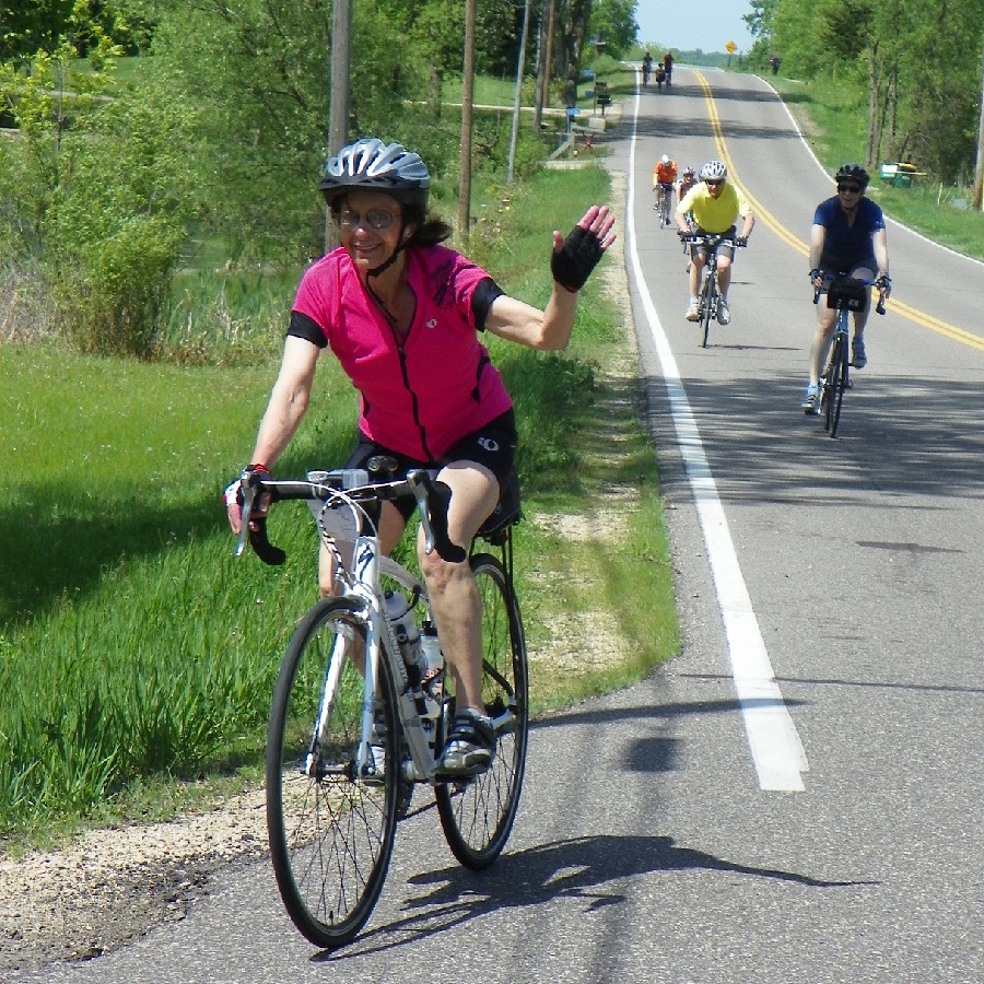
Picture yourself riding the Mississippi River Trail (MRT) through the wilds of Minnesota.
Pedal with family and friends at your own pace on this Bold North adventure.
The first leg of America’s famous 3,000-mile bicycle trail system uses bike-friendly roads and multi-use pathways. You may find some of my observations of interest. From several MRT bike tours I have led over the years and referencing my book Road Biking Minnesota.
From the Mississippi’s headwaters near Park Rapids to the Iowa border, the complete Minnesota section of the journey is roughly 620 miles. The following route descriptions are spread over nine days to keep the daily mileage comfortable for plenty of time visiting the river towns along the way. Depending on how much time you can spend on any bike vacation, this overview makes it easy to break it apart for multiple bike getaways.
Please visit the embedded links offering short video clips and maps of the Mississippi trail system as you read the following. See the first video clip to get a better feel for what you will see and experience leaving Itasca State Park on the MRT. The information in this video and subsequent videos are made possible by the MN DNR, the MN Historical Society, Explore Minnesota Tourism, and the National Park Service.
MRT – Day 1 from the Mississippi Headwaters to Bemidji
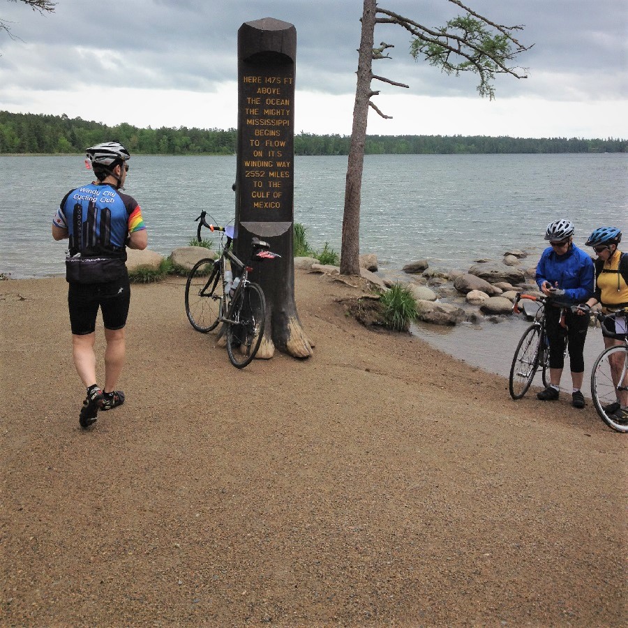
After enjoying a hearty breakfast at the historic Douglas Lodge, in Itasca State Park, it’s time to roll out. First, you will need to pedal a few miles through the towering pines to where the Mississippi River begins. At the Headwaters parking lot, walk your bike down the trail. There, dip your rear wheel in the stream to celebrate the beginning of your journey. You may hear one of Minnesota’s loons calling out. Following the internationally recognized Mississippi River Trail, depart from the park’s north entrance. Now pedaling a scenic county road in a northeasterly direction, this 30-plus mile stretch offers a beautiful rolling terrain. As you pass by patches of pine forests and an occasional old farm setting, smell the air. Soon you are pedaling into the first city on the Mississippi River.
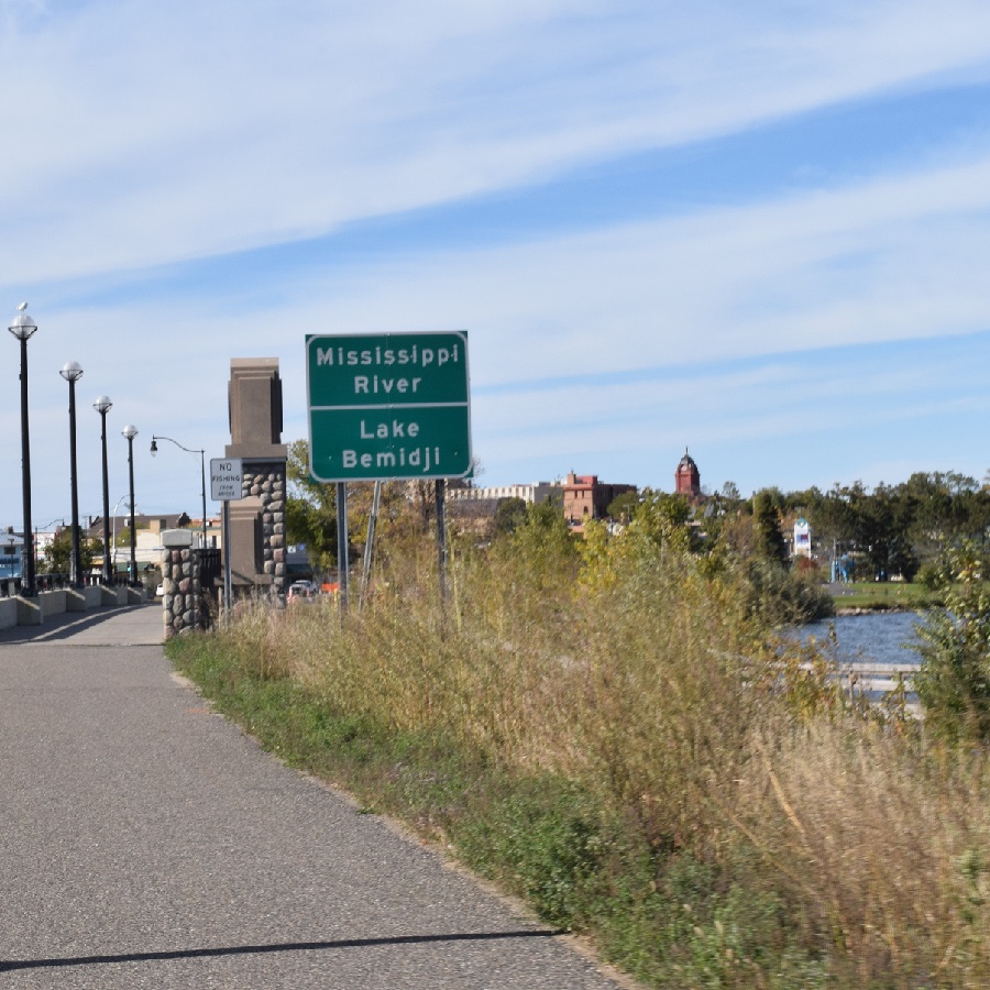
Rolling into Bemidji
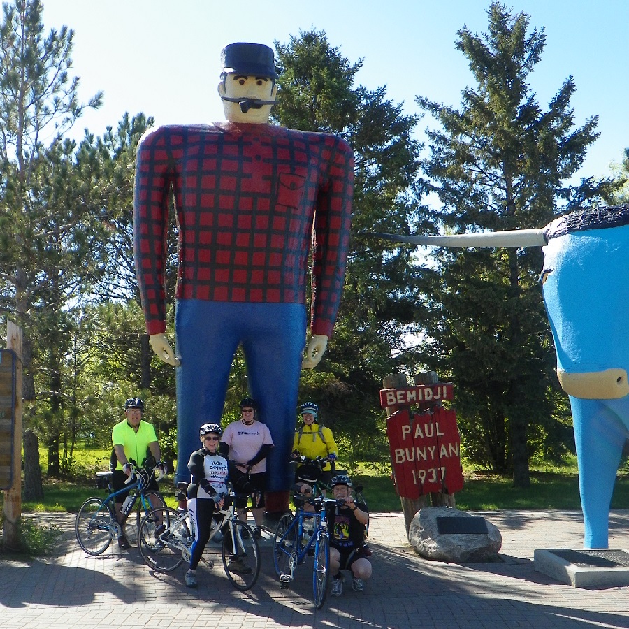
Arriving in Bemidji, the MRT enters on a city trail that connects to the Paul Bunyan Trail. As the river’s current flows into Lake Bemidji, consider spending your first evening here. While visiting, discover all this community has to offer.
A-League of American Bicyclists (LAB) Bike-Friendly Community. It’s easy to get around and explore the city by bike.
In the downtown area, metal sculptures, murals, and historic architecture are found on just about every corner. Don’t forget to stop by the visitor’s center to have your picture taken with
Paul Bunyan and Babe, his blue ox. See our Bike Bemidji article for lodging and more things to do when not riding. You will find camping options in Lake Bemidji State Park.
MRT – Day 2 from Bemidji to Grand Rapids
Back in the saddle, the MRT takes the Paul Bunyan Trail north to where the Mississippi River pours out of Lake Bemidji. As the current flows east, enjoy the sites along the Great River Road as it rolls into Chippewa National Forest. This next stretch of the MRT to Grand Rapids is roughly 80 miles. To get a better feel for what’s ahead after leaving Bemidji, watch the 2nd video clip here.
With an abundance of wildflowers along the road, pedal through the enchanted treasures this forested area offers. Along the way, notice a huge population of bald eagles and hawks as the
river meanders from one huge lake body to the next. Soon the river flows into Lake Winnibigoshish (Lake Winnie), and the MRT takes a course around the lake’s south shoreline.
The first Federal Dam on the Mississippi
P
Passing several resorts, you may want to stop for a selfie by the significant fish monument. Riding up the east shoreline through towering pines, the MRT is soon up to the Federal Dam, where Lake Winnie spills back into the Mighty Mississippi. This dam was created in the late 1800s, making it the most significant river reservoir. Approximately 45 miles from Bemidji,
there is a campground. You will find a restaurant and some lodging options a few miles further east.
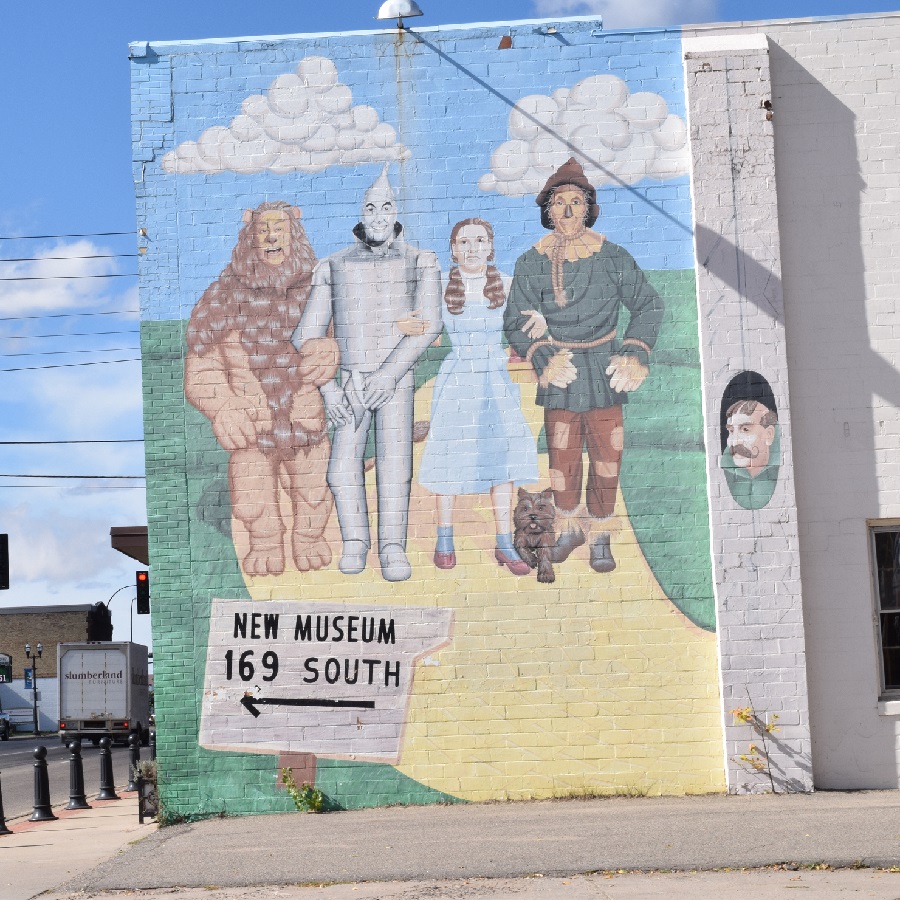
The MRT follows the river meanders, now in a southerly direction, passing through a Native American village called Ball Club. Here the river dips and then flows to the east again. Soon the MRT rolls into Schoolcraft State Park, where it meets back up with the Mississippi. This secluded park is the perfect place to take a break. Quiet and peaceful, the park offers a relaxing
environment with a virgin white pine forest over 300 years old. Take a panoramic virtual tour of the area here, and then it’s on to some Wizard of Oz trivia.
Rolling into Grand Rapids
Judy Garland, from The Wizard of Oz, spent time here as a child. Today the community offers visitors many fun options to explore, along with the Judy Garland Museum. Once settled in, visit the Forest History Center and the local art scene. This area is rich in forested beauty and offers many art forms, including many bronze sculptures and historic architectural sites. Grand Rapids is also the western gateway to the Mesabi Iron Trail and Range. Another LAB Bike Friendly Community, it’s easy to get around this river town and explore the city by bike. The mining communities along this Mesabi trail are worth checking out if you have a few extra days. See our Bike Grand Rapids article for lodging and more things to do when not riding.
MRT – Day 3 from Grand Rapids to Aitkin
As the Mississippi River pushes against the western slope of the St. Lawrence Divide, it
flows south, and the MRT hugs the west bank as it rolls out of Grand Rapids. This stretch of
the MRT is approximately a 70-miles ride to Aitkin.
Several yard art figures for a photograph.
Approximately 20 miles south, you will come to a crossroads. Here, by taking a left and crossing the river, you’re in the town of Jacobson. If you turn onto this half-mile side-trip adventure, you will discover many pieces of unusual lawn art and a rest-stop option.
Rolling into Palisade
Back on the route, continue south, and you will soon be in a town named for the high banks on each side of the river, another intriguing place to stop. The community has a restaurant
and a convenience store. Next to the river, the park here is an excellent place for a picnic or an overnight stay in the campground. Back in the saddle, riding out of Palisade, there are two options to reach Aitkin.
You can depart on the Great River Road, now a hard gravel surface, for the next 15 miles,
enjoying a peaceful ride along the river.
Rolling into Aitkin
Here, roll into a community with a riverboat full of history. Once a popular meeting point for Native American Indians and explorers, today, the town makes an excellent overnight choice that offers camping and lodging options. After you settle in, check out the museum converted from the Burlington Rail Depot. Here you can learn about the town’s steamboat history and other interesting facts. For more things to do and lodging options, click here.
MRT – Day 4 from Aitkin to Little Falls
As the Mississippi flows, now in a westerly direction, the MRT roll into Cuyuna Country. As the river passes on the north side of an iron range of the past, the MRT meanders around several abandoned open mine pits, now some of Minnesota’s newest lakes. The MRT rolls towards the Brainerd Lakes Area as the river bends southwest.
Rolling into Brainerd
Just imagine riding in an area called Paul Bunyan’s playground. Legend has it that Paul and his blue ox, Babe (remember that mythical figure you can take a selfie within Bemidji?) were having fun, wrestling around after a long rain spell. Stomping and tromping made many large depressions that eventually filled with water to create the 464 lakes in the area. With the MRT and Paul Bunyan Trail merging back together in Brainerd/Baxter, you will find many fun adventures and good things to eat here. For more, see our Brainerd/Baxter article.
Back in the saddle, the trail and river both head south again. As the Great River Road rolls
along the east bank, passing Crow Wing State Park, agriculture replaces the forested
landscape. Further down the MRT, cross to the west bank and visit Camp Ripley, which
offers a fascinating military museum. Here see hundreds of exhibits showcasing vehicles and field equipment of Minnesota’s military past. It’s still ten miles of pedaling to reach the next river town, “where the river pauses.”
Rolling into Little Falls
For centuries Little Falls has been where native inhabitants, early settlers, and recent visitors have used it as a ‘gathering place.’ Located where the Mississippi River pauses, this
river community is the town of Charles Lindbergh’s childhood. After settling in, check out the historic attractions and museums while experiencing the town’s original murals and frescoes. While here, if interested, you can discover who helped finance the production of the “Wizard of Oz.” See our Bike Little Falls article for lodging and more things to do when not riding.
MRT Day 5 from Little Falls to Monticello
Cyclists will pass by Charles Lindbergh State Park at the edge of town, where his childhood home still stands. Then the MRT passes by the Charles A. Weyerhaeuser Memorial Museum before the river valley floor opens up to more agriculture. To get a better feel for what’s ahead after leaving Little Falls, watch the 4th video clip here.
Rolling into St Cloud
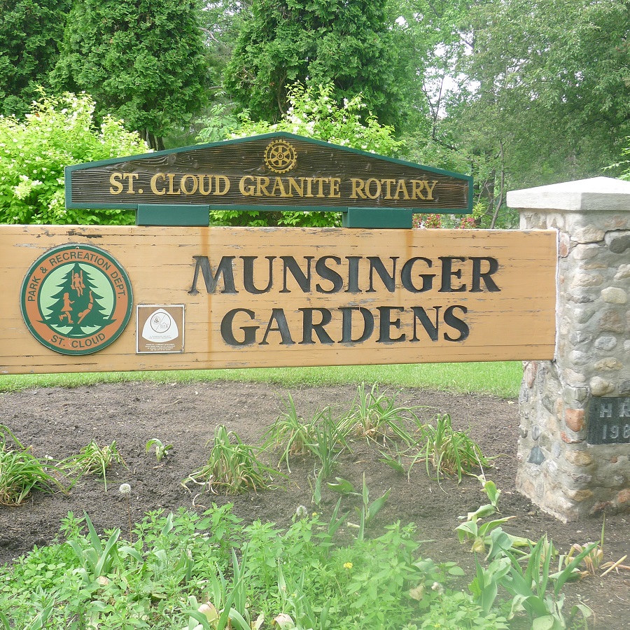
The river offers several rapids through this stretch as the MRT rolls into St. Cloud. Another LAB Bike Friendly Community, it’s easy to get around this river town and explore the city by bike. While in this river community, check out some attractions, including the Munsinger-Clemens Botanical Gardens. See our Bike St. Cloud article for lodging and more things to do when not riding.
The MRT and river swing back to the southeast on the east side of the river. The route takes you to Clearwater through county roads that parallel several irrigated potato fields. Then, crossing the Mississippi again, cyclists will notice the river is a bit wider here as they pedal to Monticello.
Rolling into Monticello
Here you will find a river town, full of charm, tucked up against the Mississippi River and conveniently located between St. Cloud and the Twin Cities. This vibrant community with many scenic parks is also home to thousands of geese and swans each winter. After settling in, check out the attractions in Monticello. For the lodging option in the area, visit the local chamber here.
MRT – Day 6 from Monticello to St Paul
Leaving Monticello, the MRT crosses the river and meanders through the farm fields of specialty crops to Elk River. To get a better feel for what you will see as you ride into the Twin Cities, watch the 5th video clip here. Stopping in Elk River, cyclists passing through the downtown area will notice the fresco mural on Main Street. You will also find plenty of options for a rest stop here.
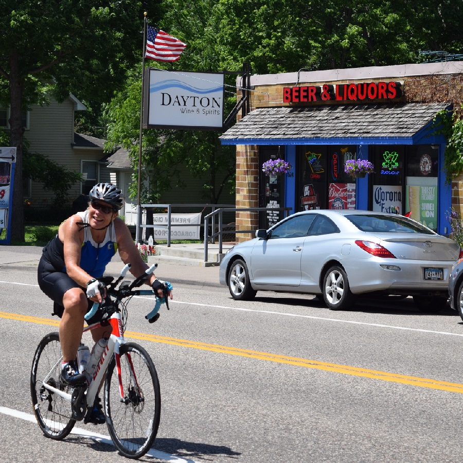
You will cross over the Mississippi River again on the Great River Road as you head out of Elk River. Soon you are passing through Dayton and entering the northern edge of the Mississippi National River and Recreational Area.
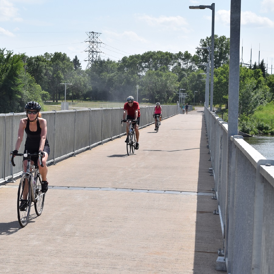
In the next twenty-five miles, MRT enthusiasts will enjoy stopping at several Twin Cities Gateway community attractions.
From here, enjoy paved bicycle paths through Minneapolis before reaching the St. Paul suburb of Inver Grove Heights.
MRT Day-7 from St Paul to Frontenac
As the Mississippi River Trail leaves the St Paul area, the route tentatively detours to the south to Hastings. To get a better feel for what’s ahead after leaving St. Paul, watch the 6th video clip here. The paved trail out of South St. Paul will connect to the Mississippi River Regional Trail, allowing cyclists a direct route to our next river town.
This new trail near Schaar’s Bluff is completed on the far end and will take cyclists into downtown Hastings’s historic district. You can find more about Hastings in our At-A-Glance article and a place to stop for cool refreshments or a meal.
Rolling into Hastings
Leaving Hastings, the MRT follows the Mississippi, winding along the backwaters of the river and past the Prairie Island Indian Community. About ten miles further, the route enters Red Wing, the next river community on the Minnesota section of the Mississippi River Trail.
Rolling into Red Wing
As the MRT runs alongside the river bank on the Great River Road, you will find the atmosphere in Red Wing both unique and charming. From the beautiful bluffs, historic sites, and world-famous boots and pottery, this river town also offers several dining opportunities for a stop here. If you decide to spend the night, see Visit Red Wing for more options.
Back on the Mississippi River Trail, it’s approximately another 10 miles to Frontenac State Park for the night. The city is on the National Register of Historic Places and contains many homes dating back to the Civil War era. Here you will find the Whistle Stop Café and a convenience store if you choose to camp in the state park for the evening.
MRT Day-8 from Frontenac to Winona
Back on the MRT, the route uses the wide paved shoulder of the Great River Road to Minnesota City. With a wide shoulder and rumble strip dividing you from the traffic, the Mississippi River is in sight, to your left most of the time. When you notice the river widening, the Mississippi flows into Lake Pepin, and you are close to the ‘Birthplace of Water Skiing.’
Rolling into the Lake City
Here discover the quaint shops and restaurants next to the harbor in the downtown area of Lake City. This river town is also a popular place for touring cyclists. In addition to the Annual Tour de Pepin bike tour, the site offers several other mapped rides. See the Lake Pepin Area Bike Map and checkout. Visit Lake City for more options.
As the river flows out of Lake Pepin, the next river community on the MRT is a town known for the eagles that populate the area and ‘Gumpy Old Men.’
Rolling into Wabasha
The oldest city on the entire upper Mississippi River, this community has been thriving since 1826. As touring cyclists roll into town, they will find 50 buildings listed on the National Register of Historic Places if time permits, enjoy their historic walking tour, and discover the stories that have made this town so unique. With Bald Eagles in abundance along the river, this is also home to the National Eagle Center, located downtown. Also, with the famous movie “Grumpy Old Men” its sequel shot here, dine at Slippery’s Bar & Grill for a nostalgic look at this river town. You can find more options at Visit Wabasha.
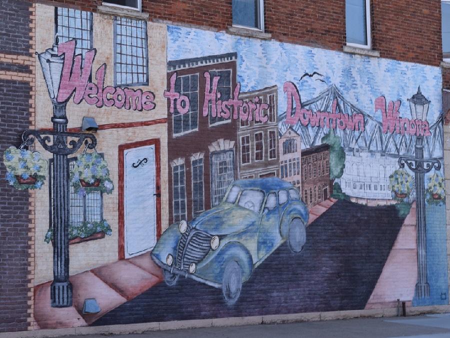
Rolling into Winona
Taking the MRT out on the back road through the village of Kellogg, it’s about 30 miles of pedaling to Winona along the bluffs. Arriving in this pristine river town, enjoy several views of the city nestled into a valley bordered by bluffs along the Mighty Mississippi. Here in Winona, there is plenty to discover, with so many attractions and museums. Be sure to visit the Minnesota Marine Art Museum. You will also notice many of the downtown buildings are on the National Register of Historical Places and self-guided history tours are an option. Being a LAB Bike Friendly Community, it’s easy to get around this river town and explore the city by bike. See our At-A-Glance Winona article for more tour, dinner, and overnight options.
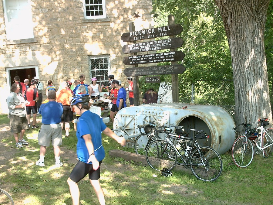
A stop a the Pickwick Mill, 2-miles off the MRT
MRT Day-9 from Winona to the Iowa Boarder
Leaving Winona, the Mississippi River Trail creatively takes you up into the bluffs, past the historic Pickwick Mill, and then onto the Apple Blossom Drive Scenic Byway. A cyclist in the area enjoys a remarkable view of the Mississippi River Valley at the top of the byway. Then it’s a cruise down the Byway into La Crescent.
From La Crescent, the last leg of Minnesota’s section of the Mississippi River Trail is approximately 24 miles to Albin, IA.
Enjoy the fun of riding all or parts of the MRT for that unforgettable adventure.
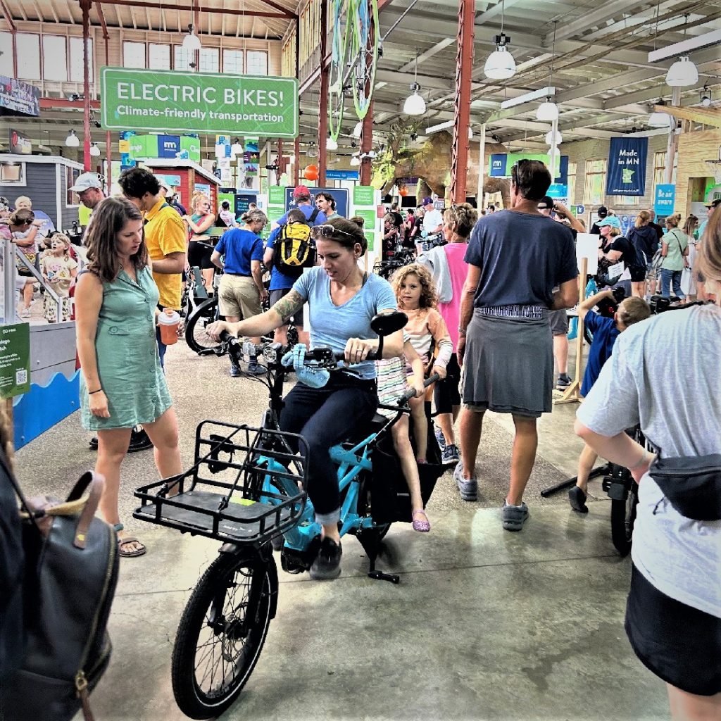
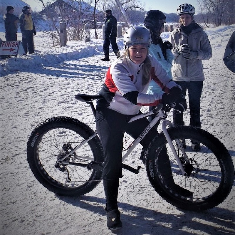
With the popularity of e-bikes (electric-assist bicycles) and the many options available, here are some of the many questions we answered at HaveFunBiking.com. The top question, along with the price of an e-bike, was how the new government rebate programs worked. What are the e-bike types and styles along with battery/motor options available? Followed by the range or distance you can expect to travel on a charge. Riding in rain and snow, and the maintenance tips. In conclusion, after reviewing the following tips, to narrow down the right bike for you, visit several bicycle shops that carry electric-assist bicycles. Ask them specific questions to we have touched on here. And like buying a car, test-ride the e-bike you are interested in.
Different types of e-bike displays in the Eco-Building at the MN State Fair
Top 10 questions asked when selecting an e-bike.
1. An e-bikes cost, and what about the Minnesota Tax Credit
Has the idea of touring by e-bike piqued your interest?
There are many variables when buying an electric assist bike, including the distance you can ride and how you will use it; the number of times you can charge the battery; its weight (bike and battery); the warranty; and whether you will need to take out a loan to finance the bike? Along with a good warranty, the quality of standard parts or upgraded parts on the electric bike can increase the price from $2,000 to $6,000 or more. Plus, having adequate insurance coverage for possible damage, theft, and liability can increase the price.
See more information on the cost of buying an e-bike here.
What’s the skinny on the MN Electric-Assisted Bicycle Rebate
The Minnesota Transportation Finance and Policy bill included a new electric bike rebate program that takes effect July 1, 2024. In the 2023 session, four million dollars was appropriated for the 2024 and 2025 calendar years. This will allow the Rebate Program $2 million to be used starting July 1, 2024. Then again, consecutively, 2 million dollars for 2025, that will be available until June 30, 2026.
Depending on your income, the credit maximum is $1,500. To qualify, an Individual must assign the credit at the time of purchase after July 1st to an eligible retailer that they have selected. This will reduce the cost of the e-bike purchased. For more information on the rebate, contact your local bike shop or see Minnesota Tax Changes.
2. Consider payment options to get the right e-bike
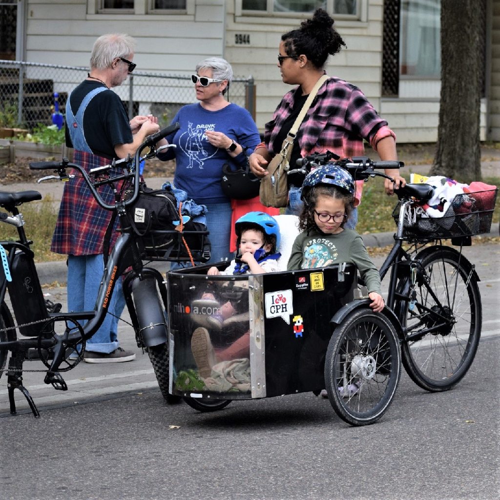
Enjoy the Micro-Mobility experience for hauling cargo or kids.
To get an electric bike that will fit your needs over the next two to five years, find out if the bike shop or bike manufacturer (if buying online) offers a no- or low-interest loan, often for six to 36 months. Some lending institutions, like Affinity Plus, offer low-interest bicycle-specific loans and let you borrow 120% of the cost of the bike to allow you to buy accessories like helmets, locks, baskets/panniers, lights, etc.
Many bikes come with limited or full warranties. Typically, e-bikes may come with a 2-year warranty on parts, motors, and batteries. Some e-bike brands have a 5-year, “no questions asked” comprehensive warranty. So, learn what sort of warranty is being offered before you buy. A reputable e-bike company will have its warranty information on its website.
A warranty should be a part of the purchase price.
It is recommended that you Insure your new bike. Check if your car, renter’s, or homeowners insurance can bundle an e-bike into your policy. If not, look at an insurance company that often covers theft and collision protection for your e-bike, similar to automobile insurance. Many companies, like AAA and Velosurance, even offer roadside assistance for bicycles and e-bikes.
See more information on warranties and insuring an e-bike Here.
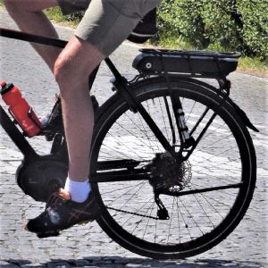
4. E-bike types and gear options
There are two types of motors: the wheel hub type and a center crank model pictured here.
There are so many types of e-bikes available! First, what is your primary use for buying an e-bike? Is it for commuting, hauling cargo, off-road riding, touring, or riding in winter conditions? Once you know how you will use the bike, check out the nationally defined classifications below and your state DOT statutes for e-bikes:
Class 1: e-bikes are pedal-assist only, no throttle, with a maximum speed of 20 mph
Class 2: e-bikes with pedal assist and throttle, with a maximum speed of 20 mph
Class 3: e-bikes are pedal-assist, with or without a throttle, with a maximum speed of 28 mph. Most states consider e-bikes with a maximum speed of 20 mph “OK to use all non-motorized bike routes.”
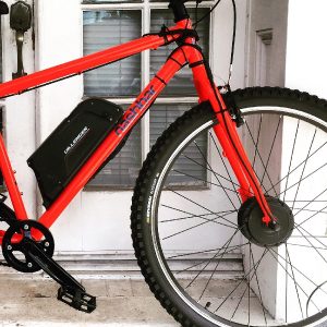
5. What’s the battery’s range and life before recycling?
A center post battery mount is standard for many electric bike models.
The general rule is that a 36-volt, 10.5Ah (ampere-hours) battery should get 20 to 40 miles per charge, with the average weight of rider + gear & cargo being less than 200 pounds in ideal weather conditions. You’ll get fewer miles the higher the assist level you use. You may enjoy 50 miles or more on a single charge on low assist. To maximize the life of your e-bike battery, try to charge it before it is close to empty.
Recycling your battery: Call2Recycle is helping e-bike owners recycle their batteries. On the right side of their website, please type in your zip code to get a list of places that will recycle your e-bike battery when it’s time to replace it.
For a more in-depth look at how volts x amps = watts can give you an approximate range, click here.
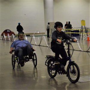
6. Weight limits, and a size that fits you
There are many sizes and types of e-bikes and trikes to test ride.
Most manufacturers recommend a maximum combined weight of around 275 pounds for a rider and gear & cargo on an e-bike. Cargo bikes are meant to carry small people or big loads and can accommodate riders + gear up to 400 pounds or more. Typically, e-bikes can handle total weights more than described by manufacturers’ specs. However, it may reduce the range or increase maintenance, including wheel spokes repairs.
Most e-bikes weigh between 30-65 pounds, with the battery weighing anywhere from five to 15 pounds. The weight of the battery goes up as the voltage goes up, but the capacity (range of the battery) will go up, too.
For more on weight limits and restrictions, click here.
7. Maintainance and your options to have your bike repaired
Like a regular bicycle, always start with an ABC’s (Air, Brake & Chain) check before you ride to maximize your e-bike investment. You should schedule a tune-up every six months or every 1,000 miles you have ridden. This will protect your warranty. Check the manufacturer’s service recommendations to what they specify.
If you’re buying an e-bike online, see what sort of repair service or online support the company provides, or make sure your local or favorite bike shop can fix the electrical components of the e-bike you select. Bikes with Bosch drivetrain systems are well respected and offer the following information for care and longevity.
For more information on maintaining our preparing an e-bike, click here.
8. Riding an e-bike in the rain or snow
E-bikes work well year-round.
Like most standard bicycles, E-bikes are water-resistant and can be used in most weather conditions. You may need accessories (like rain gear or studded tires) to ride safely. Most e-bike models also provide a high-quality, water-resistant casing to protect your battery when wet and cold. You can ride an e-bike at any temperature, but the colder it is, the more it may impact the battery’s range. Bring your battery (or the entire bike + battery) inside if you’re not riding it. Do not leave the battery on the bike if parking the e-bike outside at any time in the winter.
Click here for more information on riding an e-bike in rain or snow.
9. Keeping your new e-bike safe and secure
To protect your e-bike investment, consider using a U-lock with a cable lock when locking your bike outside (also recommended for indoor public storage areas). Another anti-theft device to consider is a GPS track tag. Ask your local bike shop for their recommendations. Again, having adequate insurance coverage for possible damage, theft, and liability is wise.
For more information on securing your e-bike, click here.
10. What else should I do before purchasing?
A test ride should be part of the plan indoors or out before purchasing.
Have fun and test-ride the e-bike(s) you want to focus on. One of the essential parts of buying an e-bike is taking the model(s) you are most interested in for a test ride. Like buying a car, test-ride the e-bike will help you finalize your decision once you have narrowed the selection down. Visit several bicycle shops that carry the e-bike brands you are most interested in. So grab your helmet and go for a test ride. Consider these questions while test-riding that new e-bike:
Does the e-bike fit the way I like it to
Do I feel comfortable on the e-bike climbing hills
And finally, is the quality and functionality over everything I expected while riding?
Now that you are back from your test ride, does the e-bike you like fit into your budget, and does it have a warranty? An e-bike is a significant investment, whether $1,500 or $10,000. So, with a warranty, you can rest assured that your investment is well covered. For more information on scheduling a test ride, click here.
Have fun on your new e-bike. We would enjoy hearing about your experiences here at HaveFunBiking!
With an e-bike, it’s easy to bring along your faithful friend or haul cargo.
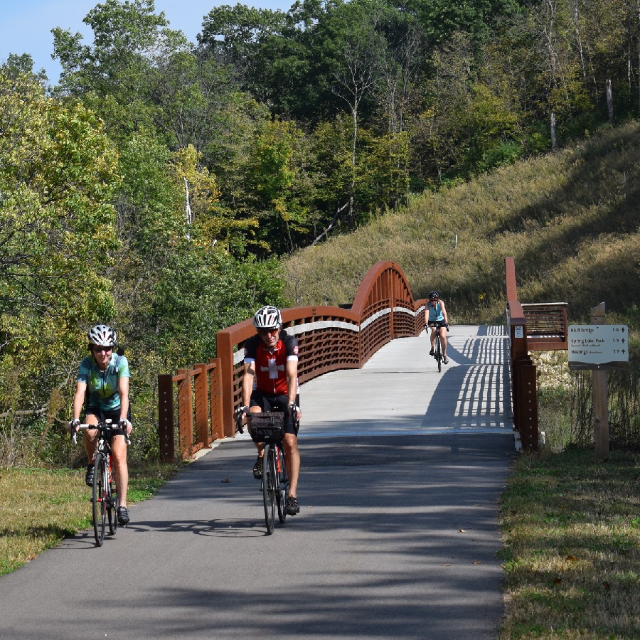
With more than 4,000 miles of paved Minnesota bike trails, the state has become a world-renowned bicycle touring destination for all to enjoy. Making considerable strides in connectivity, so in some areas, you can pedal distances of up to one hundred and fifty miles without leaving the trail. For example, in southeastern Minnesota, the Root River Trail connects to the Harmony-Preston trail for 60 miles of scenic enjoyment. In central Minnesota, the Central Lakes Trail connects to the Lake Wobegon Trails for over 120 miles of Rail-to-Trail touring pleasure.
As you plan your next adventure, look through the following list of Minnesota bike trails for miles of fun memories. Many of the trails listed are available in the Minnesota Bike/Hike Guide maps for your riding pleasure.
It’s fun riding with friends on all the Minnesota Bike Trails
With Minnesota’s bike trails listed here, find your next adventure
The Blazing Star State Trail is paved and runs from Albert Lea Lake in Albert Lea to Myre-Big Island State Park, approximately six miles. The trail currently connects to Albert Lea’s city trail system.
The Cannon Valley Trail follows the Cannon River in southeast Minnesota to the Mississippi River, using the abandoned Chicago Great Western Railway corridor from Cannon Falls to Red Wing.
The Casey Jones State Trail consists of three segments, with the most extended section of former railroad grade between the city of Pipestone and the Pipestone/Murray county line. The segment from Pipestone to County Road 67 is paved, and the third portion of the trail offers a paved loop between Lake Shetek State Park and the city of Currie.
This trail begins in the city of Fergus Falls. It ends in the city of Osakis, where users will enjoy the many different landscape views, ranging from open grassland/prairie, lakes, wetlands, farmland, and forested rolling hills. Towns to visit along the trail include Evansville, Brandon, Garfield, and Alexandria. The Central Lakes Trail at Osakis connects to the Lake Wobegon Trail for another 65-mile stretch to St. Cloud.
This trail, abandoned by mining companies over 35 years ago, runs from Crosby to Riverton, inside the Cuyuna Country State Recreation Area. Many of the lakes along this trail system were former mine pits and now offer a world-class single-track mountain bike trail system around them.
This trail stretches 165 miles from Grand Rapids to Ely and intersects with the David Dill/Arrowhead State Trail just west of Lake Vermillion. The first six miles from Grand Rapids are paved for biking and in-line skating and connect to the Mesabi trail.
The popular east metro trail begins in St. Paul, travels northeast through Maplewood, North St. Paul, and Oakdale, through Washington County, and ends at Pine Point Regional Park. Here, the Browns Valley Trail connects and runs to the city of Stillwater. Located on a former Soo Line Railroad bed, the trail is generally level and wheelchair accessible.
This trail is considered a moderately challenging route and features one scenic view of Lake Superior after another. The trail parallels Highway 61, using the road’s wide 10-foot shoulder along undeveloped segments. The opportunity to spot wildlife is also a common occurrence here.
This trail is popular with hikers, bikers, horseback riders, and snowmobilers. Currently, there are two sections of the trail. The northern portion is a paved trail between Red Wing and the Hay Creek Unit of the Richard J. Dorer State Forest and connects with Red Wing city trails and the Cannon Valley Trai. The southern segment of the trail features 4.5 miles of paved trail and is used by hikers and bikers. This segment starts in the city of Zumbrota and connects to the city’s trail system.
Located in the beautiful southeastern Minnesota river valley, this trail system follows a former railroad grade with picturesque views of river bluffs. The trail is generally level and accessible and is famous for bicycling, hiking, and in-line skating. Currently, the trail begins in Plainview, traveling south through the town of Elgin, and ends at County Road 9.
This was one of the first rail-to-trail projects in the country. The trail is located entirely on a level abandoned railroad grade, with the 27-mile segment connecting Park Rapids and Walker and the 22-mile segment connecting Walker and Cass Lake. The Park Rapids to Walker segment also has a parallel natural surface trail for horseback riding, hiking, and mountain biking. The Heartland State Trail also connects with the Paul Bunyan State Trail and other regional trail systems.
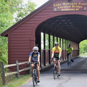
The trail runs west from St. Cloud, through Waite Park, Avon, Albany, Freeport, Melrose, Sauk Centre, and up to Osakis, where it joins the Central Lakes Trail and continues to Fergus Falls. At Albany, a paved spur heads north to Holdingford, then to the Mississippi River Trail below Little Falls.
This former railroad-grade trail stretches across the varied landscapes of metropolitan and rural Minnesota. Primarily crushed limestone surface with a parallel Treadway.
The gravel-surfaced trail passes through forests linking St. Croix State Park with Chengwatana, St. Croix, and Nemadji state forests. The entire trail is open to hiking in the summer. Mountain biking is allowed in some sections of St. Croix State Park.
You will find many trail towns along the Mesabi Trail
Mesabi Trail– 150 paved miles (Rail Pass Required)
Stretching from the Mississippi River in Grand Rapids to the Boundary Waters near Ely, the Mesabi Trail is like no other in the country. Cutting through the forests of northeast Minnesota, your adventure will take you past lakes, creeks, and ponds, by vast red pits of old iron ore mines now filled with emerald green water.
This trail currently connects with the city of Northfield trails system near Babcock and Riverside Park on the north end and follows the Cannon River to the city of Dundas, where the trailhead connects to other local trails.
Not far from the Twin Cities. Watch for wildlife as you travel the multi-use trail, which is paved for six miles from Shakopee to Chaska and unpaved from Chaska to Belle Plaine.
The scenery along the Paul Bunyan Trail can add to the experience.
The Paul Bunyan State Trail is 115 miles long, not including a couple of short on-road connections through the cities of Baxter and Bemidji. Extending from Crow Wing State Park to Lake Bemidji State Park, it is the longest of Minnesota’s state trails and the longest continuously paved rail-to-trail in the country. It connects with the 8-mile Heartland State Trail. At Lake Bemidji State Park, it connects to the Blue Ox Trail, an unpaved motorized trail for snowmobiling and off-highway vehicle riding that extends northeast to International Falls.
Discover the dramatic bluff lands of southeastern Minnesota on this popular trail. Very accessible, except for some hills near Houston on the east end. Along the trail west, visit the towns of Rusgford, Peterson, Whalon, and Lanesboro before reaching the western trailhead at Fountain. Before Fountain, the Root River Trail connects to the Harmony-Preston Valley State Trail.
Come and enjoy Minnesota hospitality, southeastern style. The paved Harmony-Preston Valley State Trail is a beautiful 18-mile-long multiple-use trail connecting Harmony and Preston communities with the existing Root River State Trail. Main summer uses are hiking, biking, and in-line skating. The trail is groomed for cross-country skiing in the winter.
The Sakatah Singing Hills State Trail is a paved, 39-mile multiple-use trail developed on an abandoned railroad grade. The trail begins at Lime Valley Road near State Highway 14, joins the Minnesota River Trail in Mankato, follows a signed route on city streets through Waterville, passes through three miles of Sakatah Lake State Park, and ends east of Interstate 35 in Faribault. It is generally level and wheelchair accessible. Horses can use a parallel treadway, from Lime Valley Road to the County Road 12 bridge.
The Shooting Star State Trail is currently paved for about 29 miles between LeRoy and Austin. It begins in the city of LeRoy, travels north through Lake Louise State Park, then west toward the communities of Taopi, Adams, and Rose Creek. There is a short break in the trail in Rose Creek between City Hall and Rose Creek Wayside Park. It picks up again in Rose Creek Wayside Park and travels west and north, primarily in state and county highway right-of-way, until it reaches the intersection of 28th Street NE and I-90. Just across the 28th Street bridge over I-90 is a paved path connecting to the Jay C. Hormel Nature Center in Austin. When complete, the trail will also connect with the community of Lyle (south of Austin) and the Wapsi-Great Western Trail in Iowa (south of Taopi).
You will want to stop often along the Willard Munger Trail for the spectacular scenery.
This 70-mile Willard Munger State Trail segment is a completely paved trail. Beginning south of Hinkley, the trail first passes through the towns of Finlayson, near Banning State Park, then Rutledge, Willow River, near General C.C. Andrews State Forest, Sturgeon Lake, Moose Lake, and Moose Lake State Park, and Barnum. At Carlton, the northeast portion of the trail transforms, offering some spectacular scenery at Jay Cooke State Park and along the St. Louis River, to the twin ports of Duluth and Superior.
It’s a great place to shred some trails. Enjoy the new mountain bike trail system in Bluffside Park, overlooking Winona, MN. The park offers over five miles of switchback trail fun above this historic river town. The mountain bike park opened in November, showing spectacular views of the scenic Mississippi River Trail in Minnesota’s Driftless Area.
Two of the four new Bluffside Park trails are exclusively for mountain bikers, with two others multipurpose. Winter snow promises to bring out fat bikers and snowshoers alike. And as soon as we have enough snow on the ground, I plan to check out the new trail to share more with you.
HFB editor is ready for snow!
Winona’s scenic bluff trails
This area of Bluffside Park provides ideal terrain for snowboarding, skiing, and snowshoeing, all just a short walk from the Holzinger Lodge parking lot. The switchback paths leading up the bluff side are perfect for winter hiking and snowshoe excursions under wintery conditions. Bluffside Park is Winona’s one-stop winter recreation oasis.
More on the trails of Winona’s scenic bluffs
According to a recent article in the Minneapolis Star & Tribune by Bob Timmons. Winona’s new mountain biking trails bring southern exposure to a cycling scene more apt to produce headlines in central and northern Minnesota parks at systems such as Cuyuna Country, Tioga, and Redhead in northern Minnesota.
Fun anytime, biking around Winona
Sheldon Morgan discovered the sport of mountain biking in the late 1980s and has been doing it ever since. Now, he rides his mountain bike and organizes rides here in Winona.
Trails can be a great therapy for kids when visiting the area. According to Sheldon Morgan, mountain biking could be great therapy for kids who’ve lost touch with their roots and with nature. “There’s a lot of stress on teenagers these days. It’s higher than ever because of social media and access to all kinds of media,” he said. “They need to re-engage with the world.”
Sheldon points out that parents and peers can do a lot to encourage kids, maybe by first getting on a bike. “The city has to provide the infrastructure, but parents and peers bring kids in.” That’s how he learned. “My whole family was very active in outdoor sports. It’s in my DNA, I think?”
Sheldon on a recent commute when not mountain biking.
He and his 26-year-old ride together, as they have for years. They go on mountain bike journeys together, riding and camping and taking a break occasionally for rock climbing. Biking, rock climbing, running, and kayaking — he loves it all. “And it’s all right here in Winona!” he exults.
Come for the trails, see the views, then stay for the hospitality.
Located in Southeast Minnesota along the Mississippi River, the city is a very comfortable place to explore on two wheels. Don’t miss the fun throughout the year. Check out the www.visitwinona.com web pages to find out what’s happening.
Famous for mountain biking, hiking, fishing, and bird watching, the Minnesota River Bottoms in Bloomington MN are some of the last natural trails in the Twin City metro. At the Bloomington Ferry Bridge site, you will find one of three starting points for many outdoor adventures along the river.
Trailhead locations and the Bloomington Ferry Bridge history
You have the option to cross under three bridges by riding the trails here along the Minnesota River. The first is the Bloomington Ferry Bridge. Started in the summer of 1849, the Bloomington Ferry began operations next to the Minnesota River bottoms. It carried people from the Bloomington shores to Shakopee. Exactly 40 years later, the first Bloomington Ferry Bridge was opened. Carrying people, carriages, and motorists across the river for over 100 years. No longer open to auto traffic, the trailhead here on the west side of Bloomington is a good starting point.
The two other trailheads are down steam from the Ferry Bridge. The next access to the trails is next to the 35W bridge. The final trailhead is at the Old Cedar Bridge site.
What are the Minnesota river bottoms?
The riders, hikers, and runners who frequent the Minnesota River bottoms.
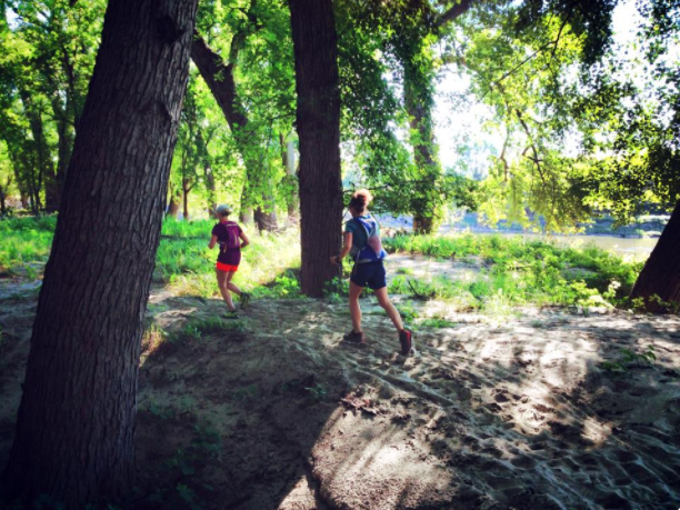
To locals, the “River Bottoms” is a trail network stretching from the southwest corner of Bloomington to the trails of Fort Snelling State Park. These trails are enjoyed by mountain bike riders and runners who frequent them. While under the jurisdiction of the National Park Service, they are not maintained by any government entity and often take on a “path of least resistance” or direction. It is not uncommon for new tracks to spring up after heavy rains and high river flooding. While riding, expect dirt trails exclusively with some log crossings, sand sections, and occasional overgrowth. Warning: in the summer, pay particular attention to the Urtica Dioica plants, or stinging nettles, growing on infrequently used trails.
Wildlife of the Minnesota River Bottoms
Bikers, birdwatchers, and hikers can enjoy wildlife sightings along the banks of the Minnesota River.
The River Bottoms are great for all types of recreation. It’s not uncommon to see hikers, bird watchers, and people fishing along the banks of the Minnesota River. I have enjoyed sharing with my son the sights of Bald eagles and Beavers who make the watershed here their home. Additionally, being a natural area, the River Bottoms are home to countless animals, including white-tailed deer and mink.
What to expect
On the map are a few more popular entrances to the River Bottom trail, including Lyndale Ave, Crest Ave, and Old Cedar Ave. These entrances offer ample parking and a clear trailhead. Once you start down the course, you will see that nothing is paved but worn-in enough to be firm under your tires. Except at the Lyndale trailhead, you will find a short section of paved land heading east, perfect for walking and wheelchair use. While a mountain bike is best for unpaved trails, fat tire bikes navigate well in winter. If you need to cross a stream, there are bridges, and at the 9-mile creek in the summer months, there is a rope ferry to get you across. Because the River Bottoms are so smooth, they are an ideal place for kids to go mountain biking.
You will find runners who frequent the natural settings of the Minnesota River bottoms.
When to ride
The Minnesota River bottoms are a natural haven for cyclists in spring, summer, winter, or fall.
The best part of the River Bottoms is that it is one of the first places to dry out each spring. It is also one of the first places to freeze when winter rolls through. Like most off-road trails, please avoid this trail in early spring as they thaw or after heavy rain. Other than that, these trails are sandy enough to drain quickly. One of the best things about the river bottoms is riding fat bikes. Fat bikes can trace their development directly to the river bottom in the winter. When the snow falls, the river bottoms are the perfect mixture of flat trails, bermed turns, and accessibility to create a near-perfect winter track.
Living in the Twin Cities, we are lucky to have a place like the river bottoms to ride. The fact that it is left free to change and natural is unique in a metro area. You will find some of the metro’s last natural trails from the Bloomington Ferry Bridge to Fort Snelling.
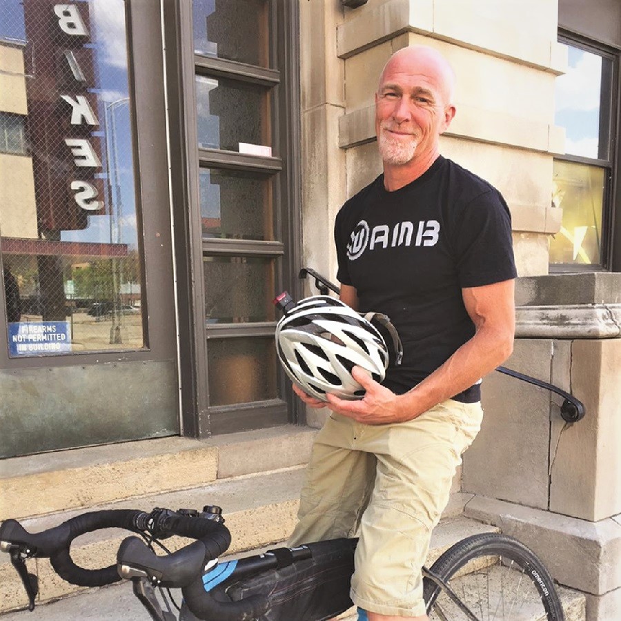
About John Brown, the author
John operates Browns Bicycle in Richfield, MN, as a lifelong cyclist and consummate tinker. It all started for him in grade school when the bike bug bit, and the fever still existed. Now, and over the past thirty years, he has worked at every level in the bike industry. He is starting, like most, sweeping floors and learning anything he can about bikes. He eventually graduated as a service manager and then as a store manager. Through the years, he has spent extensive time designing and sourcing bicycles and parts for some of the largest bike companies in the world. All the while focusing on helping as many people as possible enjoy the love of riding a bike. In that pursuit, he has taught classes (both scheduled and impromptu) on all things bikes. John also believes in helping every rider attain their optimal fit on the cycle of their dreams. Please feel free to stop in any time and talk about bikes, fit, and parts or share your latest ride. You can also see more of John’s tricks and tips on the Brown Bicycle Facebook Page.
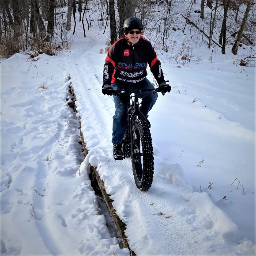
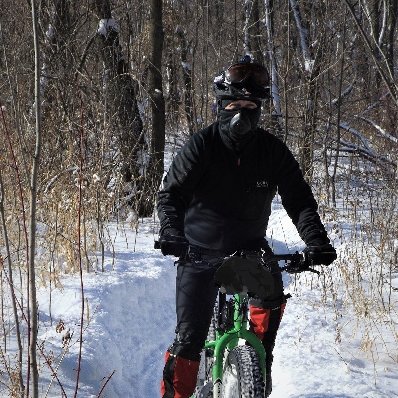
Living in the upper Midwest with four unique seasons, fat biking can be a fun way to pass the time in the winter while getting a good cardio workout. Many studies state the benefits of staying active in cold weather, and riding a fat bike will do that. As an avid cross-country skier, times are changing. With climate change affecting us all, the fat bike is a great alternative to stay active throughout the winter when the ski trail turns into a bobsled run.
Don’t get me wrong; I have not nailed my skis to the wall as decoration. I still loved the thrill of kick-an-gliding through the rolling forests and open fields. But climate change is a growing concern making the trails icy and sometimes baron of snow for skiing. In the last several years, it seems we are seeing more freeze/thaw temperature swings making skiing hazardous. If you are like me and want to stay active when the trails are icy or sparse of snow, the fat bike is an option.
Options, with studded tires when conditions are not for gliding over the trail. Here are some places to ride the trail.
Fat biking trails are waiting for you in northern Minnesota
Please note: check before you head out. Not all federal, state, county, township, or city trails are open to fat biking, but the list is growing.
Here, north to south, are some Minnesota trails waiting for you as we enter the winter season:
With plenty of layers and a mask, this biker dude is having fun in the True North.
Split Rock State Park Trails, northeast of Two Harbors. Here on the shore of Lake Superior, ride 8.7 miles of groomed trails, perfect for fat biking and skate skiing. Currently, access is only allowed near Beaver Bay.
Giants Ridge Trail, east of Biwabic, is a resort on the edge of the towering Superior National Forest that offers several fat tire biking adventures. Ride their 37-mile -plus Nordic trail system or experience downhill fat biking via their high-speed chairlift!
Redhead Trails, at the Minnesota Discovery Center, in Chisholm. This new park offers all skill levels of fat bikers nearly 25 miles of hand-crafted mountain bike trails. Here you will find an oasis of fun riding through the diverse terrain around the old open mine pits.
Suomi Hills Trail in the Chippewa National Forest is north of Grand Rapids. Here you will find a 19-miles remote and stunning trail system in a semi-primitive non-motorized area. While in the area, you will also find several other primitive trails to explore in this National Forest.
Lester River Trail, in Duluth. Fat bikers will find this 12.5-mile trail one of the most beginner-friendly trails in the area (especially riding back down). Other trails in the Duluth area are rated intermediate to advance for the steady incline/descent and rocks/roots.
Winter fun, as this fat biker takes a break for a photo op.
Jay Cooke State Park Trail in Carlton. Nestled along the St. Louis River, the state park groomed 5.4 miles of fat biking trails allows you to ride through and possibly spot white-tailed deer as they winter in this area. The trail here is intermediate, with uneven terrain and small hills.
Cuyuna Country State Recreation Area in Crosby/Ironton. A rugged park of old open mining pits, now lakes, with stockpiles of discarded quarried rocks scattered to create over 50 miles of groomed fat biking trails. Here you will find a few loops for beginners. Most trails here are designated for intermediate to advanced skill sets.
Detroit Mountain, in Detroit Lakes. The bike park here features approximately 4-miles of downhill flow trails that make the most of the natural landscape in the park. The trails mimic a rollercoaster, with a series of fast and flowing sections that take you up and down the mountainside.
Fat biking trails in the Twin Cities
Come November; it’s a perfect time of the year to jump on a fatty.Anoka Nature Preserve, north of Anoka. The nature preserve here is nestled along the bank of the Rum River with over 5-miles of double-wide trails. The perfect trail system for the novice fat-tire biker looking to enjoy nature in the winter and preserves gently rolling terrain.
Elm Creek Trail, west of Chaplin, in the north metro of the Twin Cities, is a 4,900-acre park featuring amenities for many outdoor activities. Including trails for fat biking, built to accommodate all skill levels of riders. So grab your fatty for 10 miles of fast-flowing groomed trails of winter fun.
He was commuting to work on his fatty, along the frozen lake channels in Minneapolis.
Gateway State Trail, in North St. Paul. A favorite for a quick getaway from the city, this section of the popular trail offers almost 12 miles of riding for fat bikers in the winter. From Cayuga Street to Jamaica Avenue, the plowed trail is perfect for beginners taking you out to the open fields of Ramsey and Washington County.
Theodore Wirth Park Trail, in North Minneapolis. Winter fat bike enthusiasts flock to the woods of this north metro park for seven miles of tightly twisting singletrack and a skyline-view pump track.
Murphy-Hanrehan Park Reserve, in Salvage. This peaceful wilderness park in northeast Scott County has its wild side. Another challenging trail intertwined in glacial ridges, hilly terrain, and heavy forests. Riding a fat bike here in the winter is a fantastic off-road experience.
Minnesota River Valley Trail, in Bloomington. Affectionately known as the “River Bottoms,” the trails attract a variety of nature lovers, bird-watchers, hikers, and mountain bikers throughout the year. The River Bottoms here is a fat bike paradise perfect for the beginner, intermediate, and those looking to race in the winter.
As winter temperatures drop, it’s time to dig out the layers and have some fun!
Fort Snelling State Park, in south Minneapolis. Located in the heart of the Twin Cities, where the Minnesota River meets the Mississippi River, this park offers 6-miles of groomed for fat biking. Most of this state park is on the Minnesota River’s floodplain. It is easy to ride the trail along the river’s braided channels and see white-tailed deer, foxes, and wild turkeys.
Lebanon Hills Reginal Park, in Eagan. With nearly 12 miles of a single-use, one-way trail system, winter fat bikers are discovering the park’s popularity as one of the go-to trails in the metro area. The trails feature riding for all skill levels and world-class facilities to enhance your riding experience.
South Minnesota fat bike trails are waiting
Dig out your favorite Christmas sweater and take a fat bike for a spin.
Kaplan’s Woods Singletrack, in Owatonna. For the avid fat biker, you will find 5-miles of fun loops. With a tight singletrack trail system winding through the hardwood forest next to the Straight River, climbs are short and punchy to leave you breathless on each descent.
Bronk Unit Plowline Trail, a part of the Richard J. Dorer Memorial Hardwood State Forest, is north of Winona. The fat biking trails of varying difficulty consist of a south loop and a north loop for 6.5 miles. Both loops generally follow the woods’ edge, or the plow line, as they go around the ridge, rising and falling, giving them a “more difficult” rating.
Do you have a fun trail for fat biking that we missed?
If you have a fat bike trail that you want to see added to this list and published in the Holiday Edition of the Bike/Hike Guide, send us the location and link to [email protected] – Thanks!